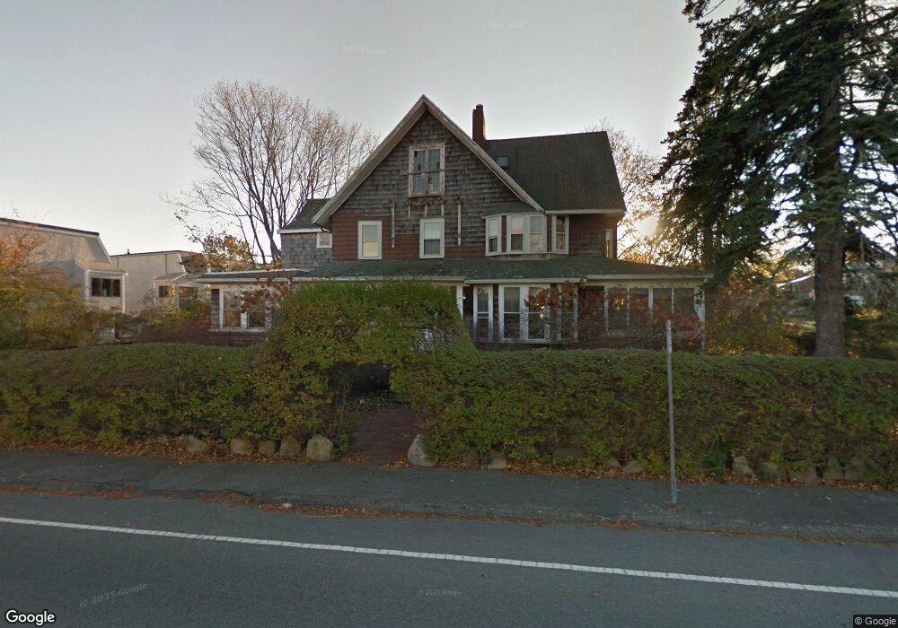
12 Beach Rd Gloucester, MA 01930
East Gloucester NeighborhoodEstimated Value: $1,207,051 - $1,652,000
5
Beds
3
Baths
3,345
Sq Ft
$419/Sq Ft
Est. Value
About This Home
This home is located at 12 Beach Rd, Gloucester, MA 01930 and is currently estimated at $1,401,013, approximately $418 per square foot. 12 Beach Rd is a home located in Essex County with nearby schools including East Gloucester Elementary School, Ralph B O'maley Middle School, and Gloucester High School.
Ownership History
Date
Name
Owned For
Owner Type
Purchase Details
Closed on
Apr 15, 2011
Sold by
Houghton Land T
Bought by
12 Beach Road Llc
Current Estimated Value
Purchase Details
Closed on
Mar 31, 2011
Sold by
Pett Arley L and Pett Barrett S
Bought by
Gloucester City Of
Create a Home Valuation Report for This Property
The Home Valuation Report is an in-depth analysis detailing your home's value as well as a comparison with similar homes in the area
Home Values in the Area
Average Home Value in this Area
Purchase History
| Date | Buyer | Sale Price | Title Company |
|---|---|---|---|
| 12 Beach Road Llc | $432,500 | -- | |
| Gloucester City Of | $4,050 | -- |
Source: Public Records
Mortgage History
| Date | Status | Borrower | Loan Amount |
|---|---|---|---|
| Closed | Gloucester City Of | $1,995,000 | |
| Closed | Gloucester City Of | $1,125,000 |
Source: Public Records
Tax History
| Year | Tax Paid | Tax Assessment Tax Assessment Total Assessment is a certain percentage of the fair market value that is determined by local assessors to be the total taxable value of land and additions on the property. | Land | Improvement |
|---|---|---|---|---|
| 2025 | $12,251 | $1,260,400 | $592,500 | $667,900 |
| 2024 | $10,851 | $1,115,200 | $447,300 | $667,900 |
| 2023 | $10,572 | $998,300 | $331,900 | $666,400 |
| 2022 | $10,245 | $873,400 | $288,700 | $584,700 |
| 2021 | $9,896 | $795,500 | $262,500 | $533,000 |
| 2020 | $9,976 | $809,100 | $262,500 | $546,600 |
| 2019 | $9,556 | $753,000 | $250,300 | $502,700 |
| 2018 | $9,745 | $753,700 | $244,200 | $509,500 |
| 2017 | $9,443 | $715,900 | $232,500 | $483,400 |
| 2016 | $9,078 | $667,000 | $222,400 | $444,600 |
| 2015 | $8,576 | $628,300 | $217,400 | $410,900 |
Source: Public Records
Map
Nearby Homes
- 70 Bass Ave
- 3 Mondello Square
- 26 Marina Dr
- 11 Wall St Unit R
- 36 Eastern Ave
- 78 Thatcher Rd Unit 6
- 25 Salt Island Rd
- 21 Marble Rd
- 197 E Main St Unit 1
- 32 Witham St Unit B
- 14R Spring St Unit 3
- 23 Mount Vernon St
- 10 Seaview Rd
- 60 Rocky Neck Ave Unit 202
- 73 Rocky Neck Ave Unit 2
- 191 Main St Unit 3
- 191 Main St Unit 2A
- 50 Warner St
- 1 Wonson St
- 28 Eastern Point Rd
- 19 Atlantic Road-Winter Unit 10
- 19 Atlantic Rd Unit 19
- 19 Atlantic Rd Unit 33
- 19 Atlantic Rd Unit 32
- 19 Atlantic Rd Unit 31
- 19 Atlantic Rd Unit 30
- 19 Atlantic Rd Unit 29
- 19 Atlantic Rd Unit 28
- 19 Atlantic Rd Unit 27
- 19 Atlantic Rd Unit 26
- 19 Atlantic Rd Unit 25
- 19 Atlantic Rd Unit 24
- 19 Atlantic Rd Unit 23
- 19 Atlantic Rd Unit 22G
- 19 Atlantic Rd Unit 21
- 19 Atlantic Rd Unit 20
- 19 Atlantic Rd
- 19 Atlantic Rd Unit 18
- 19 Atlantic Rd Unit 17
- 19 Atlantic Rd Unit 16
Your Personal Tour Guide
Ask me questions while you tour the home.