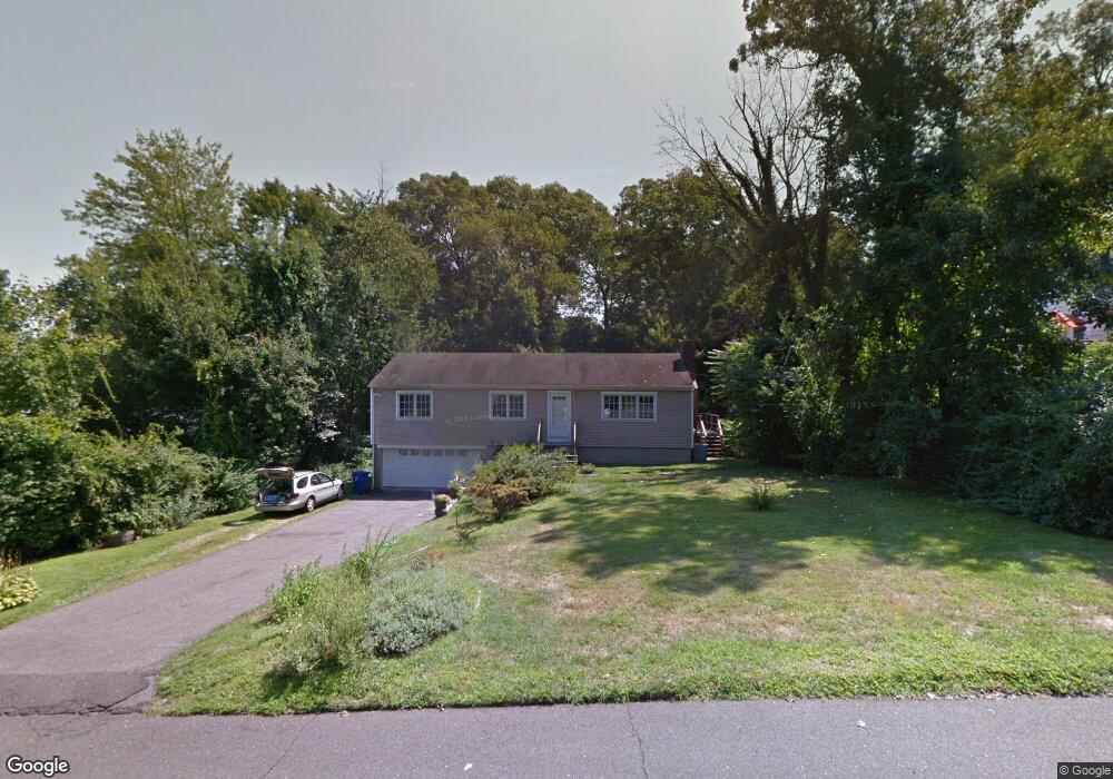
12 Blackberry Ln Norwalk, CT 06850
Broad River NeighborhoodEstimated Value: $626,271 - $749,000
3
Beds
2
Baths
1,300
Sq Ft
$523/Sq Ft
Est. Value
About This Home
This home is located at 12 Blackberry Ln, Norwalk, CT 06850 and is currently estimated at $680,068, approximately $523 per square foot. 12 Blackberry Ln is a home located in Fairfield County with nearby schools including Silvermine Elementary School, West Rocks Middle School, and Norwalk High School.
Ownership History
Date
Name
Owned For
Owner Type
Purchase Details
Closed on
Nov 11, 2021
Sold by
Serricchio Thomas M and Serricchio Mary A
Bought by
Serricchio Maureen E
Current Estimated Value
Purchase Details
Closed on
Mar 2, 1989
Sold by
Parisi Philip A
Bought by
Serricchio Thom
Create a Home Valuation Report for This Property
The Home Valuation Report is an in-depth analysis detailing your home's value as well as a comparison with similar homes in the area
Home Values in the Area
Average Home Value in this Area
Purchase History
| Date | Buyer | Sale Price | Title Company |
|---|---|---|---|
| Serricchio Maureen E | -- | None Available | |
| Serricchio Maureen E | -- | None Available | |
| Serricchio Thom | $240,000 | -- |
Source: Public Records
Mortgage History
| Date | Status | Borrower | Loan Amount |
|---|---|---|---|
| Previous Owner | Serricchio Thom | $88,000 | |
| Previous Owner | Serricchio Thom | $105,000 | |
| Previous Owner | Serricchio Thom | $135,000 | |
| Previous Owner | Serricchio Thom | $135,000 |
Source: Public Records
Tax History
| Year | Tax Paid | Tax Assessment Tax Assessment Total Assessment is a certain percentage of the fair market value that is determined by local assessors to be the total taxable value of land and additions on the property. | Land | Improvement |
|---|---|---|---|---|
| 2025 | $8,191 | $345,020 | $178,610 | $166,410 |
| 2024 | $8,065 | $345,020 | $178,610 | $166,410 |
| 2023 | $6,818 | $273,080 | $163,730 | $109,350 |
| 2022 | $6,711 | $273,080 | $163,730 | $109,350 |
| 2021 | $5,710 | $273,080 | $163,730 | $109,350 |
| 2020 | $6,446 | $273,080 | $163,730 | $109,350 |
| 2019 | $6,226 | $273,080 | $163,730 | $109,350 |
| 2018 | $7,182 | $276,980 | $183,550 | $93,430 |
| 2017 | $6,931 | $276,980 | $183,550 | $93,430 |
| 2016 | $7,060 | $277,530 | $183,550 | $93,980 |
| 2015 | $6,329 | $276,980 | $183,550 | $93,430 |
| 2014 | $6,936 | $276,980 | $183,550 | $93,430 |
Source: Public Records
Map
Nearby Homes
- 403 Silver Creek Ln
- 10 Purdy Rd
- 16 Cornwall Rd
- 239 Silvermine Ave
- 4 Nursery St
- 106A Comstock Hill Ave
- 5 Lakeview Dr
- 51 Plattsville Ave
- 3 Seir Hill Rd Unit A6
- 1 Linden St Unit A-9
- 5 Tower Dr
- 135 Comstock Hill Rd
- 8 Oakwood Ave Unit B13
- 50 Aiken St Unit 253
- 24 Grey Hollow Rd
- 71 Aiken St Unit M1
- 71 Aiken St Unit C8
- 5 Tod Rd
- 7 Douglas Dr
- 153 Fillow St
- 10 Blackberry Ln
- 14 Blackberry Ln
- 10 Belair Rd
- 6 Blackberry Ln
- 8 Belair Rd
- 9 Blackberry Ln
- 16 Blackberry Ln
- 12 Belair Rd
- 7 Blackberry Ln
- 11 Blackberry Ln
- 153 Silvermine Ave
- 6 Belair Rd
- 15 Blackberry Ln
- 5 Blackberry Ln
- 5 Blackberry Ln Unit B
- 4 Blackberry Ln
- 17 Blackberry Ln
- 4 Belair Rd
- 9 Belair Rd
- 5 Running Brook Ln
Your Personal Tour Guide
Ask me questions while you tour the home.