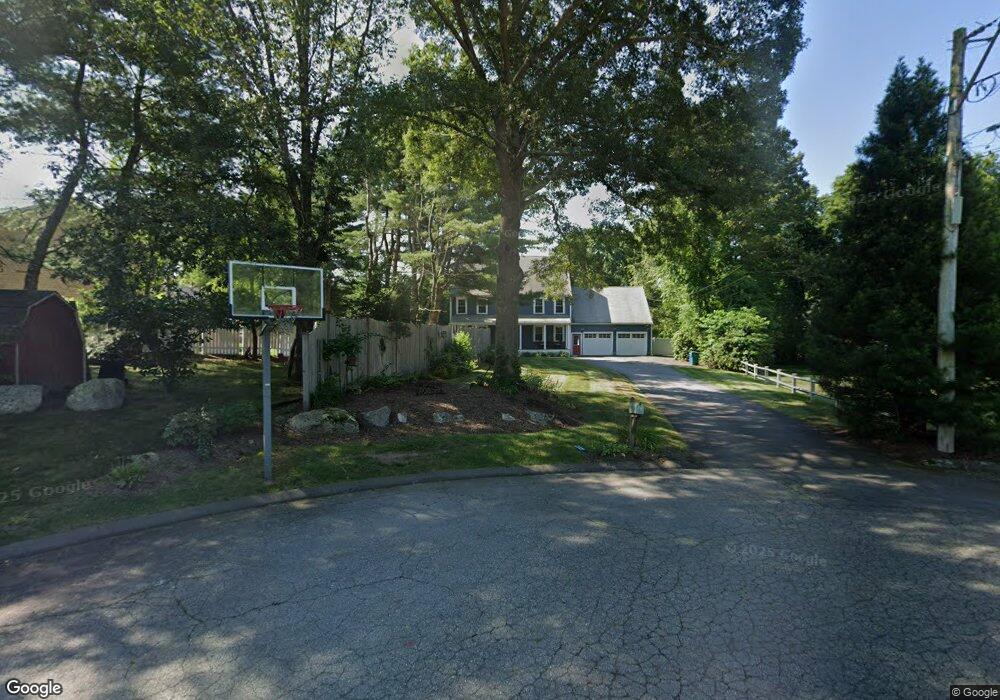
12 Blue Jay Way Attleboro, MA 02703
Estimated Value: $676,000 - $972,000
5
Beds
3
Baths
2,736
Sq Ft
$287/Sq Ft
Est. Value
About This Home
This home is located at 12 Blue Jay Way, Attleboro, MA 02703 and is currently estimated at $785,949, approximately $287 per square foot. 12 Blue Jay Way is a home located in Bristol County with nearby schools including Hyman Fine Elementary School, Wamsutta Middle School, and Attleboro High School.
Ownership History
Date
Name
Owned For
Owner Type
Purchase Details
Closed on
Oct 17, 2008
Sold by
Johnson Joel B and Johnson Cynthia J
Bought by
Goldrick Shawn M and Goldrick Kim M
Current Estimated Value
Home Financials for this Owner
Home Financials are based on the most recent Mortgage that was taken out on this home.
Original Mortgage
$408,796
Interest Rate
6.41%
Mortgage Type
Purchase Money Mortgage
Purchase Details
Closed on
Nov 13, 1991
Sold by
First Fed Sb Of Amer
Bought by
Johnson Joel B and Johnson Cynthia
Home Financials for this Owner
Home Financials are based on the most recent Mortgage that was taken out on this home.
Original Mortgage
$70,000
Interest Rate
8.8%
Mortgage Type
Purchase Money Mortgage
Create a Home Valuation Report for This Property
The Home Valuation Report is an in-depth analysis detailing your home's value as well as a comparison with similar homes in the area
Home Values in the Area
Average Home Value in this Area
Purchase History
| Date | Buyer | Sale Price | Title Company |
|---|---|---|---|
| Goldrick Shawn M | $425,000 | -- | |
| Johnson Joel B | $172,000 | -- |
Source: Public Records
Mortgage History
| Date | Status | Borrower | Loan Amount |
|---|---|---|---|
| Open | Johnson Joel B | $414,927 | |
| Closed | Goldrick Shawn M | $408,796 | |
| Previous Owner | Johnson Joel B | $72,000 | |
| Previous Owner | Johnson Joel B | $77,000 | |
| Previous Owner | Johnson Joel B | $70,000 |
Source: Public Records
Tax History Compared to Growth
Tax History
| Year | Tax Paid | Tax Assessment Tax Assessment Total Assessment is a certain percentage of the fair market value that is determined by local assessors to be the total taxable value of land and additions on the property. | Land | Improvement |
|---|---|---|---|---|
| 2025 | $7,107 | $566,300 | $174,900 | $391,400 |
| 2024 | $6,917 | $543,400 | $157,500 | $385,900 |
| 2023 | $7,232 | $528,300 | $159,100 | $369,200 |
| 2022 | $6,381 | $441,600 | $151,700 | $289,900 |
| 2021 | $5,941 | $401,400 | $145,900 | $255,500 |
| 2020 | $5,499 | $377,700 | $139,300 | $238,400 |
| 2019 | $5,773 | $407,700 | $136,700 | $271,000 |
| 2018 | $5,313 | $358,500 | $132,700 | $225,800 |
| 2017 | $5,106 | $350,900 | $129,300 | $221,600 |
| 2016 | $5,277 | $356,100 | $120,700 | $235,400 |
| 2015 | $5,510 | $374,600 | $120,700 | $253,900 |
| 2014 | $4,583 | $308,600 | $115,500 | $193,100 |
Source: Public Records
Map
Nearby Homes
- 125 Steere St
- 8 Preservation Way
- 1325 Park St
- 3 Wilmarth St
- 38 Springdale Ave
- 1080 Oakhill Ave
- 245 Smith St
- 44 Winterberry Ln
- 97 Dexter St
- 240 Smith St
- 0 Sunflower Dr
- 278 East St
- 10 French Farm Rd
- 109 Maple St Unit E3
- 19 Cherry Tree Ln
- 99 Brigham Hill Rd
- 63 Orange St
- 86 Woodstock Rd
- 60 Metacommett Dr
- 16 George St Unit 9
- 130 Steere St
- 19 Blue Jay Way
- 116 Steere St
- 124 Steere St
- 14 Virginia Meadows Dr
- 108 Steere St
- 11 Blue Jay Way
- 100 Steere St
- 136 Steere St
- 127 Steere St
- 3 Blue Jay Way
- 84 Steere St
- 84 Steere St Unit Single Fam
- 84 Steere St Unit 1
- 105 Steere St
- 129 Steere St
- 7 Virginia Meadows Dr
- 167 Steere St
- 15 Virginia Meadows Dr
- 140 Steere St