
Seller's Agent in 2025
Susan Davis
BHHS Fox & Roach
(732) 586-2337
3 in this area
14 Total Sales
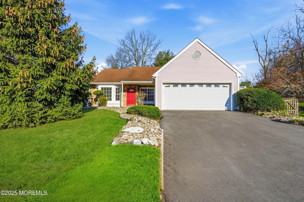

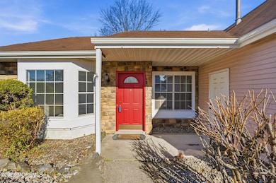
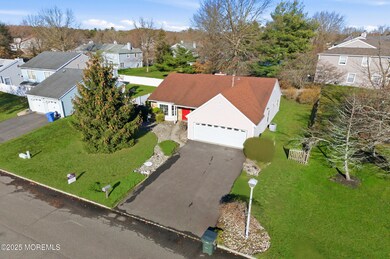
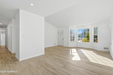
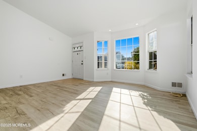

Commuter's Dream! Spacious three bedroom gem with two car garage in coveted Fox Chase. This immaculate single family residence has recently been renovated and updated. It is perfectly configured to modern living with 3 generous sized bedrooms, 2 full bathrooms and attached two car garage . The interior boasts bright, open spaces ideal for entertaining, complemented by ample natural light and a thoughtful layout. Home has recently been painted, new laminate flooring, recessed smart lights and some windows replaced. Situated within minutes of major transportation including Routes 33,66,18 and Garden State Parkway. Beyond transportation, you'll be a short drive from the Jersey Shore's beautiful beaches, the shopping mecca of the Jersey Shore Premium Outlets and vibrant dining scenes of Red Bank and Asbury Park, and the new Netflix Studios in Fort Monmouth. Don't miss the opportunity to secure a turn-key home where space, convenience and location meet. Schedule your private tour today! A truly turnkey home!
Last Agent to Sell the Property
Berkshire Hathaway HomeServices Fox & Roach - Holmdel License #9805691 Listed on: 12/06/2025
| Date | Type | Sale Price | Title Company |
|---|---|---|---|
| Deed | $690,000 | Trident Abstract Title | |
| Deed | $265,000 | -- | |
| Deed | $168,000 | -- |
| Date | Status | Loan Amount | Loan Type |
|---|---|---|---|
| Previous Owner | $159,600 | No Value Available |
| Date | Event | Price | List to Sale | Price per Sq Ft |
|---|---|---|---|---|
| 12/23/2025 12/23/25 | Sold | $690,000 | +10.4% | $483 / Sq Ft |
| 12/12/2025 12/12/25 | Pending | -- | -- | -- |
| 12/06/2025 12/06/25 | For Sale | $625,000 | -- | $438 / Sq Ft |
| Year | Tax Paid | Tax Assessment Tax Assessment Total Assessment is a certain percentage of the fair market value that is determined by local assessors to be the total taxable value of land and additions on the property. | Land | Improvement |
|---|---|---|---|---|
| 2025 | $6,876 | $505,600 | $288,800 | $216,800 |
| 2024 | $6,511 | $477,800 | $266,000 | $211,800 |
| 2023 | $6,511 | $426,700 | $218,800 | $207,900 |
| 2022 | $6,622 | $409,800 | $201,300 | $208,500 |
| 2021 | $6,641 | $343,800 | $172,500 | $171,300 |
| 2020 | $6,470 | $324,300 | $156,800 | $167,500 |
| 2019 | $6,641 | $333,400 | $166,900 | $166,500 |
| 2018 | $6,136 | $307,100 | $173,600 | $133,500 |
| 2017 | $6,278 | $306,400 | $177,000 | $129,400 |
| 2016 | $6,355 | $303,200 | $177,000 | $126,200 |
| 2015 | $6,349 | $306,700 | $183,800 | $122,900 |
| 2014 | $6,297 | $291,000 | $158,800 | $132,200 |
Seller's Agent in 2025
Susan Davis
BHHS Fox & Roach
(732) 586-2337
3 in this area
14 Total Sales
D
Buyer's Agent in 2025
Deborah Pavlis
Jamie Pavlis Real Estate, Inc.
(732) 865-0803
4 in this area
21 Total Sales
Source: MOREMLS (Monmouth Ocean Regional REALTORS®)
MLS Number: 22535568
APN: 49-00129-05-00038
Disclaimer: Certain information contained herein is derived from information provided by parties other than Homes.com. All information provided is deemed reliable, but is not guaranteed to be accurate and should be independently verified.
![]() IDX information is provided exclusively for personal, non-commercial use, and may not be used for any purpose other than to identify prospective properties consumers may be interested in purchasing.
IDX information is provided exclusively for personal, non-commercial use, and may not be used for any purpose other than to identify prospective properties consumers may be interested in purchasing.
Information is deemed reliable but not guaranteed.
Ask me questions while you tour the home.