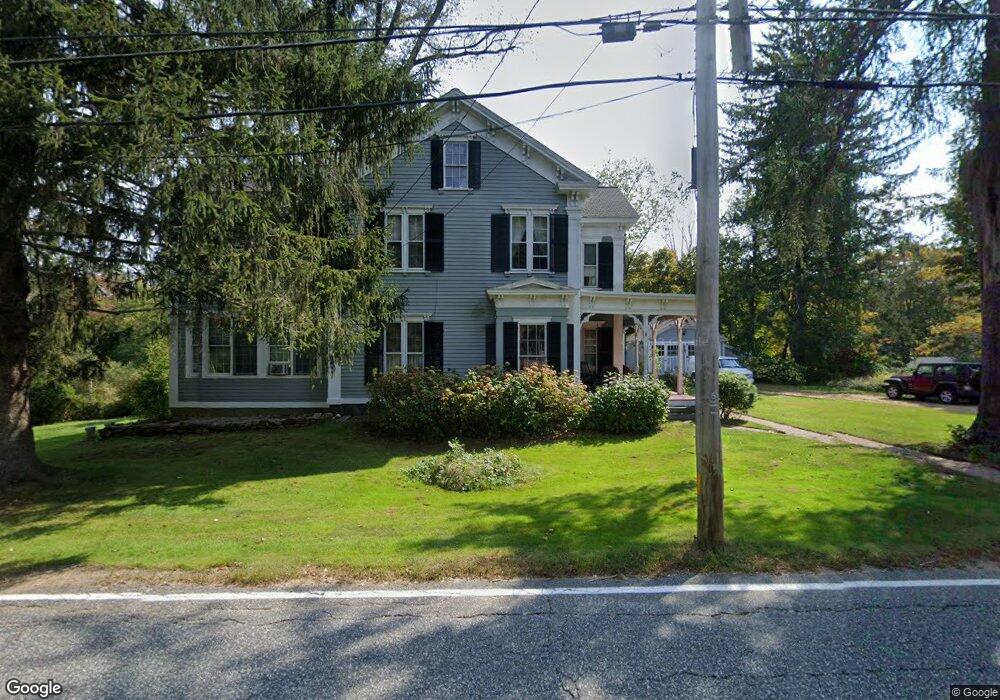
12 Brookfield Rd Brimfield, MA 01010
Estimated Value: $484,756 - $636,000
4
Beds
2
Baths
3,669
Sq Ft
$150/Sq Ft
Est. Value
About This Home
This home is located at 12 Brookfield Rd, Brimfield, MA 01010 and is currently estimated at $551,939, approximately $150 per square foot. 12 Brookfield Rd is a home located in Hampden County with nearby schools including Brimfield Elementary School, Tantasqua Regional Junior High School, and Tantasqua Regional High School.
Ownership History
Date
Name
Owned For
Owner Type
Purchase Details
Closed on
Aug 5, 2009
Sold by
Porter William W and Porter Susan K
Bought by
Holt Clifford J and Holt Susan R
Current Estimated Value
Purchase Details
Closed on
Dec 2, 1996
Sold by
Hayes Elaine L
Bought by
Porter William W and Porter Susan K
Home Financials for this Owner
Home Financials are based on the most recent Mortgage that was taken out on this home.
Original Mortgage
$118,000
Interest Rate
7.82%
Mortgage Type
Purchase Money Mortgage
Create a Home Valuation Report for This Property
The Home Valuation Report is an in-depth analysis detailing your home's value as well as a comparison with similar homes in the area
Home Values in the Area
Average Home Value in this Area
Purchase History
| Date | Buyer | Sale Price | Title Company |
|---|---|---|---|
| Holt Clifford J | $225,000 | -- | |
| Porter William W | $147,500 | -- |
Source: Public Records
Mortgage History
| Date | Status | Borrower | Loan Amount |
|---|---|---|---|
| Previous Owner | Porter William W | $157,000 | |
| Previous Owner | Porter William W | $142,000 | |
| Previous Owner | Porter William W | $118,000 |
Source: Public Records
Tax History
| Year | Tax Paid | Tax Assessment Tax Assessment Total Assessment is a certain percentage of the fair market value that is determined by local assessors to be the total taxable value of land and additions on the property. | Land | Improvement |
|---|---|---|---|---|
| 2025 | $6,264 | $443,000 | $85,300 | $357,700 |
| 2024 | $6,085 | $416,200 | $80,500 | $335,700 |
| 2023 | $5,923 | $389,400 | $80,500 | $308,900 |
| 2022 | $5,532 | $336,700 | $74,800 | $261,900 |
| 2021 | $5,391 | $307,200 | $74,800 | $232,400 |
| 2020 | $5,172 | $292,700 | $74,800 | $217,900 |
| 2019 | $3,956 | $222,500 | $74,800 | $147,700 |
| 2018 | $3,805 | $222,500 | $74,800 | $147,700 |
| 2017 | $3,705 | $222,500 | $74,800 | $147,700 |
| 2016 | $3,682 | $213,300 | $71,200 | $142,100 |
| 2015 | $3,581 | $213,300 | $71,200 | $142,100 |
| 2014 | $3,502 | $213,300 | $71,200 | $142,100 |
Source: Public Records
Map
Nearby Homes
- 0 Hillside Dr
- 15 Sturbridge Rd
- 21 Sturbridge Rd
- 8 Oakwood Rd
- 0 Haynes Hill Rd Unit 73046570
- 97 Cubles Dr
- 121 Sturbridge Rd
- Lots 1&2 Wales Rd
- 104 Wales Rd
- 43 Tower Hill Rd
- 293 Warren Rd
- 299 Warren Rd
- 291 Warren Rd
- 0 Paige Hill Rd
- Lot B Paige Hill Rd
- Lot A Paige Hill Rd
- 30 Little Rest Rd
- Lot 5 New Holland Rd
- Lot 4 New Holland Rd
- Lot 7 New Holland Rd
- 15 Brookfield Rd
- 8 Brookfield Rd
- 7 Brookfield Rd
- 7 Brookfield Rd
- 2 E Hill Rd
- 19 Brookfield Rd
- 0 E Hill Rd
- Lot 3 E Hill Rd
- Lot 0 E Hill Rd
- 0 East Hill Unit 30234098
- 2 Brookfield Rd
- 2 Brookfield Rd
- Lot 11.1 Brookfield Rd
- 1A Brookfield Rd
- - Brookfield Rd
- 21 Brookfield Rd
- 22 Brookfield Rd
- 11 E Hill Rd
- 4 N Main St
- 3 Sturbridge Rd