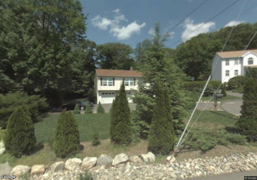
12 Bryan Cir Seymour, CT 06483
Estimated Value: $374,000 - $466,000
3
Beds
3
Baths
1,288
Sq Ft
$333/Sq Ft
Est. Value
About This Home
This home is located at 12 Bryan Cir, Seymour, CT 06483 and is currently estimated at $428,914, approximately $333 per square foot. 12 Bryan Cir is a home located in New Haven County with nearby schools including Seymour Middle School, Seymour High School, and Assumption School.
Ownership History
Date
Name
Owned For
Owner Type
Purchase Details
Closed on
Jul 31, 1998
Sold by
Nesteriak Joseph A
Bought by
Pavlik Dale J
Current Estimated Value
Home Financials for this Owner
Home Financials are based on the most recent Mortgage that was taken out on this home.
Original Mortgage
$159,850
Outstanding Balance
$33,348
Interest Rate
6.92%
Mortgage Type
Purchase Money Mortgage
Estimated Equity
$395,566
Purchase Details
Closed on
Aug 11, 1997
Sold by
Valley Limousine Svc
Bought by
Nesteriak Joseph A
Create a Home Valuation Report for This Property
The Home Valuation Report is an in-depth analysis detailing your home's value as well as a comparison with similar homes in the area
Home Values in the Area
Average Home Value in this Area
Purchase History
| Date | Buyer | Sale Price | Title Company |
|---|---|---|---|
| Pavlik Dale J | $168,300 | -- | |
| Nesteriak Joseph A | $131,000 | -- | |
| Pavlik Dale J | $168,300 | -- | |
| Nesteriak Joseph A | $131,000 | -- |
Source: Public Records
Mortgage History
| Date | Status | Borrower | Loan Amount |
|---|---|---|---|
| Open | Nesteriak Joseph A | $159,850 | |
| Closed | Nesteriak Joseph A | $159,850 |
Source: Public Records
Tax History Compared to Growth
Tax History
| Year | Tax Paid | Tax Assessment Tax Assessment Total Assessment is a certain percentage of the fair market value that is determined by local assessors to be the total taxable value of land and additions on the property. | Land | Improvement |
|---|---|---|---|---|
| 2025 | $7,622 | $274,960 | $52,290 | $222,670 |
| 2024 | $7,677 | $208,390 | $42,490 | $165,900 |
| 2023 | $7,498 | $208,390 | $42,490 | $165,900 |
| 2022 | $7,417 | $208,390 | $42,490 | $165,900 |
| 2021 | $7,233 | $208,390 | $42,490 | $165,900 |
| 2020 | $6,061 | $168,350 | $49,910 | $118,440 |
| 2019 | $6,061 | $168,350 | $49,910 | $118,440 |
| 2018 | $6,061 | $168,350 | $49,910 | $118,440 |
| 2017 | $6,061 | $168,350 | $49,910 | $118,440 |
| 2016 | $6,061 | $168,350 | $49,910 | $118,440 |
| 2015 | $6,104 | $176,470 | $54,670 | $121,800 |
| 2014 | $6,007 | $176,470 | $54,670 | $121,800 |
Source: Public Records
Map
Nearby Homes
- 9 Wooster St
- 72D Walnut St
- 169 Derby Ave
- 25 Oakwood Dr
- 77 S Main St
- 17 Patton Ave
- 50 Bissell Place
- 226 Walnut St
- 9 Omar St
- 26-28 S Main St
- 21 Great Oak Ridge Way Unit 21
- 38 Sanford St
- 36 Bungay Terrace
- 32 Roberts St
- 50 Bellevue Terrace
- 57 Bellevue Terrace
- 68 New St
- 4 Nickel Mine Dr
- 60 Acorn Hill Rd
- 35 Cogwheel Ln