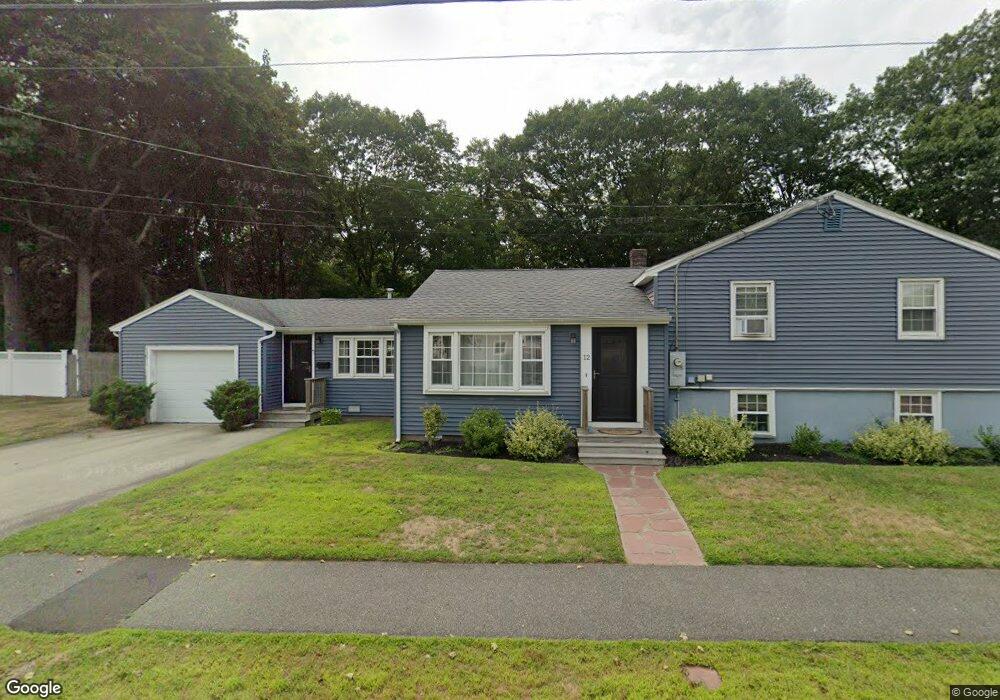
12 Cabot Rd Danvers, MA 01923
Estimated Value: $736,000 - $767,000
3
Beds
2
Baths
2,096
Sq Ft
$361/Sq Ft
Est. Value
About This Home
This home is located at 12 Cabot Rd, Danvers, MA 01923 and is currently estimated at $757,531, approximately $361 per square foot. 12 Cabot Rd is a home located in Essex County with nearby schools including Danvers High School, St. Mary of the Annunciation School, and St. John's Prep.
Ownership History
Date
Name
Owned For
Owner Type
Purchase Details
Closed on
May 31, 2011
Sold by
Mansfield Michelle L and Mansfield Patrick M
Bought by
Schirk Michael and Schirk Victoria
Current Estimated Value
Home Financials for this Owner
Home Financials are based on the most recent Mortgage that was taken out on this home.
Original Mortgage
$160,000
Interest Rate
4.94%
Mortgage Type
Purchase Money Mortgage
Purchase Details
Closed on
Dec 4, 1998
Sold by
Sorkin Michael K and Sorkin Susan
Bought by
Mansfield Michelle L and Mansfield Patrick M
Purchase Details
Closed on
Sep 2, 1994
Sold by
Meinerth Deborah
Bought by
Sorkin Michael K and Sorkin Susan
Purchase Details
Closed on
May 26, 1988
Sold by
Osgood Walter L
Bought by
Meinerth Deborah A
Create a Home Valuation Report for This Property
The Home Valuation Report is an in-depth analysis detailing your home's value as well as a comparison with similar homes in the area
Home Values in the Area
Average Home Value in this Area
Purchase History
| Date | Buyer | Sale Price | Title Company |
|---|---|---|---|
| Schirk Michael | $340,000 | -- | |
| Mansfield Michelle L | $237,900 | -- | |
| Sorkin Michael K | $189,150 | -- | |
| Meinerth Deborah A | $187,000 | -- |
Source: Public Records
Mortgage History
| Date | Status | Borrower | Loan Amount |
|---|---|---|---|
| Open | Meinerth Deborah A | $175,000 | |
| Closed | Meinerth Deborah A | $160,000 |
Source: Public Records
Tax History Compared to Growth
Tax History
| Year | Tax Paid | Tax Assessment Tax Assessment Total Assessment is a certain percentage of the fair market value that is determined by local assessors to be the total taxable value of land and additions on the property. | Land | Improvement |
|---|---|---|---|---|
| 2025 | $7,030 | $639,700 | $347,300 | $292,400 |
| 2024 | $6,695 | $602,600 | $347,300 | $255,300 |
| 2023 | $6,387 | $543,600 | $315,600 | $228,000 |
| 2022 | $6,301 | $497,700 | $286,300 | $211,400 |
| 2021 | $5,997 | $449,200 | $271,200 | $178,000 |
| 2020 | $5,582 | $427,400 | $268,100 | $159,300 |
| 2019 | $5,340 | $402,100 | $243,700 | $158,400 |
| 2018 | $5,260 | $388,500 | $241,300 | $147,200 |
| 2017 | $5,080 | $358,000 | $210,800 | $147,200 |
| 2016 | $4,944 | $348,200 | $201,000 | $147,200 |
| 2015 | $4,887 | $327,800 | $182,800 | $145,000 |
Source: Public Records
Map
Nearby Homes
- 42 Coolidge Rd
- 35 Locust St Unit 3
- 4 Butler Ave
- 12 Exeter St
- 12 Central Ave Unit 1
- 38 High St Unit 4
- 35 High St Unit 3D
- 6 Kimberly Dr
- 14 Williams St Unit C17
- 7 Riverbank Ave Unit 7
- 7 Riverbank Ave
- 11 Riverside Ave Unit 111
- 35 Bayview Terrace Unit 7
- 6 Colby Rd
- 6 Bartlett Rd
- 198 Conant St
- 63 Adams St
- 11 Spring St
- 57 Adams St
- 4 Chatham Ln