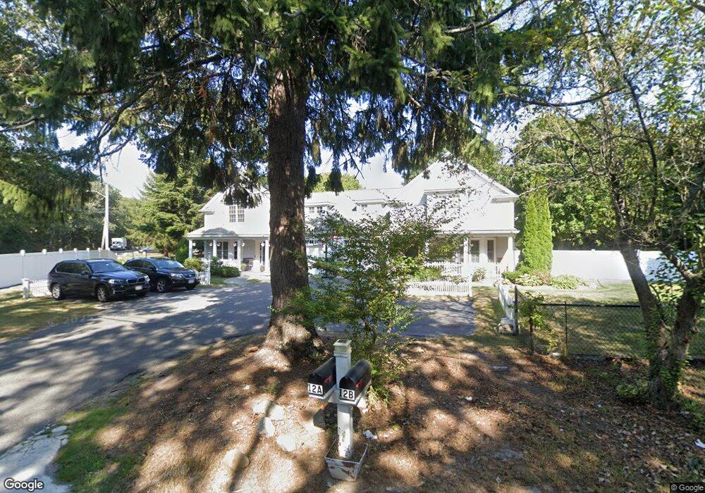
12 Cammett Rd Unit A Marstons Mills, MA 02648
Marstons Mills NeighborhoodEstimated Value: $533,000 - $757,000
2
Beds
3
Baths
1,801
Sq Ft
$336/Sq Ft
Est. Value
About This Home
This home is located at 12 Cammett Rd Unit A, Marstons Mills, MA 02648 and is currently estimated at $604,914, approximately $335 per square foot. 12 Cammett Rd Unit A is a home located in Barnstable County with nearby schools including West Villages Elementary School, Barnstable United Elementary School, and Barnstable Intermediate School.
Ownership History
Date
Name
Owned For
Owner Type
Purchase Details
Closed on
Mar 24, 2020
Sold by
Gaulin Richard D
Bought by
Riaz Mian M and Riaz Anjum
Current Estimated Value
Home Financials for this Owner
Home Financials are based on the most recent Mortgage that was taken out on this home.
Original Mortgage
$268,300
Outstanding Balance
$238,066
Interest Rate
3.6%
Mortgage Type
New Conventional
Estimated Equity
$366,848
Purchase Details
Closed on
Jan 30, 2004
Sold by
Cammett Rd Dev
Bought by
Gaulin Richard D
Create a Home Valuation Report for This Property
The Home Valuation Report is an in-depth analysis detailing your home's value as well as a comparison with similar homes in the area
Home Values in the Area
Average Home Value in this Area
Purchase History
| Date | Buyer | Sale Price | Title Company |
|---|---|---|---|
| Riaz Mian M | $335,393 | None Available | |
| Gaulin Richard D | $360,000 | -- |
Source: Public Records
Mortgage History
| Date | Status | Borrower | Loan Amount |
|---|---|---|---|
| Open | Riaz Mian M | $268,300 |
Source: Public Records
Tax History Compared to Growth
Tax History
| Year | Tax Paid | Tax Assessment Tax Assessment Total Assessment is a certain percentage of the fair market value that is determined by local assessors to be the total taxable value of land and additions on the property. | Land | Improvement |
|---|---|---|---|---|
| 2025 | $3,785 | $467,800 | $0 | $467,800 |
| 2024 | $3,477 | $445,200 | $0 | $445,200 |
| 2023 | $3,158 | $378,700 | $0 | $378,700 |
| 2022 | $3,097 | $321,300 | $0 | $321,300 |
| 2021 | $3,690 | $351,800 | $0 | $351,800 |
| 2020 | $3,743 | $341,500 | $0 | $341,500 |
| 2019 | $3,737 | $331,300 | $0 | $331,300 |
| 2018 | $3,535 | $320,000 | $0 | $320,000 |
| 2017 | $3,454 | $321,000 | $0 | $321,000 |
| 2016 | $3,499 | $321,000 | $0 | $321,000 |
| 2015 | $3,290 | $303,200 | $0 | $303,200 |
Source: Public Records
Map
Nearby Homes
- 544 Cotuit (Route-149) Rd
- 34 Mistic Dr
- 5 Conaumet Rd
- 100 River Rd
- 5 Huckleberry Ln
- 3040 Falmouth Rd Unit H
- 3040 Falmouth Rd Unit H
- 38 Lakeside Dr
- 128 Lakeside Dr
- 158 Lakeside Dr
- 49 Burnham St
- 152 Wakeby Rd
- 7 Ebenezer
- 44 Avalon Cir
- 431 Baxters Neck Rd
- 359 Baxter Neck Rd
- 268 Bumps River Rd
- 9 Tarragon Cir
- 12 Cammett Rd Unit B
- 12 Cammett Rd Unit AB
- 12 Cammett Rd
- 12 Cammett Rd Unit 12B
- 12 Cammett Rd Unit 12A
- 12B Cammett Rd Unit B
- 12A&B Cammett Rd
- 15 Old Falmouth Rd
- 30 Cammett Rd
- 23 Cammett Rd
- 27 Old Falmouth Rd
- 44 Cammett Rd
- 34 Cammett Rd
- 510 Cotuit Rd
- 420 Cotuit Rd
- 37 Old Falmouth Rd
- 510 Massachusetts 149
- 420 Massachusetts 149
- 420 Route 149
- 437 Cotuit Rd