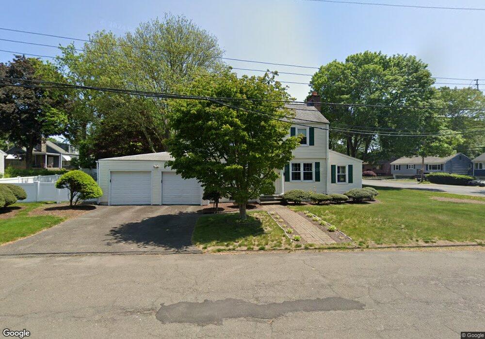
12 Campbell Rd Bridgeport, CT 06606
North End NeighborhoodEstimated Value: $460,000 - $528,000
3
Beds
2
Baths
1,536
Sq Ft
$316/Sq Ft
Est. Value
About This Home
This home is located at 12 Campbell Rd, Bridgeport, CT 06606 and is currently estimated at $485,018, approximately $315 per square foot. 12 Campbell Rd is a home located in Fairfield County with nearby schools including John Winthrop School, Central High School, and St Andrew School.
Ownership History
Date
Name
Owned For
Owner Type
Purchase Details
Closed on
Nov 2, 2001
Sold by
Abulescu Viceel and Abulescu Manuela
Bought by
Ortiz Nelson
Current Estimated Value
Home Financials for this Owner
Home Financials are based on the most recent Mortgage that was taken out on this home.
Original Mortgage
$213,072
Outstanding Balance
$83,893
Interest Rate
6.82%
Estimated Equity
$401,125
Purchase Details
Closed on
Feb 4, 1997
Sold by
Kolaniak Angela E and Ignitus Rita
Bought by
Albulescu Manula and Albulescu Viorel
Purchase Details
Closed on
Feb 8, 1993
Sold by
Dime Sb Ny
Bought by
Kolaniak Angela and Ingitus Rita
Create a Home Valuation Report for This Property
The Home Valuation Report is an in-depth analysis detailing your home's value as well as a comparison with similar homes in the area
Home Values in the Area
Average Home Value in this Area
Purchase History
| Date | Buyer | Sale Price | Title Company |
|---|---|---|---|
| Ortiz Nelson | $221,500 | -- | |
| Ortiz Nelson | $221,500 | -- | |
| Albulescu Manula | $95,000 | -- | |
| Albulescu Manula | $95,000 | -- | |
| Kolaniak Angela | $105,000 | -- | |
| Kolaniak Angela | $105,000 | -- |
Source: Public Records
Mortgage History
| Date | Status | Borrower | Loan Amount |
|---|---|---|---|
| Open | Kolaniak Angela | $213,072 | |
| Closed | Kolaniak Angela | $213,072 | |
| Previous Owner | Kolaniak Angela | $35,000 |
Source: Public Records
Tax History Compared to Growth
Tax History
| Year | Tax Paid | Tax Assessment Tax Assessment Total Assessment is a certain percentage of the fair market value that is determined by local assessors to be the total taxable value of land and additions on the property. | Land | Improvement |
|---|---|---|---|---|
| 2025 | $7,724 | $177,762 | $71,812 | $105,950 |
| 2024 | $7,724 | $177,762 | $71,812 | $105,950 |
| 2023 | $7,724 | $177,762 | $71,812 | $105,950 |
| 2022 | $7,724 | $177,762 | $71,812 | $105,950 |
| 2021 | $7,724 | $177,762 | $71,812 | $105,950 |
| 2020 | $8,129 | $150,560 | $56,270 | $94,290 |
| 2019 | $8,129 | $150,560 | $56,270 | $94,290 |
| 2018 | $8,186 | $150,560 | $56,270 | $94,290 |
| 2017 | $8,186 | $150,560 | $56,270 | $94,290 |
| 2016 | $8,186 | $150,560 | $56,270 | $94,290 |
| 2015 | $7,448 | $176,490 | $61,750 | $114,740 |
| 2014 | $7,448 | $176,490 | $61,750 | $114,740 |
Source: Public Records
Map
Nearby Homes
- 81 Lance Cir
- 44 Lance Cir Unit 44
- 153 Seaver Cir
- 66 Loftus Cir
- 42 Wendy Rd
- 26 Wendy Rd
- 65 Dobson St
- 64 Dobson St
- lot 194 Prospect Ave
- 2851 Old Town Rd
- 4293 Madison Ave
- 87 Parkway Dr
- 76 Hilary Cir Unit 76
- 178 Autumn Ridge Rd
- 236 Edgemoor Rd Unit D
- 225 Edgemoor Rd Unit H
- 394 Anton Dr
- 9 Patricia Rd Unit C
- 2998 Madison Ave Unit C
- 50 Greenhouse Rd Unit 65D
- 3690 Old Town Rd
- 40 Campbell Rd
- 11 Campbell Rd
- 27 Campbell Rd
- 125 Elmsford Rd
- 3670 Old Town Rd
- 3697 Old Town Rd
- 41 Campbell Rd
- 3685 Old Town Rd
- 3750 Old Town Rd
- 3671 Old Town Rd
- 3650 Old Town Rd
- 105 Elmsford Rd
- 55 Campbell Rd
- 152 Elmsford Rd
- 30 Maybrook Rd
- 3641 Old Town Rd
- 3764 Old Town Rd
- 280 Doreen Dr
- 48 Maybrook Rd