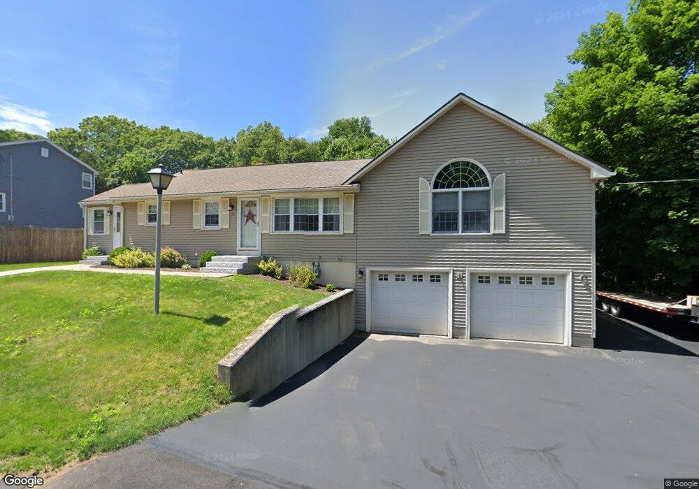
12 Capt Peter Simpson Rd Millbury, MA 01527
Armory Village NeighborhoodEstimated Value: $453,000 - $527,000
3
Beds
2
Baths
1,534
Sq Ft
$327/Sq Ft
Est. Value
About This Home
This home is located at 12 Capt Peter Simpson Rd, Millbury, MA 01527 and is currently estimated at $502,129, approximately $327 per square foot. 12 Capt Peter Simpson Rd is a home located in Worcester County with nearby schools including Elmwood Street Elementary School, Raymond E. Shaw Elementary School, and Millbury Junior/Senior High School.
Ownership History
Date
Name
Owned For
Owner Type
Purchase Details
Closed on
Nov 29, 2016
Sold by
Bouthillette Peter A and Bouthillette Linda A
Bought by
Bouthillette Linda A
Current Estimated Value
Purchase Details
Closed on
Aug 17, 1995
Sold by
Shepard Ida and Stepenovitch Linda
Bought by
Bouthillette Peter and Bouthillette Linda
Home Financials for this Owner
Home Financials are based on the most recent Mortgage that was taken out on this home.
Original Mortgage
$83,700
Interest Rate
7.61%
Mortgage Type
Purchase Money Mortgage
Create a Home Valuation Report for This Property
The Home Valuation Report is an in-depth analysis detailing your home's value as well as a comparison with similar homes in the area
Home Values in the Area
Average Home Value in this Area
Purchase History
| Date | Buyer | Sale Price | Title Company |
|---|---|---|---|
| Bouthillette Linda A | -- | -- | |
| Bouthillette Linda A | -- | -- | |
| Bouthillette Peter | $93,000 | -- | |
| Bouthillette Peter | $93,000 | -- |
Source: Public Records
Mortgage History
| Date | Status | Borrower | Loan Amount |
|---|---|---|---|
| Previous Owner | Bouthillette Peter | $50,000 | |
| Previous Owner | Bouthillette Peter | $86,500 | |
| Previous Owner | Bouthillette Peter | $83,700 |
Source: Public Records
Tax History
| Year | Tax Paid | Tax Assessment Tax Assessment Total Assessment is a certain percentage of the fair market value that is determined by local assessors to be the total taxable value of land and additions on the property. | Land | Improvement |
|---|---|---|---|---|
| 2025 | $6,604 | $493,200 | $114,200 | $379,000 |
| 2024 | $6,062 | $458,200 | $105,800 | $352,400 |
| 2023 | $5,485 | $379,600 | $74,200 | $305,400 |
| 2022 | $5,240 | $349,300 | $74,200 | $275,100 |
| 2021 | $5,114 | $331,400 | $74,200 | $257,200 |
| 2020 | $4,978 | $324,700 | $74,200 | $250,500 |
| 2019 | $4,785 | $301,900 | $67,400 | $234,500 |
| 2018 | $4,458 | $272,800 | $67,400 | $205,400 |
| 2017 | $4,213 | $256,400 | $67,400 | $189,000 |
| 2016 | $3,906 | $237,300 | $67,400 | $169,900 |
| 2015 | $3,908 | $237,400 | $71,700 | $165,700 |
| 2014 | $3,668 | $214,500 | $71,700 | $142,800 |
Source: Public Records
Map
Nearby Homes
- 2 Jessica j Dr
- 4 Jessica j Dr
- 5 Mogren Dr
- 128 Worcester Providence Turnpike
- 124 Worcester Providence Turnpike
- 7 Canal St
- 37-39 Main St
- 38 W Main St
- Lot 1 Cooper Rd
- 8 Autumn Gate Cir
- 17 Lincoln Ave
- 18 Lincoln Ave
- 13 Braney Rd
- 168 Burbank Rd
- 123 Riverlin St
- 150 Ariel Cir
- 115 Ariel Cir
- 20 Woodridge Rd
- 12 Village Green
- 99 Burbank Road Lot 182
- 14 Thomas Hill Rd
- 14 Capt Peter Simpson Rd
- 13 Capt Peter Simpson Rd
- 15 Capt Peter Simpson Rd
- 16 Capt Peter Simpson Rd
- 12 Thomas Hill Rd
- 11 Capt Peter Simpson Rd
- 17 Capt Peter Simpson Rd
- 13 Thomas Hill Rd
- 18 Capt Peter Simpson Rd
- 19 Capt Peter Simpson Rd
- 11 Thomas Hill Rd
- 7 Capt Peter Simpson Rd
- 7 Captain Peter Simpson Rd
- 4 Capt Peter Simpson Rd
- 8 Thomas Hill Rd
- 5 Capt Peter Simpson Rd
- 5 Capt Peter Simpson Rd Unit B
- 5 Thomas Hill Rd
- 4 Aldrich Ave