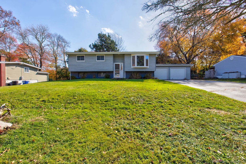
12 Cartridge Trail Ledyard, CT 06339
Estimated payment $2,132/month
Highlights
- Deck
- Attic
- Laundry Room
- Raised Ranch Architecture
- Bonus Room
- Tankless Water Heater
About This Home
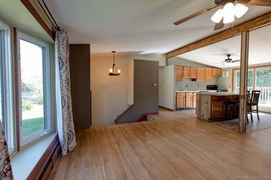
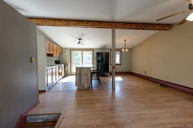
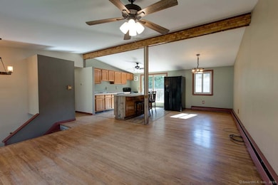
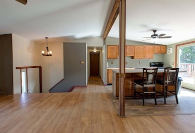
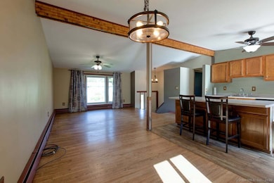
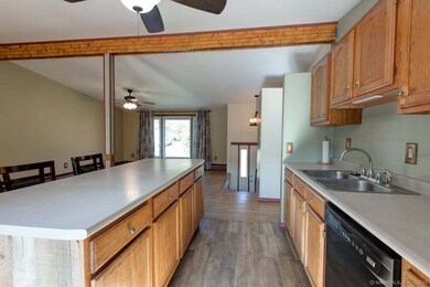
Bright and spacious Raised Ranch featuring an open layout with hardwood floors and abundant natural light. The main level offers three bedrooms and a recently renovated full bathroom with modern finishes-ideal for convenient single-level living. The full, partially finished basement includes a renovated half bath, laundry room, a large open living area, and an additional room perfect for a guest bedroom, home office, or hobby space. Step outside to a deck overlooking a fully fenced-in yard, great for pets and outdoor enjoyment. Additional features include a two-car garage providing ample parking and storage. Property is being sold as-is-bring your vision and make this home your own!
Listing Agent
RE/MAX Bell Park Realty Brokerage Phone: (860) 753-0334 License #RES.0807821 Listed on: 10/10/2025

Home Details
Home Type
- Single Family
Est. Annual Taxes
- $5,660
Year Built
- Built in 1963
Lot Details
- 0.31 Acre Lot
- Property is zoned R40
Home Design
- Raised Ranch Architecture
- Concrete Foundation
- Frame Construction
- Asphalt Shingled Roof
- Vinyl Siding
Interior Spaces
- 1,028 Sq Ft Home
- Ceiling Fan
- Bonus Room
- Partially Finished Basement
- Basement Fills Entire Space Under The House
- Attic or Crawl Hatchway Insulated
Kitchen
- Oven or Range
- Dishwasher
- Disposal
Bedrooms and Bathrooms
- 3 Bedrooms
Laundry
- Laundry Room
- Laundry on lower level
- Electric Dryer
- Washer
Parking
- 2 Car Garage
- Parking Deck
- Private Driveway
Outdoor Features
- Deck
Utilities
- Baseboard Heating
- Heating System Uses Oil
- Heating System Uses Oil Above Ground
- Tankless Water Heater
- Oil Water Heater
- Cable TV Available
Listing and Financial Details
- Assessor Parcel Number 1512493
Map
Home Values in the Area
Average Home Value in this Area
Tax History
| Year | Tax Paid | Tax Assessment Tax Assessment Total Assessment is a certain percentage of the fair market value that is determined by local assessors to be the total taxable value of land and additions on the property. | Land | Improvement |
|---|---|---|---|---|
| 2025 | $5,660 | $152,390 | $41,790 | $110,600 |
| 2024 | $5,348 | $151,900 | $41,790 | $110,110 |
| 2023 | $5,250 | $151,900 | $41,790 | $110,110 |
| 2022 | $5,137 | $151,900 | $41,790 | $110,110 |
| 2021 | $5,104 | $151,900 | $41,790 | $110,110 |
| 2020 | $4,663 | $133,350 | $33,460 | $99,890 |
| 2019 | $4,675 | $133,350 | $33,460 | $99,890 |
| 2018 | $4,573 | $133,350 | $33,460 | $99,890 |
| 2017 | $4,339 | $133,350 | $33,460 | $99,890 |
| 2016 | $4,254 | $133,350 | $33,460 | $99,890 |
| 2015 | $4,054 | $133,350 | $33,460 | $99,890 |
| 2014 | $4,133 | $135,940 | $33,460 | $102,480 |
Property History
| Date | Event | Price | List to Sale | Price per Sq Ft |
|---|---|---|---|---|
| 10/27/2025 10/27/25 | Pending | -- | -- | -- |
| 10/10/2025 10/10/25 | For Sale | $315,000 | -- | $306 / Sq Ft |
Purchase History
| Date | Type | Sale Price | Title Company |
|---|---|---|---|
| Warranty Deed | $243,000 | -- | |
| Deed | $97,000 | -- |
Mortgage History
| Date | Status | Loan Amount | Loan Type |
|---|---|---|---|
| Open | $230,547 | Stand Alone Refi Refinance Of Original Loan | |
| Closed | $248,224 | VA | |
| Previous Owner | $175,750 | No Value Available | |
| Previous Owner | $140,500 | No Value Available |
Source: SmartMLS
MLS Number: 24132798
APN: LEDY-000086-000390-000012
Disclaimer: Certain information contained herein is derived from information provided by parties other than Homes.com. All information provided is deemed reliable, but is not guaranteed to be accurate and should be independently verified.
![]() IDX information is provided exclusively for personal, non-commercial use, and may not be used for any purpose other than to identify prospective properties consumers may be interested in purchasing. Information is deemed reliable but not guaranteed.
IDX information is provided exclusively for personal, non-commercial use, and may not be used for any purpose other than to identify prospective properties consumers may be interested in purchasing. Information is deemed reliable but not guaranteed.
- 113 Meeting House Ln
- 7 Captain Amos Stanton Dr
- 61 Town Farm Rd
- 146 Gallup Hill Rd
- 148 Gallup Hill Rd
- 3 Cliff Rd
- 22 Boulder Way
- 22 Cliff Rd
- 25 Old Colony Ln
- 17 Autumn Way
- 6 Lakeside Dr Unit P
- 20 Lakeside Dr Unit P
- 4 Lakeside Dr Unit L
- 528 Colonel Ledyard Hwy
- 155 Iron St
- 7 Chidley Way
- 134 Iron St
- 45R Long Pond Rd S
- 332 Lantern Hill Rd
- 452 Colonel Ledyard Hwy