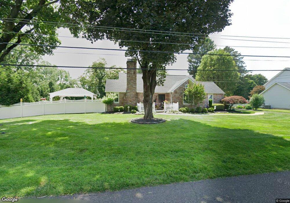
12 Catherine Ave Doylestown, PA 18901
Estimated Value: $682,000 - $808,000
3
Beds
2
Baths
2,591
Sq Ft
$276/Sq Ft
Est. Value
About This Home
This home is located at 12 Catherine Ave, Doylestown, PA 18901 and is currently estimated at $715,308, approximately $276 per square foot. 12 Catherine Ave is a home located in Bucks County with nearby schools including Linden El School, Lenape Middle School, and Central Bucks High School-West.
Ownership History
Date
Name
Owned For
Owner Type
Purchase Details
Closed on
Oct 28, 1997
Sold by
Lefrapper Claude and Gross Annette E
Bought by
Saxby Joann
Current Estimated Value
Home Financials for this Owner
Home Financials are based on the most recent Mortgage that was taken out on this home.
Original Mortgage
$160,650
Outstanding Balance
$32,111
Interest Rate
9.7%
Estimated Equity
$683,197
Purchase Details
Closed on
May 1, 1992
Bought by
Lefrapper Claude
Create a Home Valuation Report for This Property
The Home Valuation Report is an in-depth analysis detailing your home's value as well as a comparison with similar homes in the area
Home Values in the Area
Average Home Value in this Area
Purchase History
| Date | Buyer | Sale Price | Title Company |
|---|---|---|---|
| Saxby Joann | $189,000 | -- | |
| Lefrapper Claude | -- | -- |
Source: Public Records
Mortgage History
| Date | Status | Borrower | Loan Amount |
|---|---|---|---|
| Open | Saxby Joann | $160,650 |
Source: Public Records
Tax History Compared to Growth
Tax History
| Year | Tax Paid | Tax Assessment Tax Assessment Total Assessment is a certain percentage of the fair market value that is determined by local assessors to be the total taxable value of land and additions on the property. | Land | Improvement |
|---|---|---|---|---|
| 2025 | $6,618 | $37,400 | $7,200 | $30,200 |
| 2024 | $6,618 | $37,400 | $7,200 | $30,200 |
| 2023 | $6,311 | $37,400 | $7,200 | $30,200 |
| 2022 | $6,241 | $37,400 | $7,200 | $30,200 |
| 2021 | $6,112 | $37,400 | $7,200 | $30,200 |
| 2020 | $6,084 | $37,400 | $7,200 | $30,200 |
| 2019 | $6,019 | $37,400 | $7,200 | $30,200 |
| 2018 | $6,000 | $37,400 | $7,200 | $30,200 |
| 2017 | $5,953 | $37,400 | $7,200 | $30,200 |
| 2016 | $5,916 | $37,400 | $7,200 | $30,200 |
| 2015 | -- | $37,400 | $7,200 | $30,200 |
| 2014 | -- | $37,400 | $7,200 | $30,200 |
Source: Public Records
Map
Nearby Homes
- 114 Blackfriars Cir
- 194 Victoria Ct Unit 143
- 100 Bishops Gate Ln Unit 67
- 90 Chapman Ave
- 418 North St
- 5437 Rinker Cir Unit 283
- 301 Windy Run Rd
- 3723 William Daves Rd
- 121 Cottage St
- 3867 Charter Club Dr
- 146 N Church St
- 3765 William Daves Rd
- 169 N Main St
- 5 Belmont Square
- 143 Myers Dr
- 4748 Bishop Cir
- 104 Kreutz Ave
- 0 Myers Dr
- 146 E Court St
- 3711 Jacob Stout Rd Unit 5
- 8 Catherine Ave
- 101 Park Dr
- 15 Catherine Ave
- 16 Catherine Ave
- 65 Campbell Ave
- 19 Catherine Ave
- 127 Cottonwood Ct
- 80 Campbell Ave
- 18 Dorothy Ave
- 109 Park Dr
- 68 Campbell Ave
- 129 Cottonwood Ct
- 20 Dorothy Ave
- 51 Campbell Ave
- 98 Campbell Ave
- 125 Cottonwood Ct
- 131 Cottonwood Ct
- 56 Campbell Ave
- 123 Cottonwood Ct
- 133 Cottonwood Ct