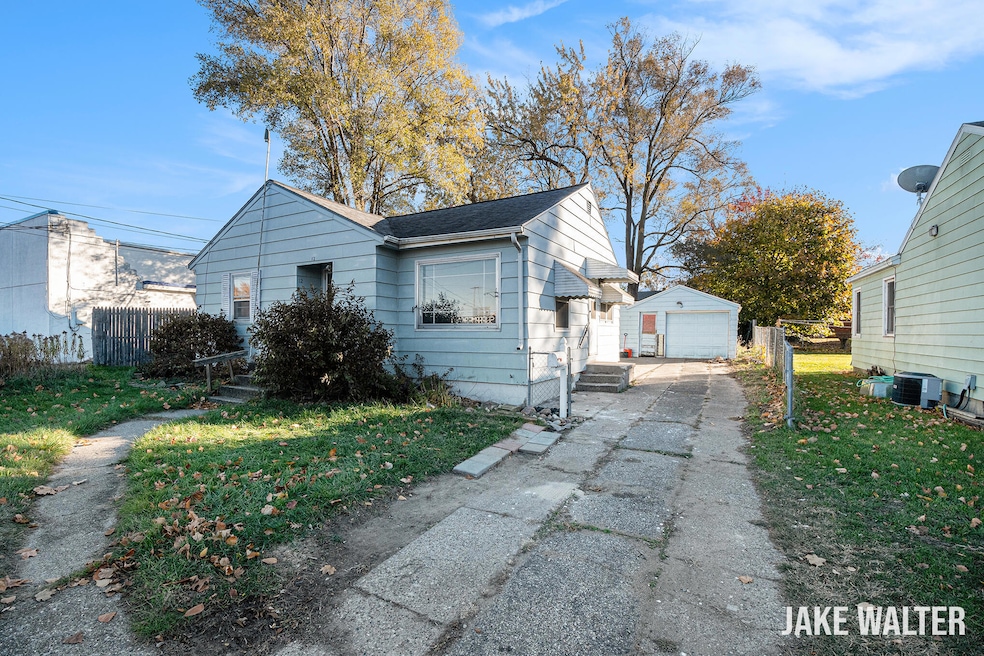
12 Celia St SW Grand Rapids, MI 49548
Garfield Park NeighborhoodEstimated payment $995/month
Highlights
- Very Popular Property
- No HOA
- Cul-De-Sac
- Wood Flooring
- 2 Car Detached Garage
- Forced Air Heating System
About This Home
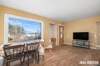
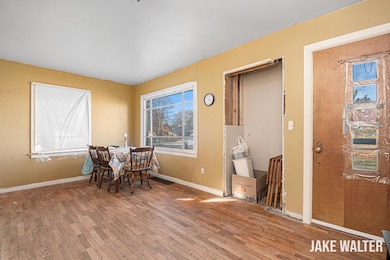
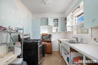
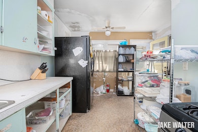
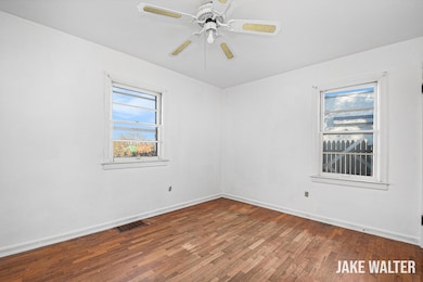
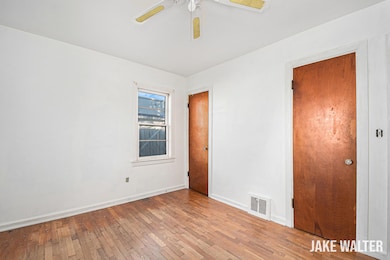
Who wants to gain some equity!!! Don't miss this great opportunity in a quiet Wyoming neighborhood located at the end of a cul-de-sac street. This 3 bedroom, 2 bath home features hardwood floors on the main level, which includes a large living room, two bedrooms and the kitchen and bath which offer a ton of room to improve and gain equity. The lower level offers a large third bedroom with egress window, a full bathroom that needs the walls to be finished and the laundry and plenty of storage space. Outside you'll find a fenced backyard and a two-stall garage. House roof was new in 2017 and garage roof was new in 2020. Close to schools, Hillcroft Park, and plenty of restaurants. This home needs work, but it offers excellent equity building potential for the right buyer. Schedule your showing today! Offer received. Seller has set an offer review deadline of 6:00 Wednesday, Nov 19th.
Home Details
Home Type
- Single Family
Est. Annual Taxes
- $1,484
Year Built
- Built in 1951
Lot Details
- 7,287 Sq Ft Lot
- Lot Dimensions are 55 x 132.5
- Cul-De-Sac
- Back Yard Fenced
Parking
- 2 Car Detached Garage
- Front Facing Garage
Home Design
- Aluminum Siding
Interior Spaces
- 1,006 Sq Ft Home
- 1-Story Property
- Ceiling Fan
- Wood Flooring
- Range
- Laundry on main level
Bedrooms and Bathrooms
- 3 Bedrooms | 2 Main Level Bedrooms
- 2 Full Bathrooms
Basement
- Basement Fills Entire Space Under The House
- Laundry in Basement
Utilities
- Forced Air Heating System
- Heating System Uses Natural Gas
Community Details
- No Home Owners Association
Map
Home Values in the Area
Average Home Value in this Area
Tax History
| Year | Tax Paid | Tax Assessment Tax Assessment Total Assessment is a certain percentage of the fair market value that is determined by local assessors to be the total taxable value of land and additions on the property. | Land | Improvement |
|---|---|---|---|---|
| 2025 | $1,275 | $87,500 | $0 | $0 |
| 2024 | $1,275 | $85,400 | $0 | $0 |
| 2023 | $1,415 | $74,800 | $0 | $0 |
| 2022 | $1,307 | $61,600 | $0 | $0 |
| 2021 | $1,276 | $56,200 | $0 | $0 |
| 2020 | $1,079 | $49,900 | $0 | $0 |
| 2019 | $1,248 | $43,100 | $0 | $0 |
| 2018 | $1,224 | $39,900 | $0 | $0 |
| 2017 | $1,193 | $33,300 | $0 | $0 |
| 2016 | $1,150 | $30,400 | $0 | $0 |
| 2015 | $1,124 | $30,400 | $0 | $0 |
| 2013 | -- | $29,200 | $0 | $0 |
Property History
| Date | Event | Price | List to Sale | Price per Sq Ft |
|---|---|---|---|---|
| 11/19/2025 11/19/25 | Pending | -- | -- | -- |
| 11/18/2025 11/18/25 | For Sale | $164,900 | -- | $164 / Sq Ft |
Purchase History
| Date | Type | Sale Price | Title Company |
|---|---|---|---|
| Interfamily Deed Transfer | -- | Lsi | |
| Warranty Deed | $75,000 | -- | |
| Warranty Deed | $53,700 | -- |
Mortgage History
| Date | Status | Loan Amount | Loan Type |
|---|---|---|---|
| Open | $70,601 | New Conventional |
Source: MichRIC
MLS Number: 25058802
APN: 41-17-13-276-018
Disclaimer: Certain information contained herein is derived from information provided by parties other than Homes.com. All information provided is deemed reliable, but is not guaranteed to be accurate and should be independently verified.
![]() Information is deemed reliable but not guaranteed.
Information is deemed reliable but not guaranteed.
Copyright 2025 MichRIC, LLC. All rights reserved.
- 36 Celia St SE
- 100 Colrain St SW
- 124 Buckingham St SW
- 104 Colrain St SE
- 120 Manchester Rd SW
- 104 Wesley St SE
- 32 Oneida St SW
- 133 Wesley St SE
- 3112 Birchwood Ave SW
- 261 32nd St SW
- 3241 Birchwood Ave SW
- 150 Frontenac St SE
- 300 Eola St SE
- 148 Freedom St SE
- 3148 Stratford Dr SW
- 435 28th St SE
- 2828 Charlesgate Ave SW
- 2924 Union Ave SE
- 2810 Charlesgate Ave SW
- 113 Coolidge St SW
