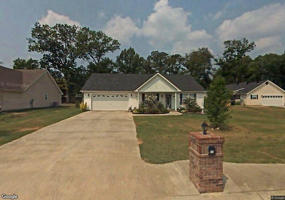
12 Century Dr Rossville, GA 30741
Westside NeighborhoodEstimated Value: $281,000 - $300,912
--
Bed
2
Baths
1,020
Sq Ft
$282/Sq Ft
Est. Value
About This Home
This home is located at 12 Century Dr, Rossville, GA 30741 and is currently estimated at $287,728, approximately $282 per square foot. 12 Century Dr is a home located in Catoosa County with nearby schools including Battlefield Primary School, Battlefield Elementary School, and Lakeview Middle School.
Ownership History
Date
Name
Owned For
Owner Type
Purchase Details
Closed on
May 24, 2024
Sold by
Grenke Raymond
Bought by
Hiland David and Hiland Shelby
Current Estimated Value
Home Financials for this Owner
Home Financials are based on the most recent Mortgage that was taken out on this home.
Original Mortgage
$280,250
Outstanding Balance
$276,532
Interest Rate
7.17%
Mortgage Type
New Conventional
Estimated Equity
$11,196
Purchase Details
Closed on
May 3, 2021
Sold by
Morgan Merida Francis
Bought by
Grenke Raymond and Grenke Sarah
Purchase Details
Closed on
Apr 13, 2015
Sold by
Cherry James Rodney
Bought by
Morgan James A and Morgan Merida
Purchase Details
Closed on
Sep 29, 2010
Sold by
Shipp Jenelle C
Bought by
Cherry James Rodney
Home Financials for this Owner
Home Financials are based on the most recent Mortgage that was taken out on this home.
Original Mortgage
$110,000
Interest Rate
4.36%
Mortgage Type
VA
Purchase Details
Closed on
Jun 17, 2002
Bought by
Shipp Jenelle C
Create a Home Valuation Report for This Property
The Home Valuation Report is an in-depth analysis detailing your home's value as well as a comparison with similar homes in the area
Home Values in the Area
Average Home Value in this Area
Purchase History
| Date | Buyer | Sale Price | Title Company |
|---|---|---|---|
| Hiland David | $295,000 | -- | |
| Grenke Raymond | $208,000 | -- | |
| Morgan James A | $126,800 | -- | |
| Cherry James Rodney | $110,000 | -- | |
| Shipp Jenelle C | $92,500 | -- |
Source: Public Records
Mortgage History
| Date | Status | Borrower | Loan Amount |
|---|---|---|---|
| Open | Hiland David | $280,250 | |
| Previous Owner | Cherry James Rodney | $110,000 |
Source: Public Records
Tax History Compared to Growth
Tax History
| Year | Tax Paid | Tax Assessment Tax Assessment Total Assessment is a certain percentage of the fair market value that is determined by local assessors to be the total taxable value of land and additions on the property. | Land | Improvement |
|---|---|---|---|---|
| 2024 | $2,480 | $94,260 | $14,000 | $80,260 |
| 2023 | $2,162 | $76,980 | $14,000 | $62,980 |
| 2022 | $1,653 | $58,857 | $14,000 | $44,857 |
| 2021 | $1,567 | $58,857 | $14,000 | $44,857 |
| 2020 | $1,518 | $51,422 | $12,000 | $39,422 |
| 2019 | $1,611 | $51,422 | $12,000 | $39,422 |
| 2018 | $1,549 | $49,422 | $10,000 | $39,422 |
| 2017 | $296 | $46,614 | $9,500 | $37,114 |
| 2016 | $292 | $44,077 | $9,500 | $34,577 |
| 2015 | -- | $44,077 | $9,500 | $34,577 |
| 2014 | -- | $41,294 | $8,900 | $32,394 |
| 2013 | -- | $40,992 | $8,900 | $32,092 |
Source: Public Records
Map
Nearby Homes
- 132 Holli Ln
- 2 Janet Ln
- 199 Mitchell Ln
- 301 Dogwood Ln
- 300 Dogwood Ln
- 129 Cedar Grove Ln
- 2237 Cloud Springs Rd
- 114 Clara Lee Dr
- 162 Huntley Meadows Dr
- 127 Huntley Meadows Dr
- 0 Battlefield Pkwy Unit 129870
- 17 Southshore Dr
- 302 Huntley Meadows Dr
- 518 Winchester Dr
- 530 Winchester Dr
- 458 Winchester Dr
- 527 Winchester Dr
- 398 Winchester Dr
- 385 Winchester Dr
- Peyton Plan at The Fields at Huntley Meadows
- 12 Century Dr
- 68 Century Station Dr
- 28 Century Dr
- 42 Century Dr
- 98 Century Station Dr
- 23 Century Dr
- 79 Century Station Dr
- 37 Century Dr
- 56 Century Dr
- 97 Century Station Dr
- 421 Mineral Ave
- 51 Century Dr
- 68 Century Dr
- 10 Holli Ln
- 22 Holli Ln
- 433 Mineral Ave
- 74 Century Dr
- 36 Holli Ln
- 119 Century Station Dr
- 89 Janet Ln