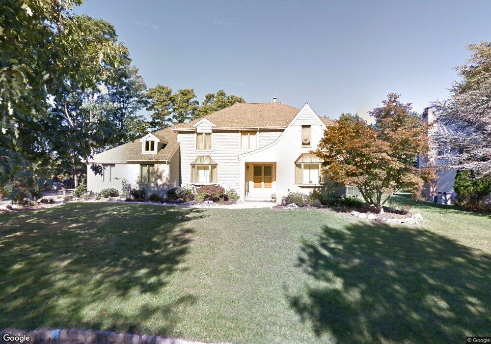
12 Cherokee Rd East Brunswick, NJ 08816
Estimated Value: $944,431 - $1,200,000
5
Beds
4
Baths
3,430
Sq Ft
$325/Sq Ft
Est. Value
About This Home
This home is located at 12 Cherokee Rd, East Brunswick, NJ 08816 and is currently estimated at $1,115,858, approximately $325 per square foot. 12 Cherokee Rd is a home located in Middlesex County with nearby schools including Robert Frost Elementary School, Hammarskjold Upper Elementary School, and Churchill Junior High School.
Ownership History
Date
Name
Owned For
Owner Type
Purchase Details
Closed on
Mar 1, 2011
Sold by
Cartus Corporation
Bought by
Patel Devang M and Patel Urvashi J
Current Estimated Value
Home Financials for this Owner
Home Financials are based on the most recent Mortgage that was taken out on this home.
Original Mortgage
$417,000
Interest Rate
4.88%
Mortgage Type
New Conventional
Purchase Details
Closed on
Feb 5, 2011
Sold by
Hsu Alfred T and Hsu Helen W
Bought by
Cartus Corporation
Home Financials for this Owner
Home Financials are based on the most recent Mortgage that was taken out on this home.
Original Mortgage
$417,000
Interest Rate
4.88%
Mortgage Type
New Conventional
Create a Home Valuation Report for This Property
The Home Valuation Report is an in-depth analysis detailing your home's value as well as a comparison with similar homes in the area
Home Values in the Area
Average Home Value in this Area
Purchase History
| Date | Buyer | Sale Price | Title Company |
|---|---|---|---|
| Patel Devang M | $600,000 | Chicago Title Insurance Co | |
| Cartus Corporation | $599,300 | Chicago Title Insurance Co |
Source: Public Records
Mortgage History
| Date | Status | Borrower | Loan Amount |
|---|---|---|---|
| Previous Owner | Patel Devang M | $417,000 |
Source: Public Records
Tax History Compared to Growth
Tax History
| Year | Tax Paid | Tax Assessment Tax Assessment Total Assessment is a certain percentage of the fair market value that is determined by local assessors to be the total taxable value of land and additions on the property. | Land | Improvement |
|---|---|---|---|---|
| 2025 | $19,303 | $158,300 | $35,000 | $123,300 |
| 2024 | $18,727 | $158,300 | $35,000 | $123,300 |
| 2023 | $18,727 | $158,300 | $35,000 | $123,300 |
| 2022 | $18,652 | $158,300 | $35,000 | $123,300 |
| 2021 | $18,121 | $158,300 | $35,000 | $123,300 |
| 2020 | $18,095 | $158,300 | $35,000 | $123,300 |
| 2019 | $17,902 | $158,300 | $35,000 | $123,300 |
| 2018 | $17,598 | $158,300 | $35,000 | $123,300 |
| 2017 | $17,315 | $158,300 | $35,000 | $123,300 |
| 2016 | $16,965 | $158,300 | $35,000 | $123,300 |
| 2015 | $16,566 | $158,300 | $35,000 | $123,300 |
| 2014 | $16,208 | $158,300 | $35,000 | $123,300 |
Source: Public Records
Map
Nearby Homes
- 20 Buffalo Run
- 23 Morgan Place
- 21 Fern Rd
- 97 Morgan Place
- 167 Applegate Ln
- 1905 Commons at Kingswood Dr
- 6 Lewis Ct
- 33 Oakcrest Dr
- 107 Commons at Kingswood Dr
- 18 Adams Ct
- 26 Dorchester Dr
- 5 Sandalwood Dr
- 17 Hyde Park Dr
- 11 Dorchester Dr
- 202 Cypress Ln
- 37 Dorchester Dr
- 20 Morton Ct
- 364 Mcdowell Dr
- 2 Candle Ln
- 396 Mcdowell Dr Unit C2