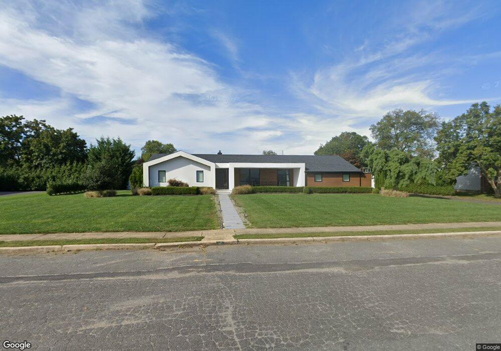
12 Cheryl Dr West Long Branch, NJ 07764
Estimated Value: $1,467,000 - $1,745,000
3
Beds
3
Baths
2,082
Sq Ft
$745/Sq Ft
Est. Value
About This Home
This home is located at 12 Cheryl Dr, West Long Branch, NJ 07764 and is currently estimated at $1,551,673, approximately $745 per square foot. 12 Cheryl Dr is a home located in Monmouth County with nearby schools including Betty McElmon Elementary School, Frank Antonides School, and Shore Regional High School.
Ownership History
Date
Name
Owned For
Owner Type
Purchase Details
Closed on
Oct 6, 2004
Sold by
Cohen Sam
Bought by
Zaytoune Raimondo and Zaytoune Nina
Current Estimated Value
Home Financials for this Owner
Home Financials are based on the most recent Mortgage that was taken out on this home.
Original Mortgage
$333,700
Outstanding Balance
$164,932
Interest Rate
5.74%
Estimated Equity
$1,386,741
Purchase Details
Closed on
Jul 17, 2001
Sold by
Ebani Jack
Bought by
Cohen Sam and Cohen Suzanne
Home Financials for this Owner
Home Financials are based on the most recent Mortgage that was taken out on this home.
Original Mortgage
$200,000
Interest Rate
7.2%
Create a Home Valuation Report for This Property
The Home Valuation Report is an in-depth analysis detailing your home's value as well as a comparison with similar homes in the area
Home Values in the Area
Average Home Value in this Area
Purchase History
| Date | Buyer | Sale Price | Title Company |
|---|---|---|---|
| Zaytoune Raimondo | $695,000 | -- | |
| Cohen Sam | $365,000 | -- |
Source: Public Records
Mortgage History
| Date | Status | Borrower | Loan Amount |
|---|---|---|---|
| Open | Zaytoune Raimondo | $333,700 | |
| Previous Owner | Cohen Sam | $200,000 |
Source: Public Records
Tax History Compared to Growth
Tax History
| Year | Tax Paid | Tax Assessment Tax Assessment Total Assessment is a certain percentage of the fair market value that is determined by local assessors to be the total taxable value of land and additions on the property. | Land | Improvement |
|---|---|---|---|---|
| 2025 | $20,968 | $1,780,300 | $1,123,100 | $657,200 |
| 2024 | $19,480 | $1,609,200 | $964,100 | $645,100 |
| 2023 | $19,480 | $1,394,400 | $800,000 | $594,400 |
| 2022 | $16,488 | $1,166,700 | $675,000 | $491,700 |
| 2021 | $16,488 | $853,000 | $518,800 | $334,200 |
| 2020 | $14,726 | $716,600 | $390,000 | $326,600 |
| 2019 | $14,506 | $709,700 | $385,000 | $324,700 |
| 2018 | $14,539 | $687,100 | $377,500 | $309,600 |
| 2017 | $14,630 | $660,200 | $360,000 | $300,200 |
| 2016 | $11,479 | $528,500 | $275,000 | $253,500 |
| 2015 | $11,354 | $522,000 | $275,000 | $247,000 |
| 2014 | $11,317 | $485,500 | $250,000 | $235,500 |
Source: Public Records
Map
Nearby Homes
- 24 Hendrickson Place
- 10 Cheryl Dr
- 10 Cheryl Dr Unit WINTER RENTAL
- 14 Cheryl Dr
- 18 Hendrickson Place
- 30 Hendrickson Place
- 6 Robin Ct
- 14 Hendrickson Place
- 5 Cheryl Dr
- 34 Hendrickson Place
- 34 Hendrickson Place Unit WINTER
- 34 Hendrickson Place Unit SUMMER
- 34 Hendrickson Place Unit ANNUAL
- 5 Robin Ct
- 27 Hendrickson Place
- 16 Cheryl Dr
- 19 Hendrickson Place
- 4 Robin Ct
- 40 Baker Dr
- 8 Cheryl Dr