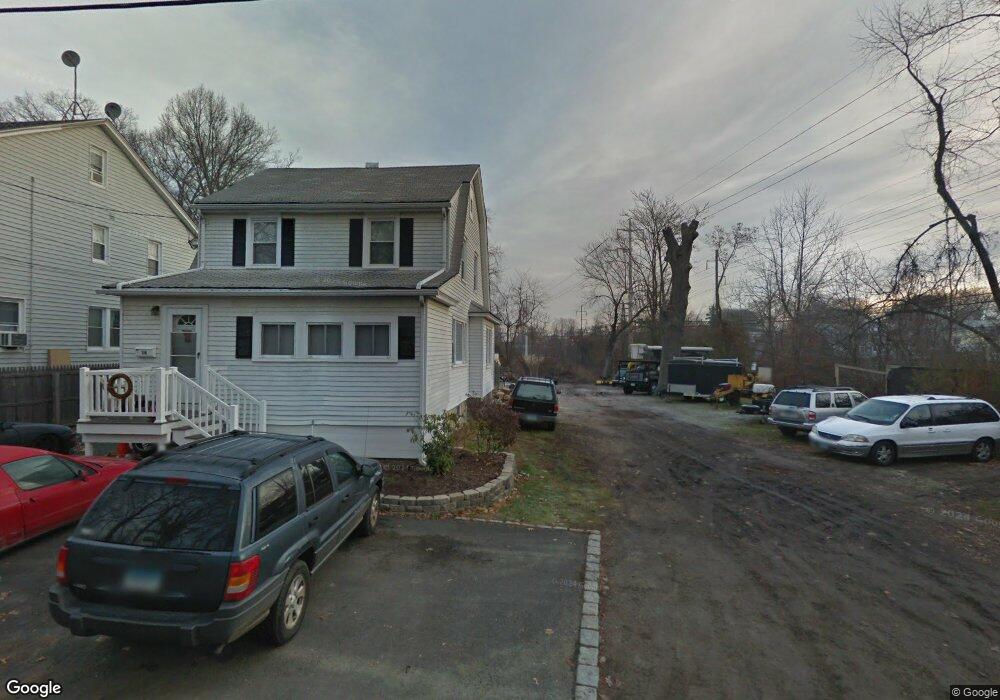
12 Chestnut St Fairfield, CT 06824
Grasmere NeighborhoodEstimated Value: $101,191 - $845,000
Studio
--
Bath
--
Sq Ft
8,712
Sq Ft Lot
About This Home
This home is located at 12 Chestnut St, Fairfield, CT 06824 and is currently estimated at $447,730. 12 Chestnut St is a home located in Fairfield County with nearby schools including Holland Hill Elementary, Fairfield Woods Middle School, and Fairfield Ludlowe High School.
Ownership History
Date
Name
Owned For
Owner Type
Purchase Details
Closed on
Aug 29, 2025
Sold by
12 Chestnut Street Llc
Bought by
Clb Holdings Llc
Current Estimated Value
Purchase Details
Closed on
Jun 30, 2011
Sold by
Sovereign Bank
Bought by
12 Chestnut Street Llc
Purchase Details
Closed on
Aug 5, 2004
Sold by
Anzlonc Llc
Bought by
Black Jeresa A
Home Financials for this Owner
Home Financials are based on the most recent Mortgage that was taken out on this home.
Original Mortgage
$121,000
Interest Rate
6.2%
Mortgage Type
Purchase Money Mortgage
Create a Home Valuation Report for This Property
The Home Valuation Report is an in-depth analysis detailing your home's value as well as a comparison with similar homes in the area
Home Values in the Area
Average Home Value in this Area
Purchase History
| Date | Buyer | Sale Price | Title Company |
|---|---|---|---|
| Clb Holdings Llc | $100,000 | -- | |
| 12 Chestnut Street Llc | $49,900 | -- | |
| 12 Chestnut Street Llc | $49,900 | -- | |
| Black Jeresa A | $185,000 | -- | |
| Black Jeresa A | $185,000 | -- |
Source: Public Records
Mortgage History
| Date | Status | Borrower | Loan Amount |
|---|---|---|---|
| Previous Owner | Black Jeresa A | $121,000 |
Source: Public Records
Tax History
| Year | Tax Paid | Tax Assessment Tax Assessment Total Assessment is a certain percentage of the fair market value that is determined by local assessors to be the total taxable value of land and additions on the property. | Land | Improvement |
|---|---|---|---|---|
| 2025 | $3,607 | $127,050 | $127,050 | $0 |
| 2024 | $3,545 | $127,050 | $127,050 | $0 |
| 2023 | $3,495 | $127,050 | $127,050 | $0 |
| 2022 | $3,461 | $127,050 | $127,050 | $0 |
| 2021 | $3,428 | $127,050 | $127,050 | $0 |
| 2020 | $2,897 | $108,150 | $108,150 | $0 |
| 2019 | $2,897 | $108,150 | $108,150 | $0 |
| 2018 | $2,851 | $108,150 | $108,150 | $0 |
| 2017 | $2,792 | $108,150 | $108,150 | $0 |
| 2016 | $2,752 | $108,150 | $108,150 | $0 |
| 2015 | $2,733 | $110,250 | $110,250 | $0 |
| 2014 | $2,690 | $110,250 | $110,250 | $0 |
Source: Public Records
Map
Nearby Homes
- 15 Barton Rd
- 98 Cambridge St
- 361 Riverside Dr
- 3250 Fairfield Ave Unit 302
- 20 Ermine St
- 1478 Jennings Rd
- 341 Crestwood Rd
- 855 Riverside Dr
- 315 Seaside Ave
- 90 Clarkson St
- 274 High St
- 165 Bennett St
- 132 Gilman St
- 377 Midland St
- 324 Sunnieholme Dr
- 855 Brewster St Unit 857
- 378 High St
- 68 Figlar Ave
- 97 Fayerweather Terrace
- 148 Alfred St
- 16 Chestnut St
- 24 Chestnut St
- 36 Chestnut St
- 44 Chestnut St
- 2046 Kings Hwy
- 2032 Kings Hwy
- 2030 Kings Hwy
- 2058 Kings Hwy
- 2010 Kings Hwy
- 2022 Kings Hwy
- 2022 Kings Hwy Unit LOWER
- 2022 Kings Hwy Unit Upper
- 1990 Kings Hwy Unit 1992
- 2037 Kings Hwy
- 2029 Kings Hwy
- 1986 Kings Hwy
- 2009 Kings Hwy
- 2057 Kings Hwy
- 118 Harris St
- 35 High Ct
Your Personal Tour Guide
Ask me questions while you tour the home.