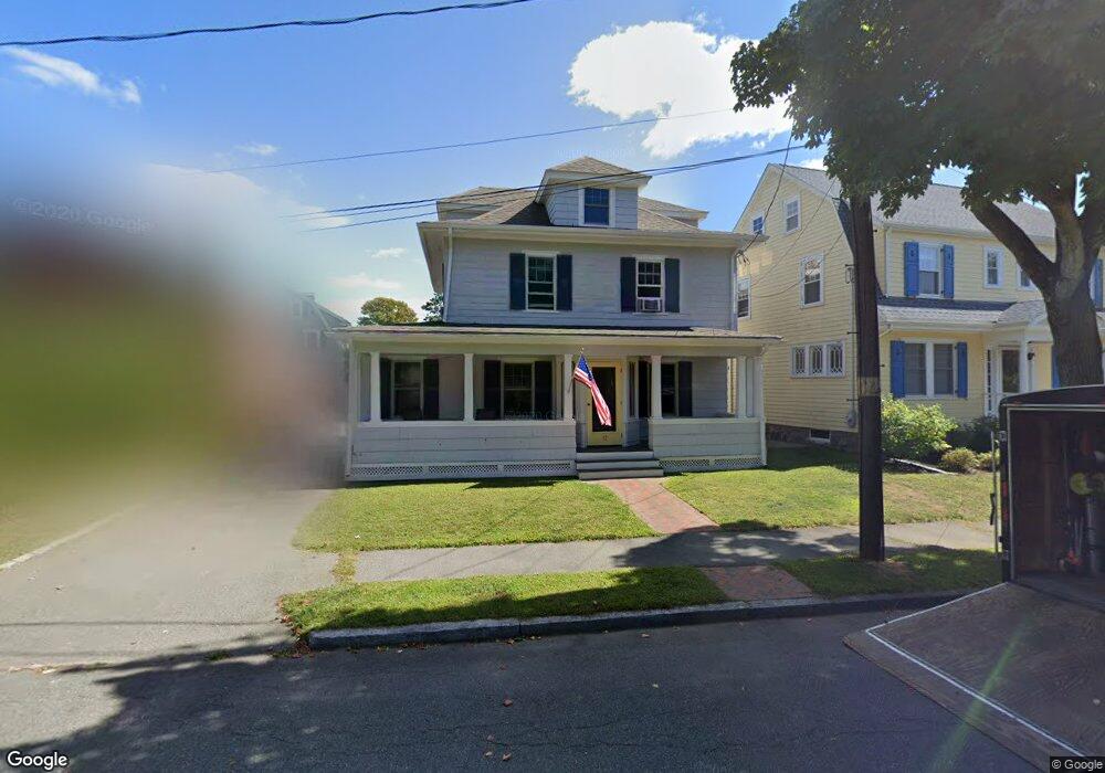
12 Conant Rd Marblehead, MA 01945
Estimated Value: $912,151 - $1,033,000
3
Beds
3
Baths
1,909
Sq Ft
$508/Sq Ft
Est. Value
About This Home
This home is located at 12 Conant Rd, Marblehead, MA 01945 and is currently estimated at $969,538, approximately $507 per square foot. 12 Conant Rd is a home located in Essex County with nearby schools including Marblehead High School, Devereux School, and Tower School.
Ownership History
Date
Name
Owned For
Owner Type
Purchase Details
Closed on
Jun 23, 2022
Sold by
Donegan Patrick
Bought by
Egypt House
Current Estimated Value
Purchase Details
Closed on
Oct 28, 2011
Sold by
Twelve Conant Road Nt
Bought by
Donegan Patrick
Home Financials for this Owner
Home Financials are based on the most recent Mortgage that was taken out on this home.
Original Mortgage
$470,407
Interest Rate
4.11%
Mortgage Type
Purchase Money Mortgage
Purchase Details
Closed on
Aug 11, 2010
Sold by
Mclaughlin Michael J and Vanderlaan Kathleen
Bought by
Mclaughlin Tr Michael J and Vanderlaan Kathleen
Purchase Details
Closed on
Oct 28, 2005
Sold by
Pitcher Barbara E
Bought by
Mclaughlin Michael J and Vanderlaan Kathleen
Create a Home Valuation Report for This Property
The Home Valuation Report is an in-depth analysis detailing your home's value as well as a comparison with similar homes in the area
Home Values in the Area
Average Home Value in this Area
Purchase History
| Date | Buyer | Sale Price | Title Company |
|---|---|---|---|
| Egypt House | $802,050 | None Available | |
| Donegan Patrick | $505,000 | -- | |
| Donegan Patrick | $505,000 | -- | |
| Mclaughlin Tr Michael J | -- | -- | |
| Mclaughlin Tr Michael J | -- | -- | |
| Mclaughlin Michael J | $472,000 | -- | |
| Mclaughlin Michael J | $472,000 | -- |
Source: Public Records
Mortgage History
| Date | Status | Borrower | Loan Amount |
|---|---|---|---|
| Previous Owner | Mclaughlin Michael J | $470,407 | |
| Previous Owner | Mclaughlin Michael J | $192,000 |
Source: Public Records
Tax History
| Year | Tax Paid | Tax Assessment Tax Assessment Total Assessment is a certain percentage of the fair market value that is determined by local assessors to be the total taxable value of land and additions on the property. | Land | Improvement |
|---|---|---|---|---|
| 2025 | $7,664 | $846,800 | $513,200 | $333,600 |
| 2024 | $7,532 | $840,600 | $513,200 | $327,400 |
| 2023 | $7,378 | $737,800 | $467,600 | $270,200 |
| 2022 | $7,196 | $684,000 | $422,000 | $262,000 |
| 2021 | $6,749 | $647,700 | $387,800 | $259,900 |
| 2020 | $6,469 | $622,600 | $387,800 | $234,800 |
| 2019 | $6,318 | $588,300 | $353,500 | $234,800 |
| 2018 | $6,232 | $565,500 | $330,700 | $234,800 |
| 2017 | $5,975 | $542,700 | $307,900 | $234,800 |
| 2016 | $5,771 | $519,900 | $285,100 | $234,800 |
| 2015 | $5,508 | $497,100 | $262,300 | $234,800 |
| 2014 | $5,192 | $468,200 | $239,500 | $228,700 |
Source: Public Records
Map
Nearby Homes
- 48 Bellevue Rd
- 212 Humphrey St Unit 205
- 11 Angenica Terrace
- 2 Ocean Ave
- 25 Tedesco St
- 1002 Paradise Rd Unit PHE
- 1004 Paradise Rd Unit 1L
- 12 Pickwick Rd
- 4 Dean Rd
- 49 Weatherly Dr
- 30 Weatherly Dr
- 11 Weatherly Dr
- 71 Walnut Rd
- 3 Didio Dr
- 445 Essex St Unit 304
- 441 Essex St Unit 302
- 35 Alden Rd
- 22 Hemenway Rd
- 28 Surrey Rd
- 50 Mountwood Rd
Your Personal Tour Guide
Ask me questions while you tour the home.