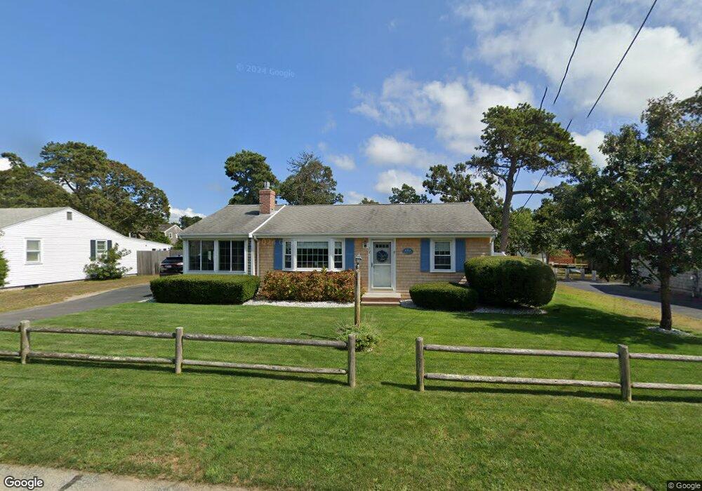
12 Cornell Dr Dennis Port, MA 02639
Dennis Port NeighborhoodEstimated Value: $584,000 - $791,000
3
Beds
1
Bath
982
Sq Ft
$713/Sq Ft
Est. Value
About This Home
This home is located at 12 Cornell Dr, Dennis Port, MA 02639 and is currently estimated at $700,650, approximately $713 per square foot. 12 Cornell Dr is a home located in Barnstable County with nearby schools including Dennis-Yarmouth Regional High School and St. Pius X. School.
Ownership History
Date
Name
Owned For
Owner Type
Purchase Details
Closed on
Oct 21, 2024
Sold by
Charest Diane E and Charest John R
Bought by
Charest Ft and Charest
Current Estimated Value
Purchase Details
Closed on
Dec 18, 2006
Sold by
Benedict David M and Benedict Richard H
Bought by
Charest Diane E and Charest John R
Home Financials for this Owner
Home Financials are based on the most recent Mortgage that was taken out on this home.
Original Mortgage
$252,000
Interest Rate
6.31%
Mortgage Type
Purchase Money Mortgage
Purchase Details
Closed on
Sep 18, 2001
Sold by
Est Benedict Donald R and Benedict Richard H
Bought by
Benedict Richard H and Benedict David M
Create a Home Valuation Report for This Property
The Home Valuation Report is an in-depth analysis detailing your home's value as well as a comparison with similar homes in the area
Home Values in the Area
Average Home Value in this Area
Purchase History
| Date | Buyer | Sale Price | Title Company |
|---|---|---|---|
| Charest Ft | -- | None Available | |
| Charest Ft | -- | None Available | |
| Charest Diane E | $315,000 | -- | |
| Charest Diane E | $315,000 | -- | |
| Charest Diane E | $315,000 | -- | |
| Benedict Richard H | $145,000 | -- | |
| Benedict Richard H | $145,000 | -- | |
| Benedict Richard H | $145,000 | -- |
Source: Public Records
Mortgage History
| Date | Status | Borrower | Loan Amount |
|---|---|---|---|
| Previous Owner | Charest Diane E | $252,000 |
Source: Public Records
Tax History Compared to Growth
Tax History
| Year | Tax Paid | Tax Assessment Tax Assessment Total Assessment is a certain percentage of the fair market value that is determined by local assessors to be the total taxable value of land and additions on the property. | Land | Improvement |
|---|---|---|---|---|
| 2025 | $3,045 | $703,300 | $212,600 | $490,700 |
| 2024 | $2,888 | $657,900 | $204,500 | $453,400 |
| 2023 | $2,717 | $581,700 | $185,900 | $395,800 |
| 2022 | $2,576 | $460,000 | $167,500 | $292,500 |
| 2021 | $2,194 | $363,900 | $187,600 | $176,300 |
| 2020 | $1,977 | $324,100 | $164,200 | $159,900 |
| 2019 | $4,714 | $303,200 | $161,000 | $142,200 |
| 2018 | $4,443 | $280,900 | $153,200 | $127,700 |
| 2017 | $4,104 | $265,900 | $142,300 | $123,600 |
| 2016 | $1,666 | $255,200 | $153,200 | $102,000 |
| 2015 | $1,633 | $255,200 | $153,200 | $102,000 |
| 2014 | $1,474 | $232,200 | $131,300 | $100,900 |
Source: Public Records
Map
Nearby Homes
- 37 Ocean Dr Unit 2
- 64 Beaten Rd
- 80 Michaels Ave
- 112 Old Wharf Rd Unit E4
- 112 Old Wharf Rd Unit E1
- 31 Easy St
- 154 Old Wharf Rd Unit 26
- 154 Old Wharf Rd Unit 14
- 120 Old Wharf Rd Unit 11
- 217 Old Wharf Rd Unit 64
- 19 Standish Way
- 241 Old Wharf Rd Unit 82
- 241 Old Wharf Rd Unit 127
- 241 Old Wharf Rd Unit 90
- 262 Old Wharf Rd Unit 67
- 262 Old Wharf Rd Unit 5
- 262 Old Wharf Rd Unit 5
- 262 Old Wharf Rd Unit 20
- 262 Old Wharf Rd Unit 87
- 22 Wixon Rd
- 8 Cornell Dr
- 16 Cornell Dr
- 108 Lower County Rd
- 108 Lower County Rd
- 20 Cornell Dr
- 9 Kibby Ln
- 17 Cornell Dr
- 102 Lower County Rd
- 102 Lower County Rd Unit 4
- 102 Lower County Rd Unit 1-4
- 13 Cornell Dr
- 1 Kibby Ln
- 5 Kibby Ln
- 21 Cornell Dr
- 7 Kibby Ln
- 9 Cornell Dr
- 24 Cornell Dr
- 25 Cornell Dr
- 11 Kibby Ln
- 22 Polly Fisk Ln Unit 22