
Seller's Agent in 2025
Nancy Casimiro
Coldwell Banker Realty - Franklin
(401) 465-2073
166 Total Sales
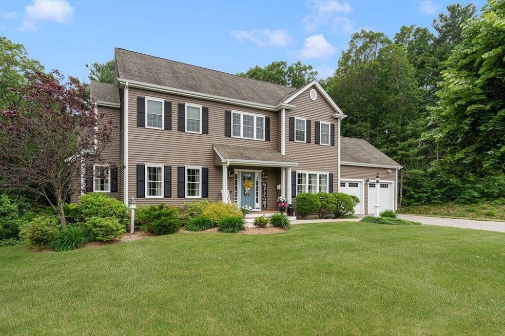
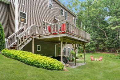
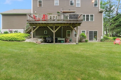
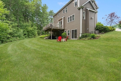
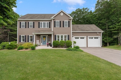

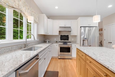
Beautiful 4 bed home in a quiet cul-de-sac location. The open flow is great for entertaining. The bright kitchen with granite counters and stainless appliances, offers informal dining, sliders to a sunny oversized deck and leads to a wonderful family room with gas fireplace. Additional features include formal dining room, home office/den, hardwoods, impressive millwork, drop zone, spacious primary ensuite with walk in closet and the nicely finished lower level has a full walk out to meticulous large level yard. The location is just outside of Wrentham Center and offers easy access to highways, shopping, schools and dining from a tucked away neighborhood.
Last Agent to Sell the Property
Coldwell Banker Realty - Franklin Listed on: 06/10/2025
| Date | Type | Sale Price | Title Company |
|---|---|---|---|
| Deed | $1,080,000 | -- | |
| Quit Claim Deed | $625,000 | -- | |
| Quit Claim Deed | $625,000 | -- |
| Date | Status | Loan Amount | Loan Type |
|---|---|---|---|
| Open | $580,000 | New Conventional | |
| Previous Owner | $240,000 | New Conventional |
| Date | Event | Price | List to Sale | Price per Sq Ft |
|---|---|---|---|---|
| 09/04/2025 09/04/25 | Sold | $1,080,000 | +2.9% | $351 / Sq Ft |
| 06/16/2025 06/16/25 | Pending | -- | -- | -- |
| 06/10/2025 06/10/25 | For Sale | $1,050,000 | -- | $342 / Sq Ft |
| Year | Tax Paid | Tax Assessment Tax Assessment Total Assessment is a certain percentage of the fair market value that is determined by local assessors to be the total taxable value of land and additions on the property. | Land | Improvement |
|---|---|---|---|---|
| 2025 | $11,086 | $956,500 | $342,300 | $614,200 |
| 2024 | $10,565 | $880,400 | $342,300 | $538,100 |
| 2023 | $10,408 | $824,700 | $311,100 | $513,600 |
| 2022 | $9,905 | $724,600 | $282,800 | $441,800 |
| 2021 | $9,697 | $689,200 | $282,800 | $406,400 |
| 2020 | $9,599 | $673,600 | $232,500 | $441,100 |
| 2019 | $9,850 | $697,600 | $232,500 | $465,100 |
| 2018 | $9,136 | $641,600 | $232,800 | $408,800 |
| 2017 | $8,943 | $627,600 | $228,300 | $399,300 |
| 2016 | $2,049 | $143,500 | $111,200 | $32,300 |
| 2015 | $1,147 | $76,600 | $76,600 | $0 |
| 2014 | $1,128 | $73,700 | $73,700 | $0 |
Seller's Agent in 2025
Nancy Casimiro
Coldwell Banker Realty - Franklin
(401) 465-2073
166 Total Sales
m
Buyer's Agent in 2025
matthew hadge
Steeplechase Realty
19 Total Sales
Source: MLS Property Information Network (MLS PIN)
MLS Number: 73384690
APN: WREN-000006J-000004-000012
Disclaimer: Certain information contained herein is derived from information provided by parties other than Homes.com. All information provided is deemed reliable, but is not guaranteed to be accurate and should be independently verified.
![]() The property listing data and information, or the Images, set forth herein were provided to MLS Property Information Network, Inc. from third party sources, including sellers, lessors and public records, and were compiled by MLS Property Information Network, Inc. The property listing data and information, and the Images, are for the personal, non-commercial use of consumers having a good faith interest in purchasing or leasing listed properties of the type displayed to them and may not be used for any purpose other than to identify prospective properties which such consumers may have a good faith interest in purchasing or leasing. MLS Property Information Network, Inc. and its subscribers disclaim any and all representations and warranties as to the accuracy of the property listing data and information, or as to the accuracy of any of the Images, set forth herein.
The property listing data and information, or the Images, set forth herein were provided to MLS Property Information Network, Inc. from third party sources, including sellers, lessors and public records, and were compiled by MLS Property Information Network, Inc. The property listing data and information, and the Images, are for the personal, non-commercial use of consumers having a good faith interest in purchasing or leasing listed properties of the type displayed to them and may not be used for any purpose other than to identify prospective properties which such consumers may have a good faith interest in purchasing or leasing. MLS Property Information Network, Inc. and its subscribers disclaim any and all representations and warranties as to the accuracy of the property listing data and information, or as to the accuracy of any of the Images, set forth herein.