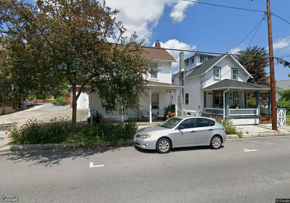
12 Cumberland St Clear Spring, MD 21722
Estimated Value: $151,000 - $295,000
Studio
1
Bath
1,567
Sq Ft
$131/Sq Ft
Est. Value
About This Home
This home is located at 12 Cumberland St, Clear Spring, MD 21722 and is currently estimated at $205,549, approximately $131 per square foot. 12 Cumberland St is a home located in Washington County with nearby schools including Clear Spring Elementary School, Clear Spring Middle School, and Clear Spring High School.
Ownership History
Date
Name
Owned For
Owner Type
Purchase Details
Closed on
Jun 24, 1993
Sold by
Baker Terry L
Bought by
White Eugene D and White Soon Y
Current Estimated Value
Home Financials for this Owner
Home Financials are based on the most recent Mortgage that was taken out on this home.
Original Mortgage
$60,400
Interest Rate
7.38%
Purchase Details
Closed on
Feb 6, 1991
Sold by
Michael Development Corp
Bought by
Baker Terry L
Purchase Details
Closed on
Dec 18, 1990
Sold by
Peterman Walter W and H M
Bought by
Michael Development Corp
Create a Home Valuation Report for This Property
The Home Valuation Report is an in-depth analysis detailing your home's value as well as a comparison with similar homes in the area
Purchase History
| Date | Buyer | Sale Price | Title Company |
|---|---|---|---|
| White Eugene D | $60,000 | -- | |
| Baker Terry L | $19,500 | -- | |
| Michael Development Corp | $75,000 | -- |
Source: Public Records
Mortgage History
| Date | Status | Borrower | Loan Amount |
|---|---|---|---|
| Closed | White Eugene D | $60,400 |
Source: Public Records
Tax History
| Year | Tax Paid | Tax Assessment Tax Assessment Total Assessment is a certain percentage of the fair market value that is determined by local assessors to be the total taxable value of land and additions on the property. | Land | Improvement |
|---|---|---|---|---|
| 2025 | $878 | $108,900 | $0 | $0 |
| 2024 | $878 | $100,100 | $0 | $0 |
| 2023 | $832 | $91,300 | $39,000 | $52,300 |
| 2022 | $807 | $88,600 | $0 | $0 |
| 2021 | $775 | $85,900 | $0 | $0 |
| 2020 | $775 | $83,200 | $39,000 | $44,200 |
| 2019 | $778 | $83,200 | $39,000 | $44,200 |
| 2018 | $778 | $83,200 | $39,000 | $44,200 |
| 2017 | $824 | $88,100 | $0 | $0 |
| 2016 | -- | $88,100 | $0 | $0 |
| 2015 | $876 | $88,100 | $0 | $0 |
| 2014 | $876 | $88,200 | $0 | $0 |
Source: Public Records
Map
Nearby Homes
- 13407 Rhodes Ct
- 11868 National Pike
- 0 Ashton Rd
- 11705 Ashton Rd
- 11430 National Pike
- 12136 Big Pool Rd
- Block 139 Lot 56 Boo Blvd
- 13100 Saint Paul Rd
- Block 87 Lot 4 Pikers Peak Dr
- LOT 37 Hot Springs Ave
- Block 90 Lot 8 Ranger Rd
- Block 7 Lot 30 & 31 Campfire Blvd
- Block 8 Lot 16 & 17 Campfire Blvd
- Block 8 Lot 32 & 33 Ice Cream St
- 0 Block 10 Lot 2 Deadwood Dr Unit WVBE2040636
- Block 12 Lot 41 Ranger Rd
- Block 1 Lot 27 Boo Blvd
- Block 1 Lot 35 Boo Blvd
- Block 5 lots 6 and 7 Poison Oak
- 25-20 Rocky Rd
- 14 Cumberland St
- 10 Cumberland St
- 16 Cumberland St
- 8 Cumberland St
- 22 Cumberland St
- 15 Cumberland St
- PARCEL 11 National Pike
- 13 Cumberland St
- 19 Cumberland St
- 10 N Hawbaker Cir
- 21 Cumberland St
- 9 Cumberland St
- 7 Cumberland St
- 2 Cumberland St
- 0 National Pike Unit 1001756952
- 0 National Pike Unit 1007659536
- 0 National Pike Unit 1007612002
- 0 National Pike Unit 1000070819
- 0 National Pike Unit 1003999489
- 0 National Pike Unit 1007213590
Your Personal Tour Guide
Ask me questions while you tour the home.