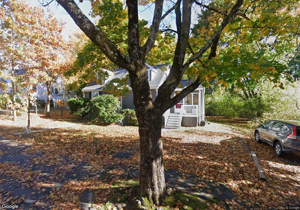
12 Cutter St Wakefield, MA 01880
West Side NeighborhoodEstimated Value: $658,000 - $819,000
3
Beds
1
Bath
1,502
Sq Ft
$485/Sq Ft
Est. Value
About This Home
This home is located at 12 Cutter St, Wakefield, MA 01880 and is currently estimated at $728,012, approximately $484 per square foot. 12 Cutter St is a home located in Middlesex County with nearby schools including Wakefield Memorial High School and St Joseph School.
Ownership History
Date
Name
Owned For
Owner Type
Purchase Details
Closed on
Jun 9, 2011
Sold by
Kovar Louise T
Bought by
Louise T Kovar T
Current Estimated Value
Purchase Details
Closed on
Nov 29, 1993
Sold by
Hanson Scott W and Hanson Leanne E
Bought by
Kovar Louise T
Home Financials for this Owner
Home Financials are based on the most recent Mortgage that was taken out on this home.
Original Mortgage
$148,500
Interest Rate
6.72%
Mortgage Type
Purchase Money Mortgage
Purchase Details
Closed on
Jul 27, 1990
Sold by
Weiss Paul R
Bought by
Hanson Scott W
Home Financials for this Owner
Home Financials are based on the most recent Mortgage that was taken out on this home.
Original Mortgage
$151,900
Interest Rate
10.01%
Mortgage Type
Purchase Money Mortgage
Create a Home Valuation Report for This Property
The Home Valuation Report is an in-depth analysis detailing your home's value as well as a comparison with similar homes in the area
Home Values in the Area
Average Home Value in this Area
Purchase History
| Date | Buyer | Sale Price | Title Company |
|---|---|---|---|
| Louise T Kovar T | -- | -- | |
| Kovar Louise T | $165,000 | -- | |
| Hanson Scott W | $159,900 | -- |
Source: Public Records
Mortgage History
| Date | Status | Borrower | Loan Amount |
|---|---|---|---|
| Previous Owner | Hanson Scott W | $186,500 | |
| Previous Owner | Hanson Scott W | $148,500 | |
| Previous Owner | Hanson Scott W | $151,900 | |
| Previous Owner | Hanson Scott W | $21,000 |
Source: Public Records
Tax History
| Year | Tax Paid | Tax Assessment Tax Assessment Total Assessment is a certain percentage of the fair market value that is determined by local assessors to be the total taxable value of land and additions on the property. | Land | Improvement |
|---|---|---|---|---|
| 2025 | $7,053 | $621,400 | $382,500 | $238,900 |
| 2024 | $6,950 | $617,800 | $380,200 | $237,600 |
| 2023 | $6,610 | $563,500 | $346,800 | $216,700 |
| 2022 | $6,324 | $513,300 | $315,800 | $197,500 |
| 2021 | $6,225 | $489,000 | $294,400 | $194,600 |
| 2020 | $5,837 | $457,100 | $275,200 | $181,900 |
| 2019 | $5,577 | $434,700 | $261,700 | $173,000 |
| 2018 | $5,192 | $400,900 | $241,400 | $159,500 |
| 2017 | $4,881 | $374,600 | $225,600 | $149,000 |
| 2016 | $4,773 | $353,800 | $213,400 | $140,400 |
| 2015 | $4,458 | $330,700 | $199,400 | $131,300 |
| 2014 | $4,064 | $318,000 | $191,700 | $126,300 |
Source: Public Records
Map
Nearby Homes
- 50 Quannapowitt Pkwy
- 95 Prospect St
- 80 Redfield Rd
- 39 Cedar St
- 2 Summit Dr Unit 43
- 1 Summit Dr Unit 57
- 403 Gazebo Cir
- 29 Cordis St
- 270 Lowell St
- 57 Wave Ave
- 248 Albion St Unit 231
- 248 Albion St Unit 321
- 3 Carnation Cir Unit C
- 43-45 Crescent St
- 62 Foundry St Unit 310
- 62 Foundry St Unit 204
- 62 Foundry St Unit 402
- 62 Foundry St Unit 507
- 62 Foundry St Unit 208
- 62 Foundry St Unit 414
Your Personal Tour Guide
Ask me questions while you tour the home.