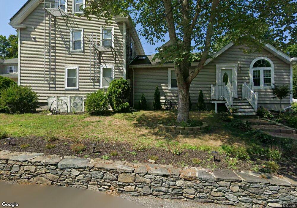
12 Dexter Ave Taunton, MA 02780
Estimated Value: $735,000 - $805,000
7
Beds
3
Baths
2,868
Sq Ft
$266/Sq Ft
Est. Value
About This Home
This home is located at 12 Dexter Ave, Taunton, MA 02780 and is currently estimated at $764,198, approximately $266 per square foot. 12 Dexter Ave is a home located in Bristol County with nearby schools including Mulcahey Elementary School, Taunton High School, and Joseph H. Martin.
Ownership History
Date
Name
Owned For
Owner Type
Purchase Details
Closed on
Nov 6, 2023
Sold by
Desousa Manuel A and Paulo-Desousa Mary E
Bought by
Dexter Ave 12 Rt and Desousa
Current Estimated Value
Purchase Details
Closed on
Sep 1, 2022
Sold by
Dexter Ave 12 Rt and Desousa
Bought by
Desousa Manuel A and Paulo-Desousa Mary E
Purchase Details
Closed on
Nov 21, 1988
Sold by
Sullivan Robert B
Bought by
Desousa Manuel
Purchase Details
Closed on
Sep 23, 1987
Sold by
12 Dexter Nom Trust
Bought by
Sullivan Robert B
Create a Home Valuation Report for This Property
The Home Valuation Report is an in-depth analysis detailing your home's value as well as a comparison with similar homes in the area
Home Values in the Area
Average Home Value in this Area
Purchase History
| Date | Buyer | Sale Price | Title Company |
|---|---|---|---|
| Dexter Ave 12 Rt | -- | None Available | |
| Desousa Manuel A | -- | None Available | |
| Dexter Ave 12 Rt | -- | None Available | |
| Desousa Manuel | $172,000 | -- | |
| Sullivan Robert B | $150,000 | -- |
Source: Public Records
Mortgage History
| Date | Status | Borrower | Loan Amount |
|---|---|---|---|
| Previous Owner | Sullivan Robert B | $50,000 | |
| Previous Owner | Sullivan Robert B | $175,200 |
Source: Public Records
Tax History
| Year | Tax Paid | Tax Assessment Tax Assessment Total Assessment is a certain percentage of the fair market value that is determined by local assessors to be the total taxable value of land and additions on the property. | Land | Improvement |
|---|---|---|---|---|
| 2025 | $7,144 | $653,000 | $127,000 | $526,000 |
| 2024 | $6,905 | $617,100 | $127,000 | $490,100 |
| 2023 | $6,572 | $545,400 | $127,000 | $418,400 |
| 2022 | $6,121 | $464,400 | $105,800 | $358,600 |
| 2021 | $5,270 | $371,100 | $96,200 | $274,900 |
| 2020 | $5,159 | $347,200 | $96,200 | $251,000 |
| 2019 | $4,832 | $306,600 | $96,200 | $210,400 |
| 2018 | $4,496 | $286,000 | $97,100 | $188,900 |
| 2017 | $4,039 | $257,100 | $92,100 | $165,000 |
| 2016 | $3,801 | $242,400 | $89,400 | $153,000 |
| 2015 | $3,787 | $252,300 | $90,400 | $161,900 |
| 2014 | $3,707 | $253,700 | $90,400 | $163,300 |
Source: Public Records
Map
Nearby Homes
- 6 Marvel St
- 450 Somerset Ave Unit 3-7
- 6 Briggs St
- 21 Briggs St
- 90 E Water St
- 24 Couch St
- 23 Couch St Unit RIGHT side
- 23 Couch St Unit LEFT side
- 6 Southeast St
- 56 Silver St
- 24 1st St
- 252 Somerset Ave
- 248 Somerset Ave
- 12 Beacon St
- 6 W Weir St
- 11 Orchard St
- 11 Talbot Ave
- 322 Dighton Ave
- 76 Plain St
- 303 Cohannet St
- 10 Dexter Ave Unit 2
- 10 Dexter Ave Unit 1
- 10B Dexter Ave
- 10 Dexter Ave
- 10 Dexter Ave Unit A
- 10B Dexter Ave Unit B
- 11 Dexter Ave
- 18 Dexter Ave
- 8 Dexter Ave
- 9 Dexter Ave
- 7 Marvel St
- 7 Marvel St Unit 2
- 7 Highland St
- 5 Dexter Ave
- 9 Highland St
- 11 Highland St
- 13 Highland St
- 643 Somerset Ave
- 647 Somerset Ave
- 635 Somerset Ave
Your Personal Tour Guide
Ask me questions while you tour the home.