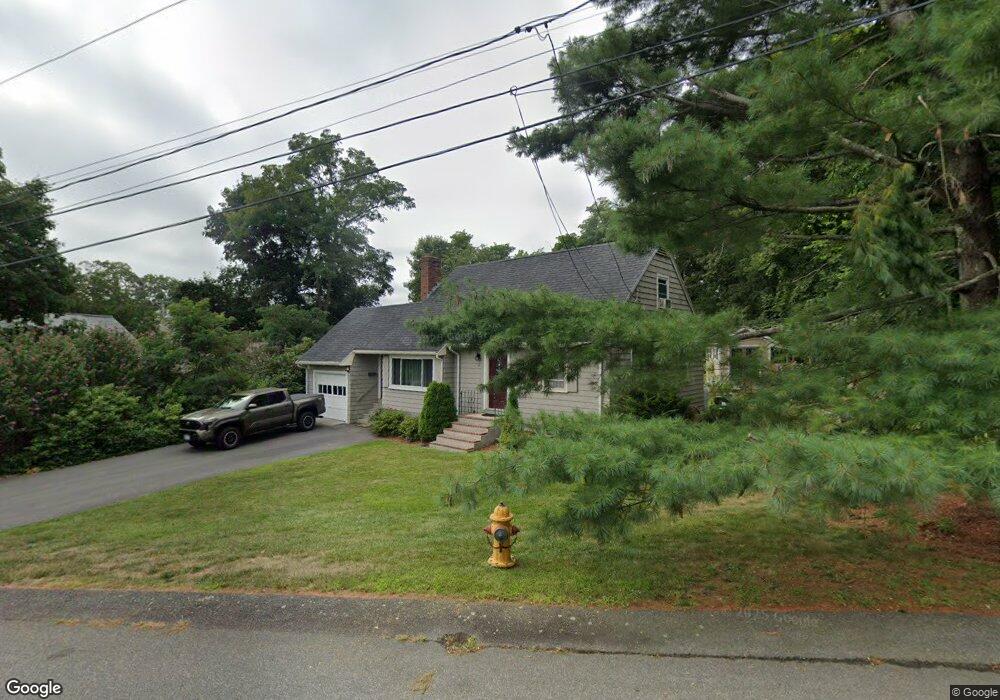
12 Df Haviland Ln Weymouth, MA 02188
Weymouth Landing NeighborhoodEstimated Value: $655,000 - $728,000
4
Beds
2
Baths
1,440
Sq Ft
$479/Sq Ft
Est. Value
About This Home
This home is located at 12 Df Haviland Ln, Weymouth, MA 02188 and is currently estimated at $689,948, approximately $479 per square foot. 12 Df Haviland Ln is a home located in Norfolk County with nearby schools including Frederick C Murphy, Abigail Adams Middle School, and Weymouth Middle School Chapman.
Ownership History
Date
Name
Owned For
Owner Type
Purchase Details
Closed on
Aug 11, 2008
Sold by
Metri Metri R R
Bought by
Cannon Land Dev Llc
Current Estimated Value
Purchase Details
Closed on
Oct 31, 2007
Sold by
Metri Metri R R
Bought by
Donggalao Antonio and Donggalao Florence
Home Financials for this Owner
Home Financials are based on the most recent Mortgage that was taken out on this home.
Original Mortgage
$362,000
Interest Rate
6.43%
Mortgage Type
Purchase Money Mortgage
Purchase Details
Closed on
Feb 28, 2007
Sold by
Haviland Ft
Bought by
Metri Metri R R
Home Financials for this Owner
Home Financials are based on the most recent Mortgage that was taken out on this home.
Original Mortgage
$288,000
Interest Rate
6.27%
Mortgage Type
Purchase Money Mortgage
Create a Home Valuation Report for This Property
The Home Valuation Report is an in-depth analysis detailing your home's value as well as a comparison with similar homes in the area
Home Values in the Area
Average Home Value in this Area
Purchase History
| Date | Buyer | Sale Price | Title Company |
|---|---|---|---|
| Cannon Land Dev Llc | $120,000 | -- | |
| Donggalao Antonio | $362,000 | -- | |
| Metri Metri R R | $400,000 | -- |
Source: Public Records
Mortgage History
| Date | Status | Borrower | Loan Amount |
|---|---|---|---|
| Previous Owner | Donggalao Antonio | $362,000 | |
| Previous Owner | Metri Metri R R | $288,000 |
Source: Public Records
Tax History Compared to Growth
Tax History
| Year | Tax Paid | Tax Assessment Tax Assessment Total Assessment is a certain percentage of the fair market value that is determined by local assessors to be the total taxable value of land and additions on the property. | Land | Improvement |
|---|---|---|---|---|
| 2025 | $6,187 | $612,600 | $255,500 | $357,100 |
| 2024 | $6,111 | $595,000 | $243,400 | $351,600 |
| 2023 | $5,760 | $551,200 | $225,400 | $325,800 |
| 2022 | $5,615 | $490,000 | $208,700 | $281,300 |
| 2021 | $5,260 | $448,000 | $208,700 | $239,300 |
| 2020 | $4,993 | $418,900 | $208,700 | $210,200 |
| 2019 | $4,860 | $401,000 | $200,700 | $200,300 |
| 2018 | $4,843 | $387,400 | $199,000 | $188,400 |
| 2017 | $4,512 | $352,200 | $189,600 | $162,600 |
| 2016 | $4,366 | $341,100 | $182,300 | $158,800 |
| 2015 | $4,217 | $326,900 | $182,300 | $144,600 |
| 2014 | $4,025 | $302,600 | $169,700 | $132,900 |
Source: Public Records
Map
Nearby Homes
- 19 Vine St Unit 3
- 19 Vine St Unit 1
- 33 Congress St
- 16 Lindbergh Ave
- 23-25 Lindbergh Ave
- 114 Broad St Unit D
- 114 Broad St Unit C
- 76 Kingman St
- 286 Broad St
- 12 Klasson Ln
- 11 Richmond St
- 24 Blake Rd
- 54 Federal St
- 15 Summer St
- 122 Washington St Unit 22
- 286 Essex St
- 42 Sundin Rd
- 367 Essex St
- 36 Brookside Rd
- 294 Commercial St
- 116 King Ave
- 114 King Ave
- 110 King Ave
- 0 Df Haviland Ln
- 18 Df Haviland Ln
- 8 Df Haviland Ln
- 5 Df Haviland Ln
- 26 Df Haviland Ln
- 82 Kensington Rd
- 66 Kensington Rd
- 34 Df Haviland Ln
- 74 Kensington Rd
- 86 Kensington Rd
- 27 Df Haviland Ln
- 80 Kensington Rd
- 58 Kensington Rd
- 95 King Ave
- 40 Df Haviland Ln
- 54 Kensington Rd
- 46 Kensington Rd