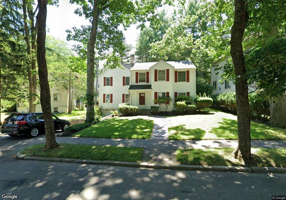
12 Drew Rd Chestnut Hill, MA 02467
Oak Hill NeighborhoodEstimated Value: $1,514,000 - $1,579,000
4
Beds
3
Baths
2,150
Sq Ft
$726/Sq Ft
Est. Value
About This Home
This home is located at 12 Drew Rd, Chestnut Hill, MA 02467 and is currently estimated at $1,561,740, approximately $726 per square foot. 12 Drew Rd is a home located in Middlesex County with nearby schools including Memorial Spaulding Elementary School, Oak Hill Middle School, and Newton South High School.
Ownership History
Date
Name
Owned For
Owner Type
Purchase Details
Closed on
Sep 12, 1988
Sold by
Viscione Gail C
Bought by
Greene Alexander N
Current Estimated Value
Home Financials for this Owner
Home Financials are based on the most recent Mortgage that was taken out on this home.
Original Mortgage
$193,500
Interest Rate
10.43%
Mortgage Type
Purchase Money Mortgage
Create a Home Valuation Report for This Property
The Home Valuation Report is an in-depth analysis detailing your home's value as well as a comparison with similar homes in the area
Home Values in the Area
Average Home Value in this Area
Purchase History
| Date | Buyer | Sale Price | Title Company |
|---|---|---|---|
| Greene Alexander N | $258,500 | -- |
Source: Public Records
Mortgage History
| Date | Status | Borrower | Loan Amount |
|---|---|---|---|
| Closed | Greene Alexander N | $52,000 | |
| Closed | Greene Alexander N | $193,500 |
Source: Public Records
Tax History Compared to Growth
Tax History
| Year | Tax Paid | Tax Assessment Tax Assessment Total Assessment is a certain percentage of the fair market value that is determined by local assessors to be the total taxable value of land and additions on the property. | Land | Improvement |
|---|---|---|---|---|
| 2025 | $11,869 | $1,211,100 | $1,059,600 | $151,500 |
| 2024 | $11,476 | $1,175,800 | $1,028,700 | $147,100 |
| 2023 | $10,980 | $1,078,600 | $787,900 | $290,700 |
| 2022 | $10,506 | $998,700 | $729,500 | $269,200 |
| 2021 | $10,138 | $942,200 | $688,200 | $254,000 |
| 2020 | $9,837 | $942,200 | $688,200 | $254,000 |
| 2019 | $9,560 | $914,800 | $668,200 | $246,600 |
| 2018 | $9,117 | $842,600 | $609,200 | $233,400 |
| 2017 | $8,839 | $794,900 | $574,700 | $220,200 |
| 2016 | $8,454 | $742,900 | $537,100 | $205,800 |
| 2015 | $8,061 | $694,300 | $502,000 | $192,300 |
Source: Public Records
Map
Nearby Homes
- 14 Rolling Ln
- 70 Pond Brook Rd
- 109 Harwich Rd
- 99 Baldpate Hill Rd
- 63 Drumlin Rd
- 56 Cynthia Rd
- 59 Deborah Rd
- 44 Broadlawn Park Unit 22
- 65 Lagrange St
- 80 Louise Rd Unit 82
- 64 Bryon Rd Unit 1
- 41 Juniper Ln
- 135 Hartman Rd
- 42 Bryon Rd Unit 6
- 21 Westgate Rd Unit 6
- 57 Broadlawn Park Unit 4B
- 21 Lovett Rd
- 44 Lovett Rd
- 23 Westgate Rd Unit 6
- 79 Florence St Unit 600S
- 20 Drew Rd
- 4 Drew Rd
- 140 Pond Brook Rd
- 49 Nickerson Rd
- 43 Nickerson Rd
- 134 Pond Brook Rd
- 11 Drew Rd
- 17 Drew Rd
- 5 Drew Rd
- 23 Drew Rd
- 39 Nickerson Rd
- 128 Pond Brook Rd
- 166 Pond Brook Rd
- 166 Pond Brook Rd Unit 1
- 151 Pond Brook Rd
- 137 Pond Brook Rd
- 155 Pond Brook Rd
- 33 Nickerson Rd
- 131 Pond Brook Rd
- 131 Pond Brook Rd Unit none