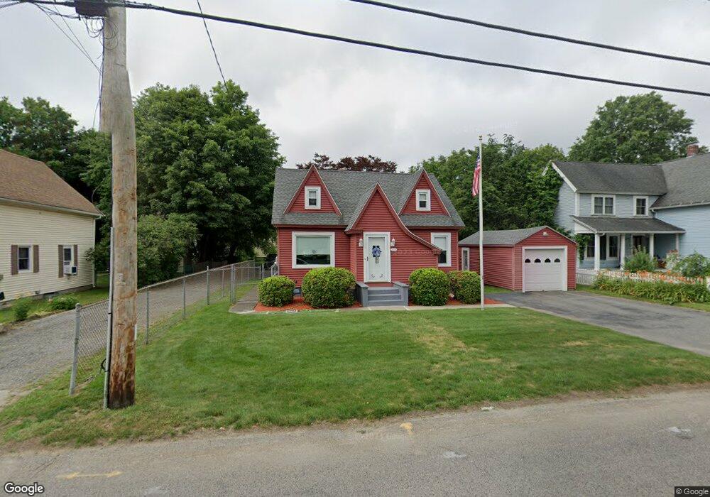
12 East St North Grafton, MA 01536
Estimated Value: $427,000 - $445,000
3
Beds
1
Bath
1,260
Sq Ft
$346/Sq Ft
Est. Value
About This Home
This home is located at 12 East St, North Grafton, MA 01536 and is currently estimated at $435,370, approximately $345 per square foot. 12 East St is a home located in Worcester County with nearby schools including Grafton High School, Silver Spruce Montessori School, and Al-Hamra Academy.
Ownership History
Date
Name
Owned For
Owner Type
Purchase Details
Closed on
Oct 7, 2019
Sold by
Normandin Dorothy P
Bought by
Normandin Dorothy and Normandin Michelle A
Current Estimated Value
Purchase Details
Closed on
Nov 24, 1987
Sold by
Morrow Shirley M
Bought by
Normandin Harold J
Create a Home Valuation Report for This Property
The Home Valuation Report is an in-depth analysis detailing your home's value as well as a comparison with similar homes in the area
Home Values in the Area
Average Home Value in this Area
Purchase History
| Date | Buyer | Sale Price | Title Company |
|---|---|---|---|
| Normandin Dorothy | -- | -- | |
| Normandin Dorothy | -- | -- | |
| Normandin Dorothy | -- | -- | |
| Normandin Harold J | $30,000 | -- |
Source: Public Records
Mortgage History
| Date | Status | Borrower | Loan Amount |
|---|---|---|---|
| Previous Owner | Normandin Harold J | $91,700 | |
| Previous Owner | Normandin Harold J | $101,500 | |
| Previous Owner | Normandin Harold J | $100,800 |
Source: Public Records
Tax History Compared to Growth
Tax History
| Year | Tax Paid | Tax Assessment Tax Assessment Total Assessment is a certain percentage of the fair market value that is determined by local assessors to be the total taxable value of land and additions on the property. | Land | Improvement |
|---|---|---|---|---|
| 2025 | $4,901 | $351,600 | $124,600 | $227,000 |
| 2024 | $4,878 | $340,900 | $118,700 | $222,200 |
| 2023 | $4,630 | $294,700 | $118,700 | $176,000 |
| 2022 | $4,428 | $262,300 | $101,900 | $160,400 |
| 2021 | $4,292 | $249,800 | $92,700 | $157,100 |
| 2020 | $4,122 | $249,800 | $92,700 | $157,100 |
| 2019 | $3,705 | $222,400 | $89,900 | $132,500 |
| 2018 | $3,441 | $207,400 | $89,600 | $117,800 |
| 2017 | $3,047 | $185,800 | $68,000 | $117,800 |
| 2016 | $3,059 | $182,600 | $71,100 | $111,500 |
| 2015 | $3,034 | $183,900 | $71,100 | $112,800 |
| 2014 | $2,838 | $186,000 | $78,800 | $107,200 |
Source: Public Records
Map
Nearby Homes
- 17 Hingham Rd
- 0 East St
- 4 Winslow Ln Unit 1410
- 11 Hovey Pond Dr Unit 11
- 7 Hovey Pond Dr Unit 7
- 4 Westboro Rd
- 194 Worcester St
- 14 Northgate Ct Unit 14
- 30 Falmouth Dr
- 22 Beverly Rd
- 15 Windle Ave
- 3 Abby Rd
- 2 Winslow Ln Unit 2302
- 2 Winslow Ln Unit 406
- 44 Meadow Ln
- Ivywood Plan at Winslow Point - The Building 1 Series
- Hayden Plan at Winslow Point - The Building 1 Series
- 14 Indian Path
- 34 Clews St
- 51 Cortland Grove Dr Unit 51