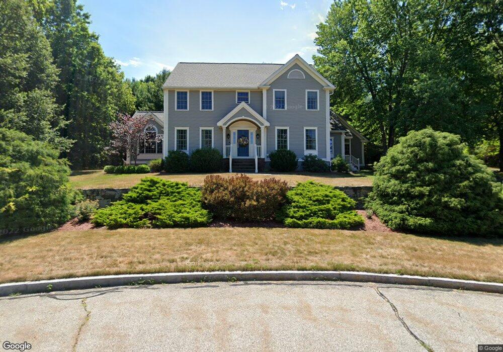
12 Edmund Brigham Way Westborough, MA 01581
Estimated Value: $1,126,000 - $1,345,000
4
Beds
3
Baths
2,982
Sq Ft
$411/Sq Ft
Est. Value
About This Home
This home is located at 12 Edmund Brigham Way, Westborough, MA 01581 and is currently estimated at $1,226,735, approximately $411 per square foot. 12 Edmund Brigham Way is a home located in Worcester County with nearby schools including Westborough High School, Ebridge Montessori School, and Westboro Knowledge Beginnings.
Ownership History
Date
Name
Owned For
Owner Type
Purchase Details
Closed on
Jun 24, 1994
Sold by
Asset Construction Co
Bought by
Cushing Gerald and Shadan Martha
Current Estimated Value
Create a Home Valuation Report for This Property
The Home Valuation Report is an in-depth analysis detailing your home's value as well as a comparison with similar homes in the area
Home Values in the Area
Average Home Value in this Area
Purchase History
| Date | Buyer | Sale Price | Title Company |
|---|---|---|---|
| Cushing Gerald | $342,773 | -- |
Source: Public Records
Mortgage History
| Date | Status | Borrower | Loan Amount |
|---|---|---|---|
| Open | Cushing Gerald | $110,000 | |
| Open | Cushing Gerald | $409,000 |
Source: Public Records
Tax History Compared to Growth
Tax History
| Year | Tax Paid | Tax Assessment Tax Assessment Total Assessment is a certain percentage of the fair market value that is determined by local assessors to be the total taxable value of land and additions on the property. | Land | Improvement |
|---|---|---|---|---|
| 2025 | $16,404 | $1,007,000 | $341,200 | $665,800 |
| 2024 | $15,649 | $953,600 | $324,700 | $628,900 |
| 2023 | $14,334 | $851,200 | $306,500 | $544,700 |
| 2022 | $13,342 | $721,600 | $244,000 | $477,600 |
| 2021 | $13,197 | $711,800 | $234,200 | $477,600 |
| 2020 | $13,071 | $713,500 | $247,900 | $465,600 |
| 2019 | $0 | $714,500 | $244,000 | $470,500 |
| 2018 | $0 | $654,300 | $234,200 | $420,100 |
| 2017 | $0 | $654,300 | $234,200 | $420,100 |
| 2016 | $11,693 | $658,000 | $234,200 | $423,800 |
Source: Public Records
Map
Nearby Homes
- 4 Upton Rd
- 56 Ruggles St
- 8 Piccadilly Way
- 9 Westminster Way
- 7 Jennings Rd
- 75 South St
- 15 Beach St
- 192 W Main St
- 45 Piccadilly Way
- 14 Nourse St
- 21 South St Unit 31
- 6 Folly Ln
- 14 Grove St Unit 3
- 14 Grove St Unit 2
- 5 Blossom Ct Unit 5
- 9 Baldwin Ct
- 43 Church St
- 22 Capt Samuel Forbush Rd
- 30 Old Nourse St
- 41 Adams St
- 10 Edmund Brigham Way
- 33 Mount Pleasant St
- 17 Edmund Brigham Way
- 15 Edmund Brigham Way
- 11 Edmund Brigham Way
- 31 Mount Pleasant St
- 8 Edmund Brigham Way
- 35 Mount Pleasant St
- 9 Edmund Brigham Way
- 9 Edmund Brigham Way
- 29 Mount Pleasant St
- 6 Edmund Brigham Way
- 6 Edmund Brigham Way
- 37 Mount Pleasant St
- 40 Mount Pleasant St
- 7 Edmund Brigham Way
- 4 Edmund Brigham Way
- 4 Edmund Brigham Way
- 86 Ruggles St
- 46 Mt Pleasant