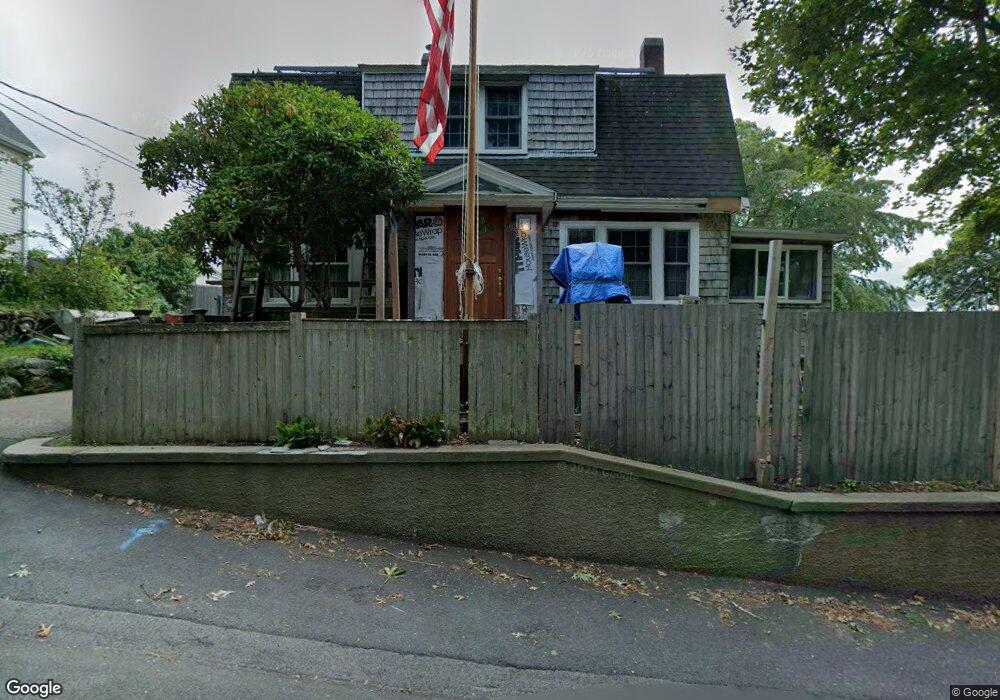
12 Essex St Gloucester, MA 01930
Central Gloucester NeighborhoodEstimated Value: $572,000 - $617,000
3
Beds
2
Baths
1,437
Sq Ft
$408/Sq Ft
Est. Value
About This Home
This home is located at 12 Essex St, Gloucester, MA 01930 and is currently estimated at $585,600, approximately $407 per square foot. 12 Essex St is a home located in Essex County with nearby schools including East Veterans Memorial Elementary, Ralph B O'maley Middle School, and Gloucester High School.
Ownership History
Date
Name
Owned For
Owner Type
Purchase Details
Closed on
Jul 1, 2013
Sold by
Dow David R and Dow Alice M
Bought by
Dow David R
Current Estimated Value
Purchase Details
Closed on
Feb 1, 1971
Bought by
Dow David R
Create a Home Valuation Report for This Property
The Home Valuation Report is an in-depth analysis detailing your home's value as well as a comparison with similar homes in the area
Home Values in the Area
Average Home Value in this Area
Purchase History
| Date | Buyer | Sale Price | Title Company |
|---|---|---|---|
| Dow David R | -- | -- | |
| Dow David R | -- | -- |
Source: Public Records
Mortgage History
| Date | Status | Borrower | Loan Amount |
|---|---|---|---|
| Previous Owner | Dow David R | $90,000 | |
| Previous Owner | Dow David R | $40,000 |
Source: Public Records
Tax History Compared to Growth
Tax History
| Year | Tax Paid | Tax Assessment Tax Assessment Total Assessment is a certain percentage of the fair market value that is determined by local assessors to be the total taxable value of land and additions on the property. | Land | Improvement |
|---|---|---|---|---|
| 2025 | $5,186 | $533,500 | $164,900 | $368,600 |
| 2024 | $5,114 | $525,600 | $157,000 | $368,600 |
| 2023 | $4,903 | $463,000 | $140,200 | $322,800 |
| 2022 | $4,755 | $405,400 | $121,900 | $283,500 |
| 2021 | $4,595 | $369,400 | $110,800 | $258,600 |
| 2020 | $4,521 | $366,700 | $110,800 | $255,900 |
| 2019 | $4,303 | $339,100 | $110,800 | $228,300 |
| 2018 | $4,131 | $319,500 | $110,800 | $208,700 |
| 2017 | $3,931 | $298,000 | $99,800 | $198,200 |
| 2016 | $3,770 | $277,000 | $99,800 | $177,200 |
| 2015 | $3,602 | $263,900 | $99,800 | $164,100 |
Source: Public Records
Map
Nearby Homes
- 40 Sargent St
- 119 Pleasant St
- 16 Cleveland Place Unit 11
- 78 Grove St
- 33 Maplewood Ave Unit 21
- 4 Mount Vernon St
- 22 Taylor St Unit 1
- 19 Mystic Ave
- 160 Prospect St Unit 3
- 90 Middle St Unit L
- 65 Poplar St
- 191 Main St Unit 2B
- 191 Main St Unit 3
- 191 Main St Unit 2A
- 196 Washington St
- 35 Middle St Unit 4
- 8 Summer St Unit 103
- 33 Middle St
- 5 Washington Square
- 29 Harrison Ave