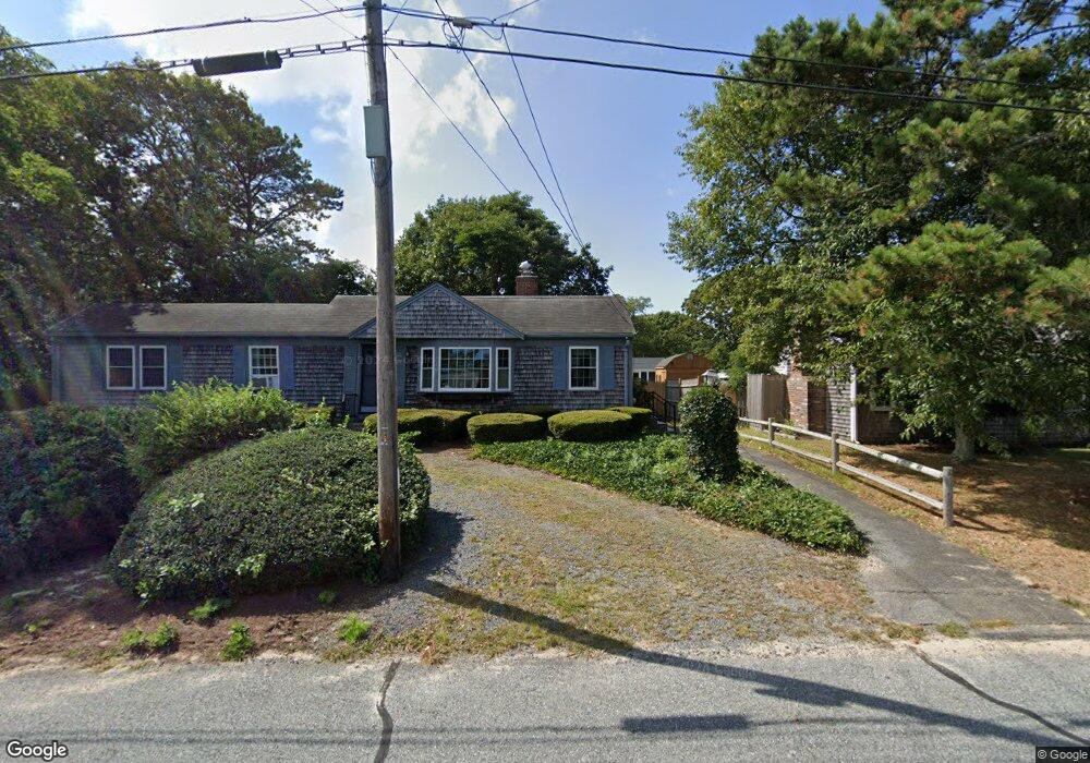
12 Ezras Path Dennis Port, MA 2639
Dennis Port NeighborhoodEstimated Value: $571,000 - $990,000
3
Beds
1
Bath
1,070
Sq Ft
$653/Sq Ft
Est. Value
About This Home
This home is located at 12 Ezras Path, Dennis Port, MA 2639 and is currently estimated at $699,085, approximately $653 per square foot. 12 Ezras Path is a home located in Barnstable County with nearby schools including Dennis-Yarmouth Regional High School and St. Pius X. School.
Ownership History
Date
Name
Owned For
Owner Type
Purchase Details
Closed on
Nov 5, 2015
Sold by
Mccauley Kevin P and Mccauley Gemma M
Bought by
Mccauley Rt
Current Estimated Value
Purchase Details
Closed on
Jul 8, 2011
Sold by
Beaudet Michael K and Beaudet Kathleen A
Bought by
Mccauley Kevin and Mccauley Gemma M
Home Financials for this Owner
Home Financials are based on the most recent Mortgage that was taken out on this home.
Original Mortgage
$188,000
Interest Rate
4.6%
Mortgage Type
Purchase Money Mortgage
Purchase Details
Closed on
Apr 18, 1996
Sold by
Mahan John F and Mahan Mary G
Bought by
Beaudet Michael K and Beaudet Kathleen A
Home Financials for this Owner
Home Financials are based on the most recent Mortgage that was taken out on this home.
Original Mortgage
$63,000
Interest Rate
7.34%
Mortgage Type
Purchase Money Mortgage
Create a Home Valuation Report for This Property
The Home Valuation Report is an in-depth analysis detailing your home's value as well as a comparison with similar homes in the area
Home Values in the Area
Average Home Value in this Area
Purchase History
| Date | Buyer | Sale Price | Title Company |
|---|---|---|---|
| Mccauley Rt | -- | -- | |
| Mccauley Kevin | $235,000 | -- | |
| Beaudet Michael K | -- | -- | |
| Beaudet Michael K | $82,500 | -- |
Source: Public Records
Mortgage History
| Date | Status | Borrower | Loan Amount |
|---|---|---|---|
| Previous Owner | Beaudet Michael K | $188,000 | |
| Previous Owner | Beaudet Michael K | $63,000 | |
| Previous Owner | Beaudet Michael K | $65,000 |
Source: Public Records
Tax History Compared to Growth
Tax History
| Year | Tax Paid | Tax Assessment Tax Assessment Total Assessment is a certain percentage of the fair market value that is determined by local assessors to be the total taxable value of land and additions on the property. | Land | Improvement |
|---|---|---|---|---|
| 2025 | $2,098 | $484,500 | $193,500 | $291,000 |
| 2024 | $1,975 | $449,900 | $186,100 | $263,800 |
| 2023 | $1,910 | $409,100 | $169,200 | $239,900 |
| 2022 | $1,866 | $333,200 | $152,400 | $180,800 |
| 2021 | $1,932 | $320,400 | $170,800 | $149,600 |
| 2020 | $1,751 | $287,100 | $149,400 | $137,700 |
| 2019 | $1,659 | $268,900 | $146,500 | $122,400 |
| 2018 | $1,599 | $252,200 | $139,500 | $112,700 |
| 2017 | $1,468 | $238,700 | $129,500 | $109,200 |
| 2016 | $1,521 | $232,900 | $139,500 | $93,400 |
| 2015 | $1,491 | $232,900 | $139,500 | $93,400 |
| 2014 | $1,352 | $212,900 | $119,500 | $93,400 |
Source: Public Records
Map
Nearby Homes
- 31 Easy St
- 22 Wixon Rd
- 19 Standish Way
- 72 Bassett Ln
- 4 Coffey Ln
- 80 Michaels Ave
- 125 Main St Unit 3
- 268 Main St
- 71 Main St
- 22 Ferncliff Rd
- 37 Beach Hills Rd
- 37-A Beach Hills Rd
- 262 Old Wharf Rd Unit 67
- 262 Old Wharf Rd Unit 5
- 262 Old Wharf Rd Unit 5
- 262 Old Wharf Rd Unit 20
- 262 Old Wharf Rd Unit 87
- 12 Spoonbill Rd
- 102 Sea St