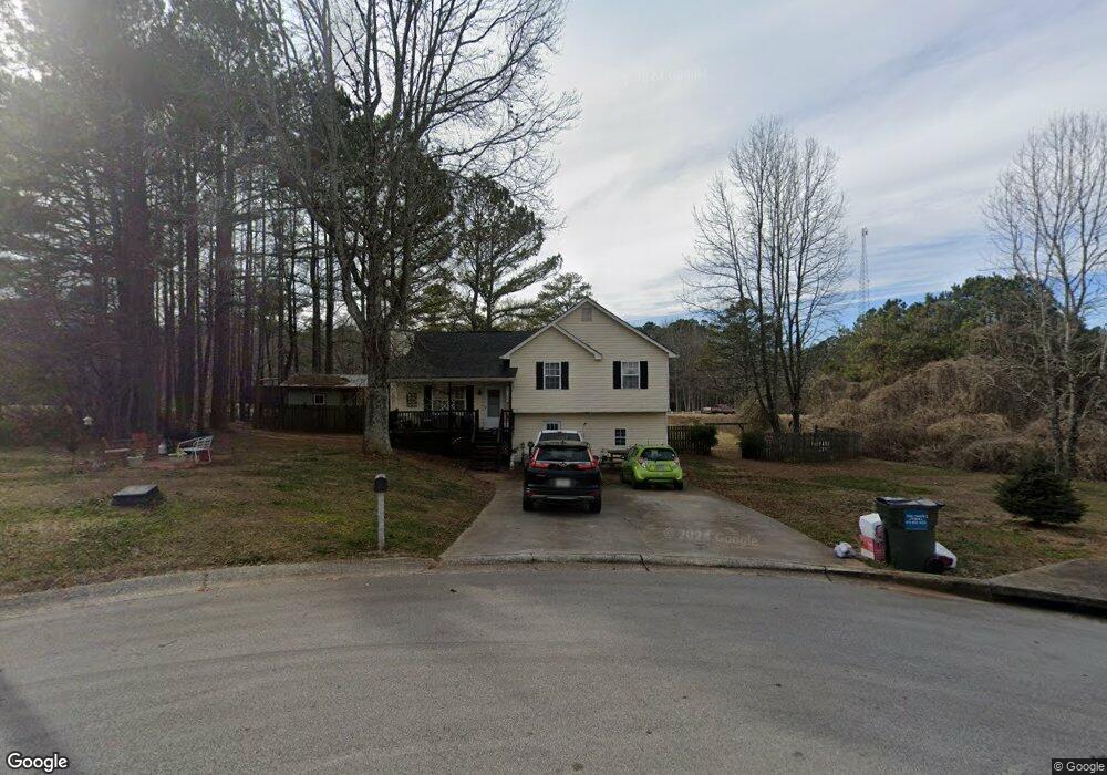
12 Farm Brook Ln Dallas, GA 30157
Estimated Value: $255,259 - $264,000
3
Beds
2
Baths
1,104
Sq Ft
$234/Sq Ft
Est. Value
About This Home
This home is located at 12 Farm Brook Ln, Dallas, GA 30157 and is currently estimated at $258,815, approximately $234 per square foot. 12 Farm Brook Ln is a home located in Paulding County with nearby schools including Sara M. Ragsdale Elementary School, Carl Scoggins Sr. Middle School, and Paulding County High School.
Ownership History
Date
Name
Owned For
Owner Type
Purchase Details
Closed on
Jul 5, 2022
Sold by
American Investments Llc
Bought by
Sfr Jv 2 Property Llc
Current Estimated Value
Purchase Details
Closed on
Sep 14, 2000
Sold by
Ltp Construction Co
Bought by
Umanzor Javier A
Home Financials for this Owner
Home Financials are based on the most recent Mortgage that was taken out on this home.
Original Mortgage
$80,750
Interest Rate
8.05%
Mortgage Type
FHA
Create a Home Valuation Report for This Property
The Home Valuation Report is an in-depth analysis detailing your home's value as well as a comparison with similar homes in the area
Home Values in the Area
Average Home Value in this Area
Purchase History
| Date | Buyer | Sale Price | Title Company |
|---|---|---|---|
| Sfr Jv 2 Property Llc | $325,000 | -- | |
| American Investments Llc | $290,000 | -- | |
| Umanzor Javier A | $81,900 | -- |
Source: Public Records
Mortgage History
| Date | Status | Borrower | Loan Amount |
|---|---|---|---|
| Previous Owner | Umanzor Javier A | $80,750 |
Source: Public Records
Tax History Compared to Growth
Tax History
| Year | Tax Paid | Tax Assessment Tax Assessment Total Assessment is a certain percentage of the fair market value that is determined by local assessors to be the total taxable value of land and additions on the property. | Land | Improvement |
|---|---|---|---|---|
| 2024 | $2,414 | $100,280 | $12,000 | $88,280 |
| 2023 | $2,701 | $106,140 | $12,000 | $94,140 |
| 2022 | $1,986 | $78,060 | $12,000 | $66,060 |
| 2021 | $1,925 | $68,096 | $8,000 | $60,096 |
| 2020 | $1,615 | $56,228 | $8,000 | $48,228 |
| 2019 | $1,505 | $51,804 | $8,000 | $43,804 |
| 2018 | $1,359 | $46,956 | $8,000 | $38,956 |
| 2017 | $1,226 | $42,008 | $8,000 | $34,008 |
| 2016 | $871 | $30,676 | $8,000 | $22,676 |
| 2015 | $826 | $28,688 | $8,000 | $20,688 |
| 2014 | $856 | $28,968 | $8,000 | $20,968 |
| 2013 | -- | $17,120 | $6,000 | $11,120 |
Source: Public Records
Map
Nearby Homes
- 89 Farm Brook Ln
- 50 Old Oak Trace
- 373 Farm Brook Ln
- 194 Spring Leaf Dr
- 0 Ayers Rd
- 355 Spring Leaf Dr
- 434 Spring Leaf Dr
- 1979 Gold Mine Rd
- 186 Puckett Rd
- 164 Puckett Rd
- 259 Fairview Ln
- 233 Winterville Dr
- 75 Rabbit Creek Path
- 1754 Gold Mine Rd
- 409 Benjamin Dr
- 706 Holly Springs Rd
- 158 Fairview Oak Place
- 24 Farm Brook Ln
- 1 Farm Brook Ln
- 40 Farm Brook Ln
- 15 Farm Brook Ln
- 64 Farm Brook Ln
- 20 Old Oak Trace
- 128 Golden Dr S
- 128 Golden South Dr
- 43 Old Oak Trace
- 23 Shadow Ridge Dr
- 5857 Highway 101 N
- 71 Farm Brook Ln
- 112 Golden South Dr
- 112 Golden Dr S
- 44 Old Oak Trace
- 0 Shadow Ridge Rd
- 132 Golden Dr S
- 132 Golden South Dr
- 22 Shadow Ridge Dr
- 70 Golden Dr S