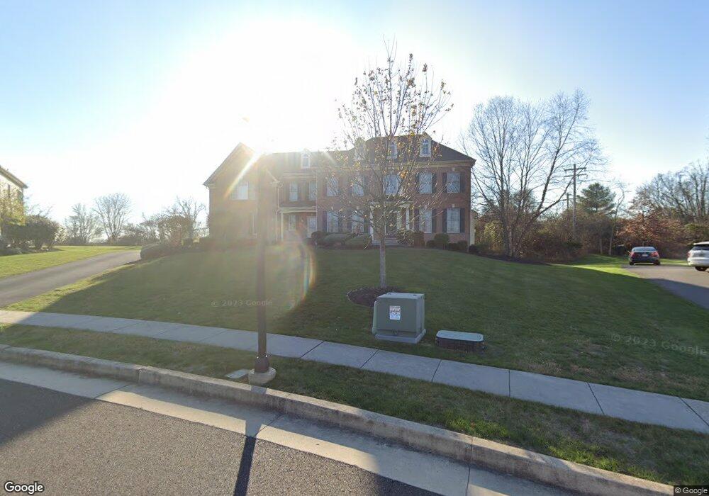
12 Foxhall Rd Newtown, PA 18940
Estimated Value: $1,689,000 - $1,818,634
5
Beds
6
Baths
6,455
Sq Ft
$273/Sq Ft
Est. Value
About This Home
This home is located at 12 Foxhall Rd, Newtown, PA 18940 and is currently estimated at $1,764,211, approximately $273 per square foot. 12 Foxhall Rd is a home located in Bucks County with nearby schools including Goodnoe Elementary School, Newtown Middle School, and Council Rock High School North.
Ownership History
Date
Name
Owned For
Owner Type
Purchase Details
Closed on
Mar 20, 2009
Sold by
Cartus Financial Corporation
Bought by
Piel Spencer and Piel Vicki
Current Estimated Value
Home Financials for this Owner
Home Financials are based on the most recent Mortgage that was taken out on this home.
Original Mortgage
$417,000
Interest Rate
4.9%
Mortgage Type
Purchase Money Mortgage
Purchase Details
Closed on
Mar 19, 2009
Sold by
Quick Thomas A and Quick Christine M
Bought by
Cartus Financial Corporation
Home Financials for this Owner
Home Financials are based on the most recent Mortgage that was taken out on this home.
Original Mortgage
$417,000
Interest Rate
4.9%
Mortgage Type
Purchase Money Mortgage
Purchase Details
Closed on
Dec 28, 2007
Sold by
Brookshire Estates Lp
Bought by
Quick Thomas A and Quick Christine M
Home Financials for this Owner
Home Financials are based on the most recent Mortgage that was taken out on this home.
Original Mortgage
$400,000
Interest Rate
6.17%
Mortgage Type
Purchase Money Mortgage
Create a Home Valuation Report for This Property
The Home Valuation Report is an in-depth analysis detailing your home's value as well as a comparison with similar homes in the area
Home Values in the Area
Average Home Value in this Area
Purchase History
| Date | Buyer | Sale Price | Title Company |
|---|---|---|---|
| Piel Spencer | $900,000 | None Available | |
| Cartus Financial Corporation | $1,000,000 | None Available | |
| Quick Thomas A | $1,377,955 | None Available |
Source: Public Records
Mortgage History
| Date | Status | Borrower | Loan Amount |
|---|---|---|---|
| Previous Owner | Piel Spencer | $417,000 | |
| Previous Owner | Quick Thomas A | $400,000 |
Source: Public Records
Tax History Compared to Growth
Tax History
| Year | Tax Paid | Tax Assessment Tax Assessment Total Assessment is a certain percentage of the fair market value that is determined by local assessors to be the total taxable value of land and additions on the property. | Land | Improvement |
|---|---|---|---|---|
| 2025 | $16,043 | $90,270 | $10,500 | $79,770 |
| 2024 | $16,043 | $90,270 | $10,500 | $79,770 |
| 2023 | $15,349 | $90,270 | $10,500 | $79,770 |
| 2022 | $15,052 | $90,270 | $10,500 | $79,770 |
| 2021 | $14,818 | $90,270 | $10,500 | $79,770 |
| 2020 | $14,105 | $90,270 | $10,500 | $79,770 |
| 2019 | $13,771 | $90,270 | $10,500 | $79,770 |
| 2018 | $13,510 | $90,270 | $10,500 | $79,770 |
| 2017 | $13,041 | $90,270 | $10,500 | $79,770 |
| 2016 | $12,951 | $90,270 | $10,500 | $79,770 |
| 2015 | -- | $90,270 | $10,500 | $79,770 |
| 2014 | -- | $90,270 | $10,500 | $79,770 |
Source: Public Records
Map
Nearby Homes
- 7 Adrian Place
- 44 Aster Way
- 22 Delaney Dr
- 25 Hillyer Ln
- 21 Violet Ln Unit 161A
- 513 Atwood Ct
- 12 Farmington Place
- 2 Farmington Place
- 351 Milford Ct
- 215 Rumford Ct
- 69 Hillyer Ln
- 3 Farmington Place
- 25 Wellington Rd
- 5 Pansy Ct
- 128 Thornhill Ln
- 8 Bennington Place
- 277 Willow Dr
- 208 Paxon Alley Unit 50
- 206 Paxon Alley Unit 51
- 144 Yeates Alley