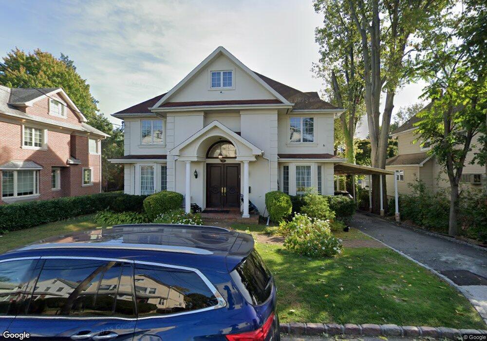
12 Franklin Rd Great Neck, NY 11024
Estimated Value: $1,925,000 - $2,028,375
--
Bed
5
Baths
2,958
Sq Ft
$668/Sq Ft
Est. Value
About This Home
This home is located at 12 Franklin Rd, Great Neck, NY 11024 and is currently estimated at $1,976,688, approximately $668 per square foot. 12 Franklin Rd is a home located in Nassau County with nearby schools including John F Kennedy School, Richard S. Sherman - Great Neck North Middle School, and John L. Miller Great Neck North High School.
Ownership History
Date
Name
Owned For
Owner Type
Purchase Details
Closed on
Nov 25, 2008
Sold by
Lalezarzadeh Shahram and Lalezarzadeh Shahrzad
Bought by
Lalezarzadeh Shahram and Lalezarzadeh Shahrzad
Current Estimated Value
Purchase Details
Closed on
Apr 5, 1995
Sold by
Gordon Raymond
Bought by
Lalehzarzadeh Shahrzad and Lalehzarzadeh Shahram
Home Financials for this Owner
Home Financials are based on the most recent Mortgage that was taken out on this home.
Original Mortgage
$220,000
Interest Rate
8.66%
Create a Home Valuation Report for This Property
The Home Valuation Report is an in-depth analysis detailing your home's value as well as a comparison with similar homes in the area
Home Values in the Area
Average Home Value in this Area
Purchase History
| Date | Buyer | Sale Price | Title Company |
|---|---|---|---|
| Lalezarzadeh Shahram | -- | None Available | |
| Lalehzarzadeh Shahrzad | $275,000 | -- |
Source: Public Records
Mortgage History
| Date | Status | Borrower | Loan Amount |
|---|---|---|---|
| Closed | Lalehzarzadeh Shahrzad | $220,000 |
Source: Public Records
Tax History Compared to Growth
Tax History
| Year | Tax Paid | Tax Assessment Tax Assessment Total Assessment is a certain percentage of the fair market value that is determined by local assessors to be the total taxable value of land and additions on the property. | Land | Improvement |
|---|---|---|---|---|
| 2025 | $29,113 | $1,543 | $544 | $999 |
| 2024 | $8,006 | $1,543 | $544 | $999 |
| 2023 | $25,197 | $1,543 | $544 | $999 |
| 2022 | $25,197 | $1,516 | $544 | $972 |
| 2021 | $23,450 | $1,431 | $505 | $926 |
| 2020 | $20,668 | $1,820 | $1,203 | $617 |
| 2019 | $19,942 | $2,408 | $1,591 | $817 |
| 2018 | $24,864 | $2,408 | $0 | $0 |
| 2017 | $14,782 | $2,408 | $1,591 | $817 |
| 2016 | $21,854 | $2,365 | $1,591 | $774 |
| 2015 | $6,643 | $2,365 | $1,591 | $774 |
| 2014 | $6,643 | $2,365 | $1,591 | $774 |
| 2013 | $6,308 | $2,365 | $1,591 | $774 |
Source: Public Records
Map
Nearby Homes
- 7 Hayden Ave
- 21 Hayden Ave
- 17 Hicks Ln
- 24 Steamboat Rd
- 11 Lee Ct
- 23 Burbury Ln
- 6 Red Brook Terrace
- 15 Beach Rd Unit 1P
- 6 Grady Ct
- 94 Fairview Ave
- 58 Steamboat Rd
- 5 Devonshire Ln
- 74 Colgate Rd
- 62 Essex Rd
- 32 Carriage Rd
- 69 Warwick Rd
- 33 Van Nostrand Ave
- 88 Steamboat Rd
- 60 Plymouth Rd
- 90 Baker Hill Rd