Estimated Value: $1,065,983 - $1,295,000
4
Beds
3
Baths
2,738
Sq Ft
$433/Sq Ft
Est. Value
About This Home
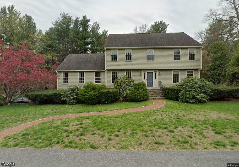
This home is located at 12 Freedom Farme Rd, Acton, MA 01720 and is currently estimated at $1,185,746, approximately $433 per square foot. 12 Freedom Farme Rd is a home located in Middlesex County with nearby schools including Acton-Boxborough Regional High School.
Ownership History
Date
Name
Owned For
Owner Type
Purchase Details
Closed on
May 25, 2007
Sold by
Pitts George E and Pitts Maria E
Bought by
Fox Kevin and Fox Michelle
Current Estimated Value
Create a Home Valuation Report for This Property
The Home Valuation Report is an in-depth analysis detailing your home's value as well as a comparison with similar homes in the area
Home Values in the Area
Average Home Value in this Area
Purchase History
| Date | Buyer | Sale Price | Title Company |
|---|---|---|---|
| Fox Kevin | $658,000 | -- |
Source: Public Records
Tax History Compared to Growth
Tax History
| Year | Tax Paid | Tax Assessment Tax Assessment Total Assessment is a certain percentage of the fair market value that is determined by local assessors to be the total taxable value of land and additions on the property. | Land | Improvement |
|---|---|---|---|---|
| 2025 | $15,605 | $909,900 | $341,800 | $568,100 |
| 2024 | $14,561 | $873,500 | $341,800 | $531,700 |
| 2023 | $14,204 | $808,900 | $310,700 | $498,200 |
| 2022 | $13,646 | $701,600 | $270,000 | $431,600 |
| 2021 | $13,326 | $658,700 | $250,100 | $408,600 |
| 2020 | $12,564 | $653,000 | $250,100 | $402,900 |
| 2019 | $12,007 | $619,900 | $250,100 | $369,800 |
| 2018 | $11,787 | $608,200 | $250,100 | $358,100 |
| 2017 | $11,659 | $611,700 | $250,100 | $361,600 |
| 2016 | $11,417 | $593,700 | $250,100 | $343,600 |
| 2015 | $11,205 | $588,200 | $250,100 | $338,100 |
| 2014 | $10,797 | $555,100 | $250,100 | $305,000 |
Source: Public Records
Map
Nearby Homes
- 4 Huron Rd
- 31 Mohawk Dr
- 9 Elm St Unit 1
- 5 Elm St Unit 1
- 285 Central St Unit 285
- 89 Windsor Ave
- 23 John Swift Rd
- 4 Omega Way
- 68 Macintosh Ln
- 134 Russet Ln
- 4,7,8 Crestwood Ln
- 92 Willow St Unit 3
- 92 Willow St Unit 2
- 90 Willow St Unit 1
- 491 Main St
- 524 Main St
- 169 Main St
- 709 Main St
- 5 Oakwood Rd
- 19 Railroad St Unit C2
- 14 Freedom Farme Rd
- 10 Freedom Farme Rd
- 18 Freedom Farme Rd
- 16 Freedom Farme Rd
- 11 Freedom Farme Rd
- 9 Freedom Farme Rd
- 17 Freedom Farme Rd
- 20 Freedom Farme Rd
- 8 Freedom Farme Rd
- 7 Freedom Farme Rd
- 19 Freedom Farme Rd
- 22 Freedom Farme Rd
- 21 Freedom Farme Rd
- 2 Olde Barn Way
- 13 Agawam Rd
- 25 Mohegan Rd
- 11 Agawam Rd
- 29 Mohegan Rd
- 23 Mohegan Rd
- 4 Freedom Farme Rd