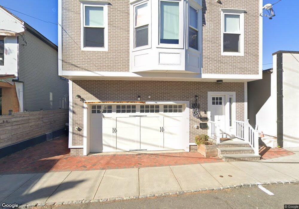
12 Frink St Unit A Montclair, NJ 07042
Estimated Value: $1,348,000 - $1,531,000
3
Beds
3
Baths
1,850
Sq Ft
$772/Sq Ft
Est. Value
About This Home
This home is located at 12 Frink St Unit A, Montclair, NJ 07042 and is currently estimated at $1,427,511, approximately $771 per square foot. 12 Frink St Unit A is a home located in Essex County with nearby schools including Hillside School, Nishuane School, and Bradford School.
Ownership History
Date
Name
Owned For
Owner Type
Purchase Details
Closed on
Sep 17, 2021
Sold by
Patel Yatin and Patel Nelti
Bought by
Patel Yatin
Current Estimated Value
Home Financials for this Owner
Home Financials are based on the most recent Mortgage that was taken out on this home.
Original Mortgage
$686,000
Outstanding Balance
$620,113
Interest Rate
2.8%
Mortgage Type
New Conventional
Estimated Equity
$807,398
Purchase Details
Closed on
Mar 26, 2010
Sold by
Taylor Maud
Bought by
Patel Yatin
Create a Home Valuation Report for This Property
The Home Valuation Report is an in-depth analysis detailing your home's value as well as a comparison with similar homes in the area
Home Values in the Area
Average Home Value in this Area
Purchase History
| Date | Buyer | Sale Price | Title Company |
|---|---|---|---|
| Patel Yatin | -- | Servicelink | |
| Patel Yatin | $99,400 | Chicago Title Insurance Co |
Source: Public Records
Mortgage History
| Date | Status | Borrower | Loan Amount |
|---|---|---|---|
| Open | Patel Yatin | $686,000 |
Source: Public Records
Tax History Compared to Growth
Tax History
| Year | Tax Paid | Tax Assessment Tax Assessment Total Assessment is a certain percentage of the fair market value that is determined by local assessors to be the total taxable value of land and additions on the property. | Land | Improvement |
|---|---|---|---|---|
| 2025 | $21,605 | $639,200 | $159,400 | $479,800 |
| 2024 | $21,605 | $639,200 | $159,400 | $479,800 |
| 2022 | $21,017 | $639,200 | $159,400 | $479,800 |
| 2021 | $20,653 | $639,200 | $159,400 | $479,800 |
| 2020 | $8,246 | $259,400 | $159,400 | $100,000 |
| 2019 | $5,015 | $159,400 | $159,400 | $0 |
| 2018 | $4,932 | $159,400 | $159,400 | $0 |
| 2017 | $12,617 | $337,900 | $194,000 | $143,900 |
| 2016 | $12,279 | $337,900 | $194,000 | $143,900 |
| 2015 | $11,914 | $337,900 | $194,000 | $143,900 |
| 2014 | $11,516 | $337,900 | $194,000 | $143,900 |
Source: Public Records
Map
Nearby Homes
- 119 Walnut St Unit C0010
- 119 Walnut St Unit 1
- 70 N Willow St
- 153 Walnut St
- 153 Walnut St Unit 2
- 69 N Fullerton Ave
- 101 Park St
- 197 N Fullerton Ave
- 76 Grove St
- 92-94 Midland Ave
- 36 James St
- 6 William St
- 163 Park St
- 48 S Park St Unit 517
- 112 Valley Rd Unit A
- 112 Valley Rd Unit B
- 80 Bay St Unit 8
- 26 Orange Rd
- 412 Ridgewood Ave
- 41 Glenridge Ave Unit 2L
- 12 Frink St
- 6 Frink St
- 22 Frink St
- 102 Walnut St Unit 5
- 120 Walnut St Unit 2L
- 120 Walnut St Unit 2R
- 96 Walnut St Unit 4
- 96 Walnut St
- 98 Walnut St Unit 1
- 98 Walnut St
- 95 Forest St
- 94 Walnut St Unit 2
- 94 Walnut St Unit 3
- 94 Walnut St
- 124 Walnut St
- 104 Walnut St Unit 5
- 104 Walnut St Unit 2
- 104 Walnut St Unit 4
- 104 Walnut St Unit 1
- 104 Walnut St