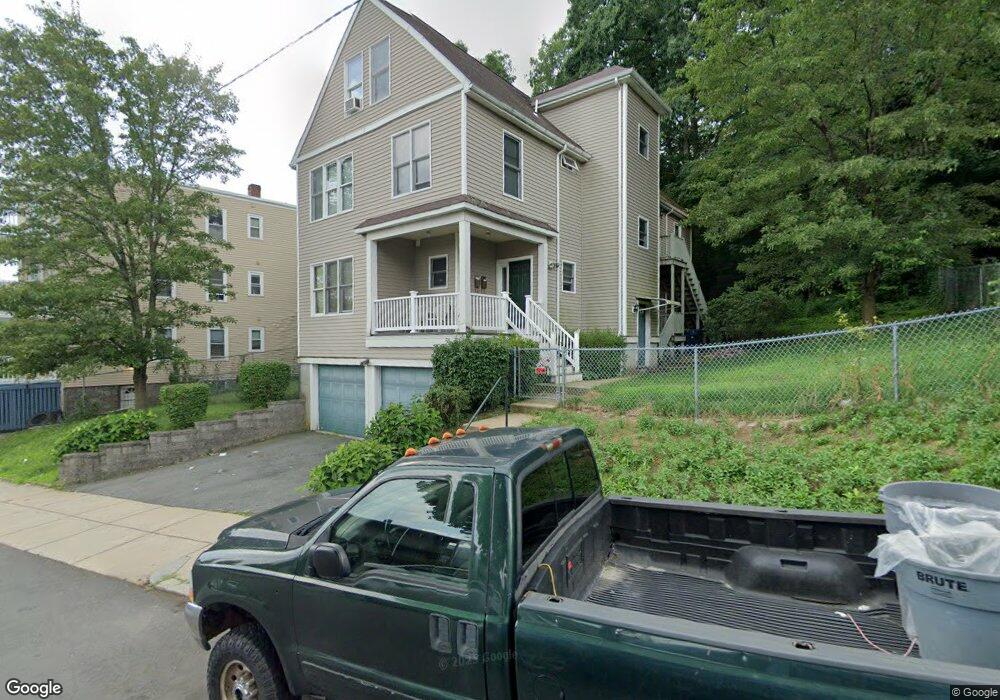
12 Goodale Rd Mattapan, MA 02126
Wellington Hill NeighborhoodEstimated Value: $680,493 - $914,000
5
Beds
4
Baths
3,433
Sq Ft
$233/Sq Ft
Est. Value
About This Home
This home is located at 12 Goodale Rd, Mattapan, MA 02126 and is currently estimated at $801,123, approximately $233 per square foot. 12 Goodale Rd is a home located in Suffolk County with nearby schools including KIPP Academy Boston Charter School and Berea Seventh-day Adventist Academy.
Ownership History
Date
Name
Owned For
Owner Type
Purchase Details
Closed on
Aug 25, 1999
Sold by
Boston Affrdbl Hmshp
Bought by
Patterson Donna
Current Estimated Value
Home Financials for this Owner
Home Financials are based on the most recent Mortgage that was taken out on this home.
Original Mortgage
$112,425
Interest Rate
7.53%
Mortgage Type
Purchase Money Mortgage
Create a Home Valuation Report for This Property
The Home Valuation Report is an in-depth analysis detailing your home's value as well as a comparison with similar homes in the area
Home Values in the Area
Average Home Value in this Area
Purchase History
| Date | Buyer | Sale Price | Title Company |
|---|---|---|---|
| Patterson Donna | $149,900 | -- |
Source: Public Records
Mortgage History
| Date | Status | Borrower | Loan Amount |
|---|---|---|---|
| Open | Patterson Donna | $212,612 | |
| Closed | Patterson Donna | $112,425 | |
| Previous Owner | Patterson Donna | $660,000 | |
| Closed | Patterson Donna | $29,980 |
Source: Public Records
Tax History Compared to Growth
Tax History
| Year | Tax Paid | Tax Assessment Tax Assessment Total Assessment is a certain percentage of the fair market value that is determined by local assessors to be the total taxable value of land and additions on the property. | Land | Improvement |
|---|---|---|---|---|
| 2025 | $5,878 | $507,600 | $167,508 | $340,092 |
| 2024 | $5,269 | $483,400 | $130,518 | $352,882 |
| 2023 | $4,945 | $460,400 | $124,308 | $336,092 |
| 2022 | $4,771 | $438,500 | $118,395 | $320,105 |
| 2021 | $4,456 | $417,600 | $0 | $417,600 |
| 2020 | $4,200 | $397,700 | $0 | $397,700 |
| 2019 | $3,993 | $378,800 | $144,300 | $234,500 |
| 2018 | $3,781 | $360,800 | $144,300 | $216,500 |
| 2017 | $3,639 | $343,600 | $144,300 | $199,300 |
| 2016 | $3,599 | $327,200 | $144,300 | $182,900 |
| 2015 | $3,773 | $311,600 | $102,300 | $209,300 |
| 2014 | $3,734 | $296,800 | $102,300 | $194,500 |
Source: Public Records
Map
Nearby Homes
- 6 Deering Rd
- 67 Wildwood St
- 10 Hosmer St
- 5 Sutton St
- 5 Sutton St Unit 3B
- 17 Greendale Rd Unit 2F
- 30-32 Westmore Rd
- 10 Sutton St
- 27 Havelock St
- 29 Havelock St
- 4 Gilmer St
- 14 Estella St Unit 2
- 24 Marden Ave
- 492 Harvard St
- 28 Hansborough St Unit 2
- 28 Hansborough St Unit 5
- 23 Fessenden St
- 25 Fessenden St
- 69 Lucerne St
- 21 Ashton St Unit 1
- 8 Goodale Rd
- 20 Goodale Rd
- 24 Goodale Rd Unit 3
- 24 Goodale Rd Unit 2
- 24 Goodale Rd Unit 1
- 24 Goodale Rd
- 97 Ormond St
- 99 Ormond St
- 93 Ormond St
- 28 Goodale Rd
- 1215 Blue Hill Ave
- 1215 Blue Hill Ave Unit 1
- 1215 Blue Hill Ave Unit 2
- 101 Ormond St
- 19 Goodale Rd
- 1211 Blue Hill Ave
- 23 Goodale Rd
- 103 Ormond St
- 1207 Blue Hill Ave
- 91 Ormond St Unit 1