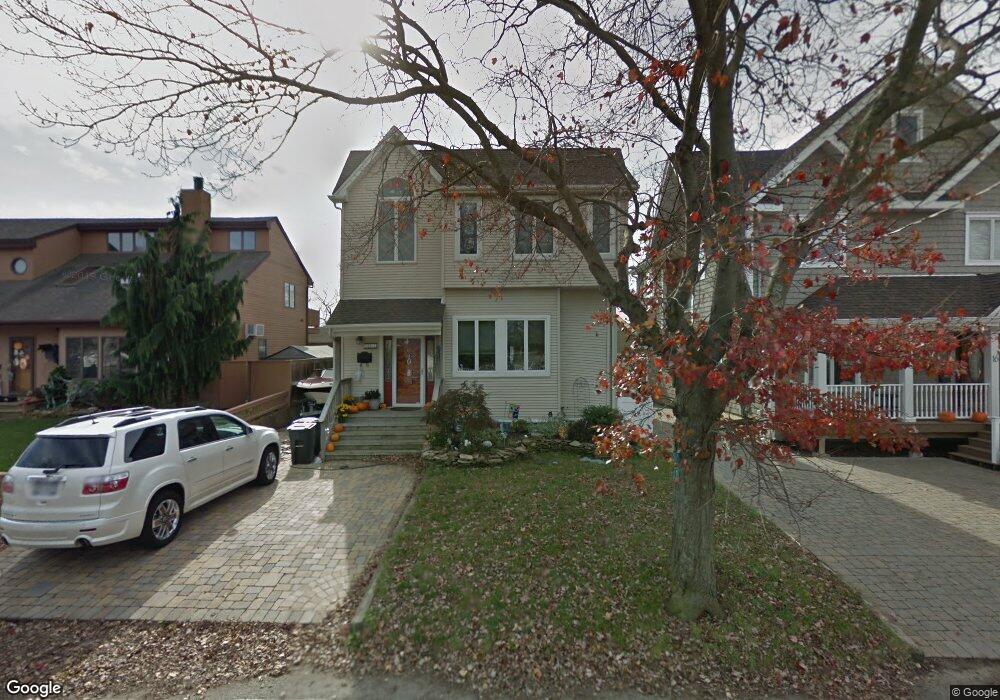
12 Grant Ave W Babylon, NY 11702
Estimated Value: $440,000 - $718,000
--
Bed
--
Bath
--
Sq Ft
--
Built
About This Home
This home is located at 12 Grant Ave W, Babylon, NY 11702 and is currently estimated at $627,928. 12 Grant Ave W is a home located in Suffolk County with nearby schools including West Babylon Senior High School and South Bay Junior Academy.
Ownership History
Date
Name
Owned For
Owner Type
Purchase Details
Closed on
Sep 25, 2002
Sold by
Lee Stephen A and Lee Stephen D
Bought by
Lee Stephen A
Current Estimated Value
Home Financials for this Owner
Home Financials are based on the most recent Mortgage that was taken out on this home.
Original Mortgage
$200,000
Outstanding Balance
$83,971
Interest Rate
6.18%
Estimated Equity
$543,957
Purchase Details
Closed on
Jun 26, 1997
Sold by
Skiber Richard and Skiber Janet
Bought by
Lee Stephen A and Lee Stephen D
Create a Home Valuation Report for This Property
The Home Valuation Report is an in-depth analysis detailing your home's value as well as a comparison with similar homes in the area
Home Values in the Area
Average Home Value in this Area
Purchase History
| Date | Buyer | Sale Price | Title Company |
|---|---|---|---|
| Lee Stephen A | -- | Titleserv | |
| Lee Stephen A | $152,000 | Chicago Title Insurance Co |
Source: Public Records
Mortgage History
| Date | Status | Borrower | Loan Amount |
|---|---|---|---|
| Open | Lee Stephen A | $200,000 |
Source: Public Records
Tax History
| Year | Tax Paid | Tax Assessment Tax Assessment Total Assessment is a certain percentage of the fair market value that is determined by local assessors to be the total taxable value of land and additions on the property. | Land | Improvement |
|---|---|---|---|---|
| 2024 | $21,789 | $5,860 | $310 | $5,550 |
| 2023 | $21,789 | $5,860 | $310 | $5,550 |
| 2022 | $17,965 | $5,860 | $310 | $5,550 |
| 2021 | $17,965 | $5,860 | $310 | $5,550 |
| 2020 | $19,805 | $5,860 | $310 | $5,550 |
| 2019 | $19,805 | $0 | $0 | $0 |
| 2018 | -- | $5,860 | $310 | $5,550 |
| 2017 | $17,607 | $5,860 | $310 | $5,550 |
| 2016 | $17,650 | $5,860 | $310 | $5,550 |
| 2015 | -- | $5,860 | $310 | $5,550 |
| 2014 | -- | $5,860 | $310 | $5,550 |
Source: Public Records
Map
Nearby Homes
- 57-61 E Shore Dr
- 87 E Shore Dr
- 10 Stuart Ave
- 20 Westbridge Dr
- 40 Alton Rd
- 19 Gamecock Ln
- 24 Midway St
- 165 Peninsula Dr
- 823 Venetian Blvd
- 6 White Birch Dr
- 351 Venetian Blvd
- 9 Pratt St
- 66 Cedar Ln
- 356 Granada Pkwy
- 33 Robbins Ave
- 222 Lido Pkwy
- 141 Annuskemunnica Rd
- 243 Lido Pkwy
- 90 Thompson Ave
- 219 Granada Pkwy
- 16 Grant Ave W
- 10 Grant Ave W
- 18 Grant Ave W
- 2 Grant Ave W
- 46 S Bay Dr
- 48 S Bay Dr
- 22 Grant Ave W
- 21 Grant Ave W
- 17 Grant Ave W
- 17 Grant Ave W Unit 2nd Fl
- 11 W Harrison Ave
- 50 S Bay Dr
- 21 W Harrison Ave
- 23 W Harrison Ave
- 23 W Harrison Ave
- 26 Grant Ave W
- 25 Grant Ave W
- 64 S Bay Dr
- 25 W Harrison Ave
- 32 S Bay Dr
Your Personal Tour Guide
Ask me questions while you tour the home.