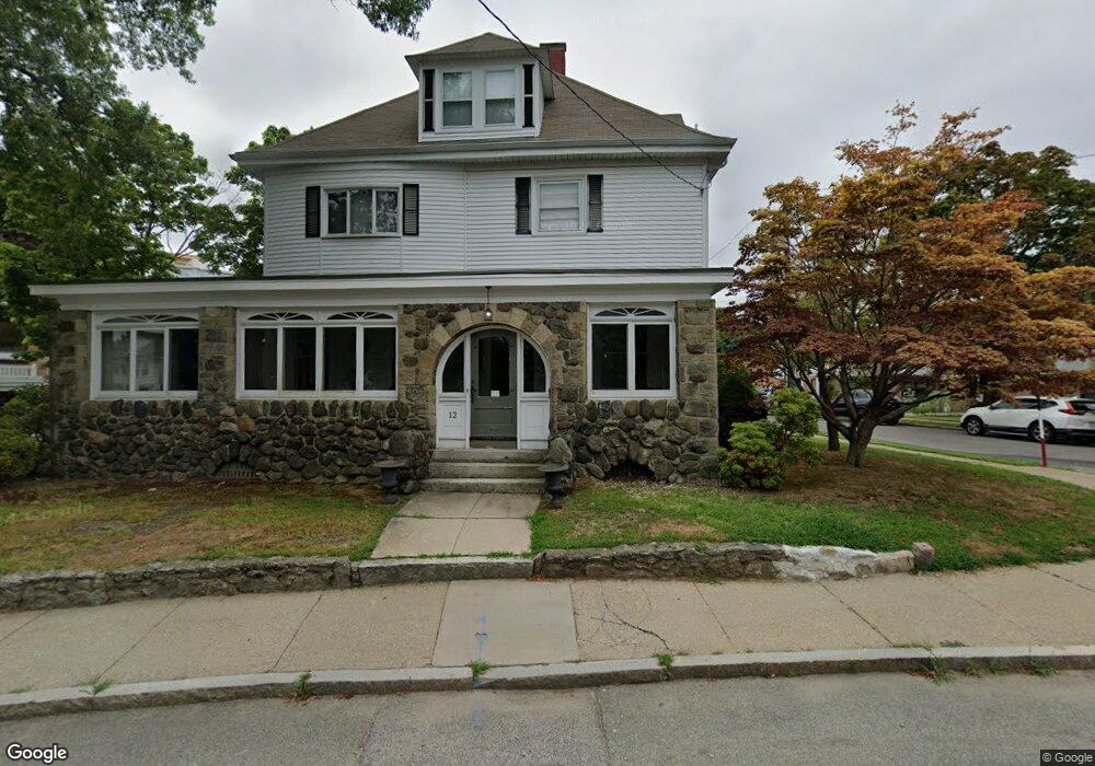
12 Green St Newton, MA 02458
Nonantum NeighborhoodEstimated Value: $1,216,069 - $1,386,000
3
Beds
3
Baths
2,276
Sq Ft
$573/Sq Ft
Est. Value
About This Home
This home is located at 12 Green St, Newton, MA 02458 and is currently estimated at $1,303,767, approximately $572 per square foot. 12 Green St is a home located in Middlesex County with nearby schools including Lincoln-Eliot Elementary School, Bigelow Middle School, and Newton North High School.
Ownership History
Date
Name
Owned For
Owner Type
Purchase Details
Closed on
Dec 1, 1994
Sold by
Cloonan Thomas M and Cloonan Maureen A
Bought by
Darr John A and Darr Katheryn P
Current Estimated Value
Home Financials for this Owner
Home Financials are based on the most recent Mortgage that was taken out on this home.
Original Mortgage
$234,000
Interest Rate
8.81%
Mortgage Type
Purchase Money Mortgage
Create a Home Valuation Report for This Property
The Home Valuation Report is an in-depth analysis detailing your home's value as well as a comparison with similar homes in the area
Home Values in the Area
Average Home Value in this Area
Purchase History
| Date | Buyer | Sale Price | Title Company |
|---|---|---|---|
| Darr John A | $260,000 | -- |
Source: Public Records
Mortgage History
| Date | Status | Borrower | Loan Amount |
|---|---|---|---|
| Open | Darr John A | $35,000 | |
| Closed | Darr John A | $234,000 | |
| Previous Owner | Darr John A | $170,000 |
Source: Public Records
Tax History Compared to Growth
Tax History
| Year | Tax Paid | Tax Assessment Tax Assessment Total Assessment is a certain percentage of the fair market value that is determined by local assessors to be the total taxable value of land and additions on the property. | Land | Improvement |
|---|---|---|---|---|
| 2025 | $10,706 | $1,092,400 | $674,700 | $417,700 |
| 2024 | $10,351 | $1,060,600 | $655,000 | $405,600 |
| 2023 | $9,700 | $952,800 | $486,100 | $466,700 |
| 2022 | $9,281 | $882,200 | $450,100 | $432,100 |
| 2021 | $8,956 | $832,300 | $424,600 | $407,700 |
| 2020 | $8,689 | $832,300 | $424,600 | $407,700 |
| 2019 | $8,445 | $808,100 | $412,200 | $395,900 |
| 2018 | $7,958 | $735,500 | $372,100 | $363,400 |
| 2017 | $7,716 | $693,900 | $351,000 | $342,900 |
| 2016 | $7,380 | $648,500 | $328,000 | $320,500 |
| 2015 | $7,037 | $606,100 | $306,500 | $299,600 |
Source: Public Records
Map
Nearby Homes
- 12-14 Middle St
- 86 West St
- 90 Waban Park Unit 2
- 53 West St
- 290 Watertown St Unit 3
- 290 Watertown St Unit 4
- 34 West St Unit A
- 77 Pond Ave Unit 1103
- 188-190 Adams St
- 11 Murphy Ct
- 324 Adams St Unit 2
- 158 Adams St
- 3 Ashmont Ave
- 49 Hawthorn St
- 22-24 Emerald St
- 15-17 Jewett Place Unit 2
- 141 Morse St
- 44 Faxon St Unit 2
- 68 Los Angeles St Unit PH5
- 1 Channing St
- 15 Green St
- 13 Green St
- 232 Pearl St
- 232 Pearl St Unit 2
- 232 Pearl St
- 232 Pearl St Unit xx
- 232 Pearl St Unit 232
- 13 - 15 Green St Unit 2
- 214 Pearl St Unit 216
- 234 Pearl St
- 214-216 Pearl St
- 26 Green St
- 19 Green St Unit 21
- 227 Pearl St Unit 229
- 106 John F. Kennedy Cir
- 23 Green Park
- 217 Pearl St Unit 219
- 219 Pearl St Unit 219
- 25 Green St
- 235 Pearl St Unit 237