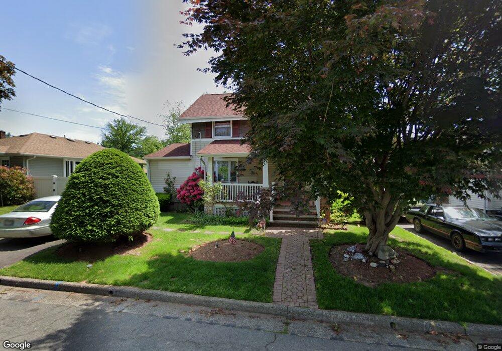
12 Gresser Ave Linden, NJ 07036
Estimated Value: $457,000 - $531,000
--
Bed
--
Bath
1,254
Sq Ft
$401/Sq Ft
Est. Value
About This Home
This home is located at 12 Gresser Ave, Linden, NJ 07036 and is currently estimated at $502,717, approximately $400 per square foot. 12 Gresser Ave is a home located in Union County with nearby schools including Number 10, Myles J. McManus Middle School, and Linden High School.
Ownership History
Date
Name
Owned For
Owner Type
Purchase Details
Closed on
Mar 15, 2024
Sold by
Rudick Anna Marie and Czar Karen Lynn
Bought by
Iliovits Moshe and Iliovits Estelle
Current Estimated Value
Home Financials for this Owner
Home Financials are based on the most recent Mortgage that was taken out on this home.
Original Mortgage
$392,000
Outstanding Balance
$385,650
Interest Rate
6.77%
Mortgage Type
New Conventional
Estimated Equity
$117,067
Purchase Details
Closed on
Feb 24, 2011
Sold by
Czar Ann
Bought by
Rudick Anna Marie and Czar Karen Lynn
Create a Home Valuation Report for This Property
The Home Valuation Report is an in-depth analysis detailing your home's value as well as a comparison with similar homes in the area
Home Values in the Area
Average Home Value in this Area
Purchase History
| Date | Buyer | Sale Price | Title Company |
|---|---|---|---|
| Iliovits Moshe | $490,000 | Dekel Abstract | |
| Iliovits Moshe | $490,000 | Dekel Abstract | |
| Rudick Anna Marie | -- | None Available |
Source: Public Records
Mortgage History
| Date | Status | Borrower | Loan Amount |
|---|---|---|---|
| Open | Iliovits Moshe | $392,000 | |
| Closed | Iliovits Moshe | $392,000 |
Source: Public Records
Tax History Compared to Growth
Tax History
| Year | Tax Paid | Tax Assessment Tax Assessment Total Assessment is a certain percentage of the fair market value that is determined by local assessors to be the total taxable value of land and additions on the property. | Land | Improvement |
|---|---|---|---|---|
| 2025 | $8,234 | $117,100 | $62,500 | $54,600 |
| 2024 | $8,054 | $117,100 | $62,500 | $54,600 |
| 2023 | $8,054 | $117,100 | $62,500 | $54,600 |
| 2022 | $8,096 | $117,100 | $62,500 | $54,600 |
| 2021 | $8,137 | $117,100 | $62,500 | $54,600 |
| 2020 | $8,094 | $117,100 | $62,500 | $54,600 |
| 2019 | $8,067 | $117,100 | $62,500 | $54,600 |
| 2018 | $8,065 | $117,100 | $62,500 | $54,600 |
| 2017 | $7,890 | $117,100 | $62,500 | $54,600 |
| 2016 | $7,642 | $117,100 | $62,500 | $54,600 |
| 2015 | $7,100 | $117,100 | $62,500 | $54,600 |
| 2014 | $6,958 | $117,100 | $62,500 | $54,600 |
Source: Public Records
Map
Nearby Homes
- 2513 N Wood Ave
- 63 Elmwood Terrace
- 38 Pallant Ave
- 74 Raritan Rd
- 540 W 7th Ave
- 113 Raritan Rd
- 123 Robbinwood Terrace
- 112 Melrose Terrace
- 53 Pallant Ave
- 538 Dietz St
- 221 Douglas Rd
- 46 Palisade Rd
- 13 Independence Dr
- 1605 Wood Ave Unit F1
- 57 Berlant Ave
- 1715 Orchard Terrace
- 38 Independence Dr
- 333 Livingston Rd
- 382 Douglas Rd
- 15 Swarthmore Rd