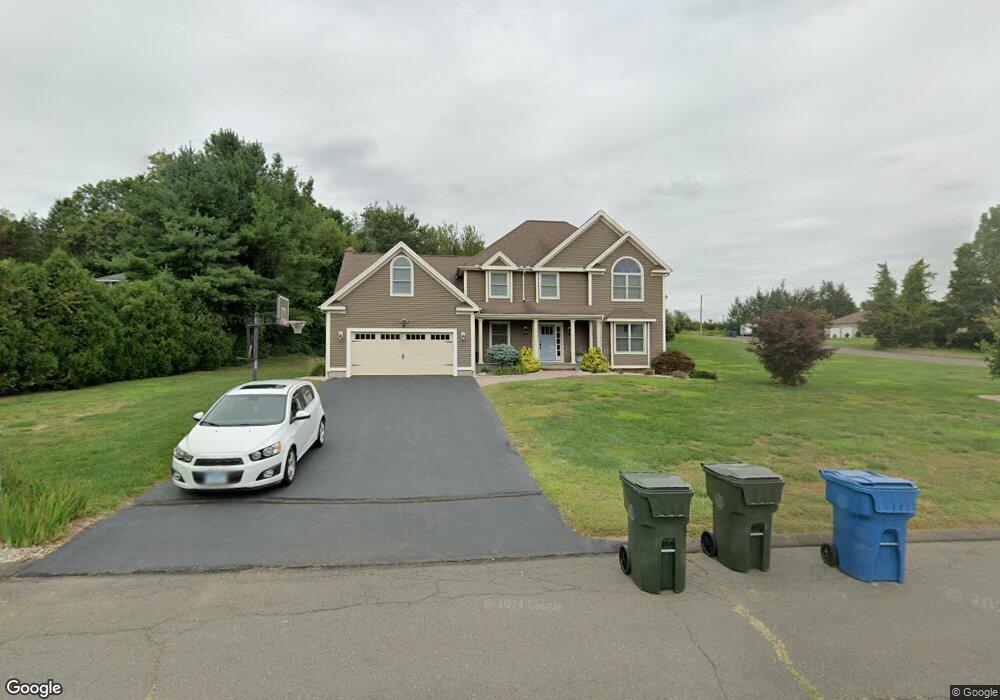
12 Haman Ct Berlin, CT 06037
Estimated Value: $800,000 - $884,000
4
Beds
5
Baths
3,535
Sq Ft
$236/Sq Ft
Est. Value
About This Home
This home is located at 12 Haman Ct, Berlin, CT 06037 and is currently estimated at $835,342, approximately $236 per square foot. 12 Haman Ct is a home located in Hartford County with nearby schools including Emma Hart Willard School, Catherine M. Mcgee Middle School, and Berlin High School.
Ownership History
Date
Name
Owned For
Owner Type
Purchase Details
Closed on
Apr 7, 2015
Sold by
Beatman Matthew K
Bought by
Beatman Debra T
Current Estimated Value
Purchase Details
Closed on
May 12, 1997
Sold by
Farr Bldg Co Inc
Bought by
Beatmau Matthew and Tobin Debra S
Home Financials for this Owner
Home Financials are based on the most recent Mortgage that was taken out on this home.
Original Mortgage
$95,000
Interest Rate
6.75%
Mortgage Type
Unknown
Create a Home Valuation Report for This Property
The Home Valuation Report is an in-depth analysis detailing your home's value as well as a comparison with similar homes in the area
Home Values in the Area
Average Home Value in this Area
Purchase History
| Date | Buyer | Sale Price | Title Company |
|---|---|---|---|
| Beatman Debra T | -- | -- | |
| Beatman Debra T | -- | -- | |
| Beatmau Matthew | $262,385 | -- | |
| Beatmau Matthew | $262,385 | -- |
Source: Public Records
Mortgage History
| Date | Status | Borrower | Loan Amount |
|---|---|---|---|
| Previous Owner | Beatmau Matthew | $95,000 |
Source: Public Records
Tax History Compared to Growth
Tax History
| Year | Tax Paid | Tax Assessment Tax Assessment Total Assessment is a certain percentage of the fair market value that is determined by local assessors to be the total taxable value of land and additions on the property. | Land | Improvement |
|---|---|---|---|---|
| 2025 | $12,551 | $409,500 | $87,600 | $321,900 |
| 2024 | $12,371 | $409,500 | $87,600 | $321,900 |
| 2023 | $12,105 | $409,500 | $87,600 | $321,900 |
| 2022 | $11,830 | $344,800 | $85,200 | $259,600 |
| 2021 | $11,699 | $344,800 | $85,200 | $259,600 |
| 2020 | $11,699 | $344,800 | $85,200 | $259,600 |
| 2019 | $11,699 | $344,800 | $85,200 | $259,600 |
| 2018 | $11,206 | $344,800 | $85,200 | $259,600 |
| 2017 | $11,310 | $357,800 | $84,300 | $273,500 |
| 2016 | $11,024 | $357,800 | $84,300 | $273,500 |
| 2015 | $10,859 | $357,800 | $84,300 | $273,500 |
| 2014 | $10,348 | $357,800 | $84,300 | $273,500 |
Source: Public Records
Map
Nearby Homes
- 785 Norton Rd
- 1152 Worthington Ridge
- 1175 Worthington Ridge
- 51 Towne Dr
- 30 Blue Ridge Ln
- 117 Old Wood Rd
- 144 Overhill Dr
- 110 Old Wood Rd
- 953 High Rd
- 941 High Rd
- 927 High Rd
- 568 Chamberlain Hwy
- 95 S Ridge Ln Unit E202
- Lot 4 Burnham St
- 87 Warner Rd
- 381 Chamberlain Hwy
- 8 Canoe Birch Ct Unit 8
- 225 Ox Yoke Dr
- 116 Silver Island Way Unit 116
- 405 Alling St
- 30 Haman Ct
- 1047 Kensington Rd
- 58 Crooked Brook Ln
- 39 Crooked Brook Ln
- 25 Crooked Brook Ln
- 42 Haman Ct
- 1057 Kensington Rd
- 61 Crooked Brook Ln
- 35 Haman Ct
- 1005 Kensington Rd
- 72 Crooked Brook Ln
- 91 Renn Ln
- 89 Renn Ln
- 1069 Kensington Rd
- 1050 Kensington Rd
- 47 Haman Ct
- 92 Renn Ln
- 31 Elton Rd
- 997 Kensington Rd
- 81 Crooked Brook Ln