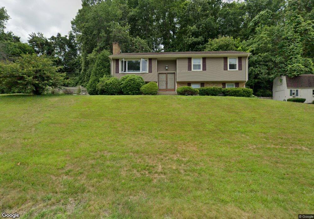
12 Hemlock Dr Millbury, MA 01527
Estimated Value: $462,000 - $514,000
3
Beds
1
Bath
1,398
Sq Ft
$351/Sq Ft
Est. Value
About This Home
This home is located at 12 Hemlock Dr, Millbury, MA 01527 and is currently estimated at $490,283, approximately $350 per square foot. 12 Hemlock Dr is a home located in Worcester County with nearby schools including Elmwood Street Elementary School, Raymond E. Shaw Elementary School, and Millbury Junior/Senior High School.
Ownership History
Date
Name
Owned For
Owner Type
Purchase Details
Closed on
Oct 28, 2020
Sold by
Stephan A Brisson Ft and Brisson
Bought by
Morin Joanna and Greiner Timothy
Current Estimated Value
Home Financials for this Owner
Home Financials are based on the most recent Mortgage that was taken out on this home.
Original Mortgage
$295,000
Outstanding Balance
$261,307
Interest Rate
2.8%
Mortgage Type
New Conventional
Estimated Equity
$228,976
Purchase Details
Closed on
Feb 21, 2020
Sold by
Brisson Stephan A and Brisson Mary D
Bought by
Stephan A Brisson Ft and Brisson
Create a Home Valuation Report for This Property
The Home Valuation Report is an in-depth analysis detailing your home's value as well as a comparison with similar homes in the area
Home Values in the Area
Average Home Value in this Area
Purchase History
| Date | Buyer | Sale Price | Title Company |
|---|---|---|---|
| Morin Joanna | $335,000 | None Available | |
| Morin Joanna | $335,000 | None Available | |
| Stephan A Brisson Ft | -- | None Available | |
| Stephan A Brisson Ft | -- | None Available |
Source: Public Records
Mortgage History
| Date | Status | Borrower | Loan Amount |
|---|---|---|---|
| Open | Morin Joanna | $295,000 | |
| Closed | Morin Joanna | $295,000 |
Source: Public Records
Tax History
| Year | Tax Paid | Tax Assessment Tax Assessment Total Assessment is a certain percentage of the fair market value that is determined by local assessors to be the total taxable value of land and additions on the property. | Land | Improvement |
|---|---|---|---|---|
| 2025 | $5,436 | $406,000 | $116,800 | $289,200 |
| 2024 | $4,992 | $377,300 | $108,100 | $269,200 |
| 2023 | $4,579 | $316,900 | $75,900 | $241,000 |
| 2022 | $4,298 | $286,500 | $75,900 | $210,600 |
| 2021 | $4,237 | $274,600 | $75,900 | $198,700 |
| 2020 | $4,340 | $283,100 | $75,900 | $207,200 |
| 2019 | $4,409 | $278,200 | $75,500 | $202,700 |
| 2018 | $4,361 | $266,900 | $75,500 | $191,400 |
| 2017 | $3,925 | $238,900 | $75,500 | $163,400 |
| 2016 | $3,679 | $223,500 | $75,500 | $148,000 |
| 2015 | $3,613 | $219,500 | $76,800 | $142,700 |
| 2014 | $3,533 | $206,600 | $80,200 | $126,400 |
Source: Public Records
Map
Nearby Homes
- 11 Laurel Dr
- 0 W Main St
- 13 Emily Dr Unit 13
- 152 W Main St Unit A
- 196 Horne Way Unit 196
- 100 Horne Way
- 168 Burbank Rd
- 124 Worcester Providence Turnpike
- 128 Worcester Providence Turnpike
- 99 Burbank Road Lot 182
- 99 Burbank Rd
- 38 W Main St
- 0 Auburn Rd
- 4 Jessica j Dr
- 5 Mogren Dr
- 2 Jessica j Dr
- 303 W Main St
- 8 Sycamore Cir
- 26 Leslie Ln
- 5 Putnam Hill Rd
Your Personal Tour Guide
Ask me questions while you tour the home.