Estimated Value: $698,349 - $992,000
3
Beds
2
Baths
1,148
Sq Ft
$702/Sq Ft
Est. Value
About This Home
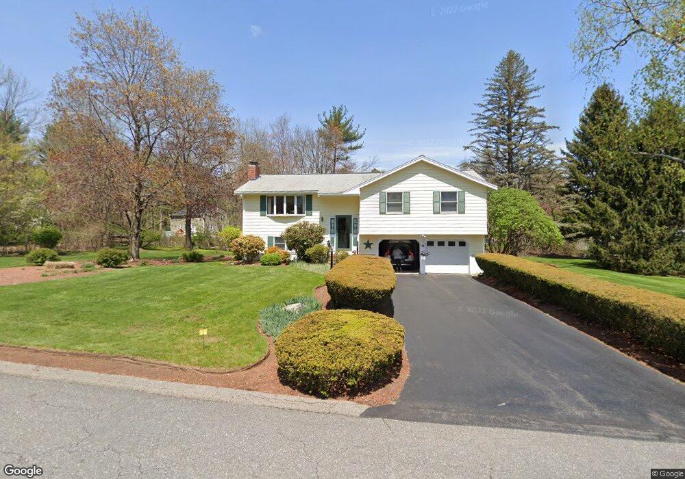
This home is located at 12 Hillcrest Dr, Acton, MA 01720 and is currently estimated at $805,587, approximately $701 per square foot. 12 Hillcrest Dr is a home located in Middlesex County with nearby schools including Acton-Boxborough Regional High School, Maynard Knowledge Beginnings, and The Imago School.
Ownership History
Date
Name
Owned For
Owner Type
Purchase Details
Closed on
Dec 31, 1993
Sold by
Smith Sherman W and Heath Linda S
Bought by
Srebnick David L and Srebnick Carol L
Current Estimated Value
Home Financials for this Owner
Home Financials are based on the most recent Mortgage that was taken out on this home.
Original Mortgage
$189,900
Interest Rate
7%
Mortgage Type
Purchase Money Mortgage
Purchase Details
Closed on
Aug 4, 1988
Sold by
Varma Snehananda
Bought by
Smith Sherman W
Home Financials for this Owner
Home Financials are based on the most recent Mortgage that was taken out on this home.
Original Mortgage
$145,000
Interest Rate
10.36%
Mortgage Type
Purchase Money Mortgage
Create a Home Valuation Report for This Property
The Home Valuation Report is an in-depth analysis detailing your home's value as well as a comparison with similar homes in the area
Home Values in the Area
Average Home Value in this Area
Purchase History
| Date | Buyer | Sale Price | Title Company |
|---|---|---|---|
| Srebnick David L | $211,000 | -- | |
| Smith Sherman W | $219,900 | -- |
Source: Public Records
Mortgage History
| Date | Status | Borrower | Loan Amount |
|---|---|---|---|
| Closed | Smith Sherman W | $189,900 | |
| Previous Owner | Smith Sherman W | $35,000 | |
| Previous Owner | Smith Sherman W | $145,000 |
Source: Public Records
Tax History
| Year | Tax Paid | Tax Assessment Tax Assessment Total Assessment is a certain percentage of the fair market value that is determined by local assessors to be the total taxable value of land and additions on the property. | Land | Improvement |
|---|---|---|---|---|
| 2025 | $11,288 | $658,200 | $321,200 | $337,000 |
| 2024 | $10,697 | $641,700 | $321,200 | $320,500 |
| 2023 | $10,645 | $606,200 | $291,800 | $314,400 |
| 2022 | $10,301 | $529,600 | $253,700 | $275,900 |
| 2021 | $9,684 | $478,700 | $235,200 | $243,500 |
| 2020 | $9,210 | $478,700 | $235,200 | $243,500 |
| 2019 | $8,598 | $443,900 | $235,200 | $208,700 |
| 2018 | $8,262 | $426,300 | $235,200 | $191,100 |
| 2017 | $7,965 | $417,900 | $235,200 | $182,700 |
| 2016 | $7,748 | $402,900 | $235,200 | $167,700 |
| 2015 | $7,193 | $377,600 | $235,200 | $142,400 |
| 2014 | $7,056 | $362,800 | $235,200 | $127,600 |
Source: Public Records
Map
Nearby Homes
- 7 Hillcrest Dr
- 1 Vanderbelt Rd
- 70 River St
- 128 Parker St Unit 3B
- 30 Brewster Ln
- 31 Drummer Rd Unit 31
- 1 Drummer Rd Unit A5
- 40 High St
- 59 Lexington Dr
- 25 Nylander Way
- 129 Main St Unit 129
- 131 Main St
- 303 School St
- 184 Main St Unit 3
- 27 Forest Rd
- 7 Kelley Rd
- 65 Summit St
- 46 Taylor Rd
- 246 Main St Unit 2
- 95 Concord Rd
- 14 Hillcrest Dr
- 10 Hillcrest Dr
- 185 School St
- 13 Hillcrest Dr
- 11 Hillcrest Dr
- 189 School St Unit R
- 189 School St Unit L
- 183 School St
- 183 School St Unit A
- 183 School St Unit 183A
- 183 School St Unit Right
- 183 School St Unit Left
- 9 Hillcrest Dr
- 16 Hillcrest Dr
- 15 Hillcrest Dr
- 8 Hillcrest Dr
- 186 School St
- 11 Pond View Dr
- 13 Pond View Dr
- 4 Fox Hill Rd
Your Personal Tour Guide
Ask me questions while you tour the home.