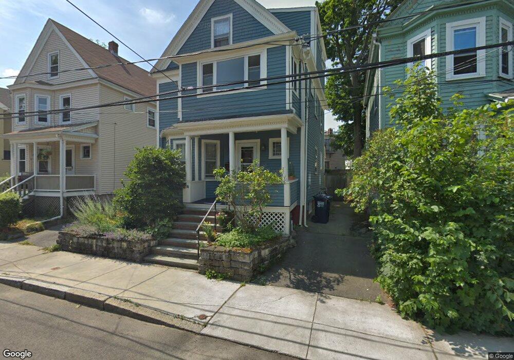
12 Hubbard Ave Cambridge, MA 02140
Neighborhood Nine NeighborhoodEstimated Value: $1,538,000 - $1,853,000
4
Beds
3
Baths
1,556
Sq Ft
$1,099/Sq Ft
Est. Value
About This Home
This home is located at 12 Hubbard Ave, Cambridge, MA 02140 and is currently estimated at $1,709,512, approximately $1,098 per square foot. 12 Hubbard Ave is a home located in Middlesex County with nearby schools including Benjamin Banneker Charter Public School, Cambridge Montessori School, and Cambridge Friends School.
Ownership History
Date
Name
Owned For
Owner Type
Purchase Details
Closed on
Sep 30, 2005
Sold by
Nagle Robert J
Bought by
Wakeley John R and Chalfin Sonia F
Current Estimated Value
Home Financials for this Owner
Home Financials are based on the most recent Mortgage that was taken out on this home.
Original Mortgage
$226,000
Outstanding Balance
$121,575
Interest Rate
5.84%
Mortgage Type
Purchase Money Mortgage
Estimated Equity
$1,587,937
Purchase Details
Closed on
Aug 11, 2003
Sold by
Nagle Robert J
Bought by
Nagle Robert J
Purchase Details
Closed on
Aug 1, 1988
Sold by
Oshea Michael
Bought by
Nagle Robert J
Home Financials for this Owner
Home Financials are based on the most recent Mortgage that was taken out on this home.
Original Mortgage
$205,500
Interest Rate
10.39%
Mortgage Type
Purchase Money Mortgage
Create a Home Valuation Report for This Property
The Home Valuation Report is an in-depth analysis detailing your home's value as well as a comparison with similar homes in the area
Home Values in the Area
Average Home Value in this Area
Purchase History
| Date | Buyer | Sale Price | Title Company |
|---|---|---|---|
| Wakeley John R | $710,000 | -- | |
| Nagle Robert J | -- | -- | |
| Nagle Robert J | $257,000 | -- |
Source: Public Records
Mortgage History
| Date | Status | Borrower | Loan Amount |
|---|---|---|---|
| Open | Wakeley John R | $226,000 | |
| Previous Owner | Nagle Robert J | $205,500 |
Source: Public Records
Tax History Compared to Growth
Tax History
| Year | Tax Paid | Tax Assessment Tax Assessment Total Assessment is a certain percentage of the fair market value that is determined by local assessors to be the total taxable value of land and additions on the property. | Land | Improvement |
|---|---|---|---|---|
| 2025 | $8,966 | $1,412,000 | $658,900 | $753,100 |
| 2024 | $8,428 | $1,423,700 | $702,500 | $721,200 |
| 2023 | $7,866 | $1,342,400 | $718,400 | $624,000 |
| 2022 | $7,476 | $1,262,800 | $710,000 | $552,800 |
| 2021 | $7,074 | $1,209,300 | $694,900 | $514,400 |
| 2020 | $6,761 | $1,175,900 | $688,000 | $487,900 |
| 2019 | $6,226 | $1,048,200 | $596,900 | $451,300 |
| 2018 | $6,189 | $984,000 | $553,000 | $431,000 |
| 2017 | $6,042 | $930,900 | $527,800 | $403,100 |
| 2016 | $5,797 | $829,300 | $455,500 | $373,800 |
| 2015 | $5,419 | $693,000 | $358,200 | $334,800 |
| 2014 | $5,270 | $628,900 | $298,500 | $330,400 |
Source: Public Records
Map
Nearby Homes
- 70 Walden St Unit 1
- 70 Walden St Unit 7
- 70 Walden St Unit 11
- 86 Avon Hill St
- 24 Cambridge Terrace Unit 2
- 8 Cogswell Ave
- 1 Richdale Ave Unit 2
- 273 Walden St Unit 2
- 43 Linnaean St Unit 42
- 22 Agassiz St
- 12 Rindge Ave Unit 1
- 3 Arlington St Unit 52
- 84 Garden St
- 12-14 Gray Gardens W
- 61 Bolton St Unit 304
- 7 Beech St Unit 319
- 7 Beech St Unit 211
- 18 Donnell St
- 148 Huron Ave
- 202 Garden St
- 10 Hubbard Ave
- 14 Hubbard Ave
- 97 Walden St
- 97 Walden St Unit 2
- 101 Walden St
- 89 Walden St
- 89 Walden St Unit 3
- 89 Walden St Unit 1
- 89 Walden St Unit 2
- 2 Hubbard Ave
- 2 Hubbard Ave Unit 1
- 2 Hubbard Ave Unit 2
- 85 Walden St Unit 1
- 107 Walden St
- 16 Hubbard Ave Unit 12
- 16 Hubbard Ave Unit 11
- 16 Hubbard Ave Unit 10
- 16 Hubbard Ave Unit 9
- 16 Hubbard Ave Unit 8
- 16 Hubbard Ave Unit 7