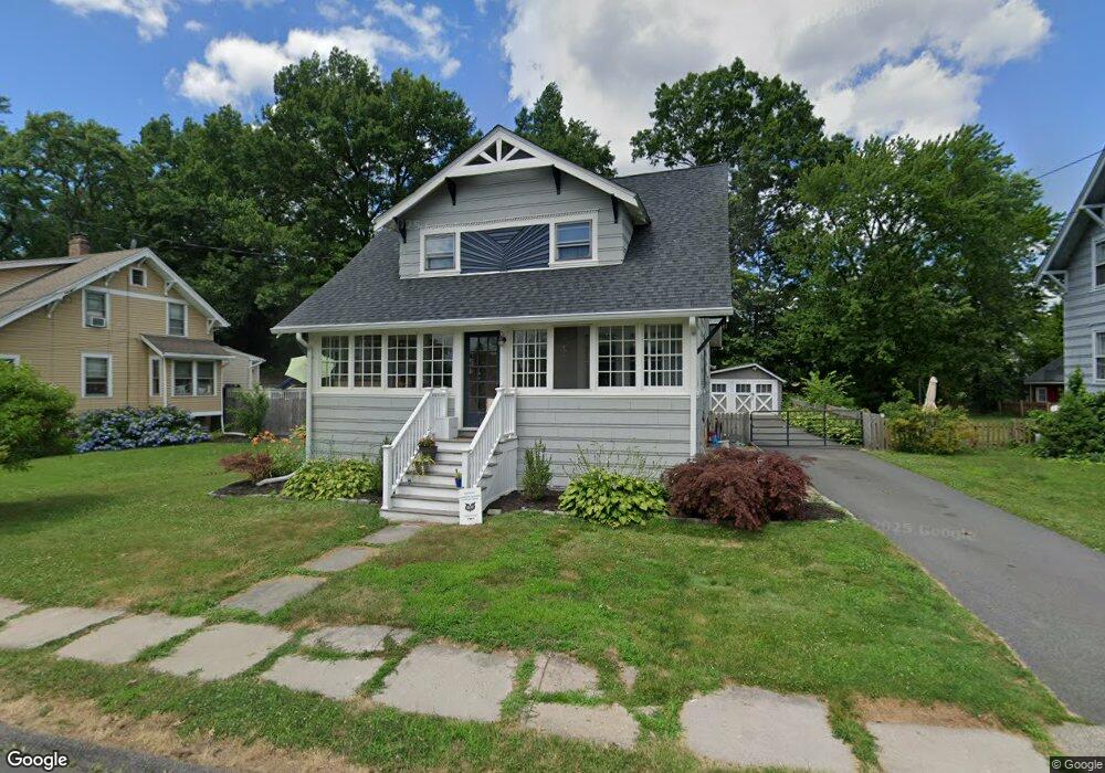
12 Hubbard Place Wethersfield, CT 06109
Estimated Value: $424,000 - $502,016
4
Beds
2
Baths
1,620
Sq Ft
$286/Sq Ft
Est. Value
About This Home
This home is located at 12 Hubbard Place, Wethersfield, CT 06109 and is currently estimated at $462,754, approximately $285 per square foot. 12 Hubbard Place is a home located in Hartford County with nearby schools including Alfred W. Hanmer School, Silas Deane Middle School, and Wethersfield High School.
Ownership History
Date
Name
Owned For
Owner Type
Purchase Details
Closed on
Mar 28, 2008
Sold by
Lemieux Daniel J and Lemieux Carol L
Bought by
Deyo Steven H and Reilly Elizabeth M
Current Estimated Value
Home Financials for this Owner
Home Financials are based on the most recent Mortgage that was taken out on this home.
Original Mortgage
$279,907
Interest Rate
5.76%
Purchase Details
Closed on
Jun 25, 1991
Sold by
Nelson Arthur and Anderson Priscilla
Bought by
Burke Thomas P
Create a Home Valuation Report for This Property
The Home Valuation Report is an in-depth analysis detailing your home's value as well as a comparison with similar homes in the area
Home Values in the Area
Average Home Value in this Area
Purchase History
| Date | Buyer | Sale Price | Title Company |
|---|---|---|---|
| Deyo Steven H | $284,300 | -- | |
| Burke Thomas P | $151,818 | -- |
Source: Public Records
Mortgage History
| Date | Status | Borrower | Loan Amount |
|---|---|---|---|
| Open | Burke Thomas P | $244,460 | |
| Closed | Burke Thomas P | $282,838 | |
| Closed | Burke Thomas P | $279,907 | |
| Previous Owner | Burke Thomas P | $140,000 |
Source: Public Records
Tax History Compared to Growth
Tax History
| Year | Tax Paid | Tax Assessment Tax Assessment Total Assessment is a certain percentage of the fair market value that is determined by local assessors to be the total taxable value of land and additions on the property. | Land | Improvement |
|---|---|---|---|---|
| 2025 | $10,543 | $255,770 | $123,480 | $132,290 |
| 2024 | $6,557 | $151,710 | $74,900 | $76,810 |
| 2023 | $6,338 | $151,710 | $74,900 | $76,810 |
| 2022 | $6,232 | $151,710 | $74,900 | $76,810 |
| 2021 | $6,170 | $151,710 | $74,900 | $76,810 |
| 2020 | $6,173 | $151,710 | $74,900 | $76,810 |
| 2019 | $6,181 | $151,710 | $74,900 | $76,810 |
| 2018 | $6,721 | $164,800 | $72,400 | $92,400 |
| 2017 | $6,554 | $164,800 | $72,400 | $92,400 |
| 2016 | $6,351 | $164,800 | $72,400 | $92,400 |
| 2015 | $6,294 | $164,800 | $72,400 | $92,400 |
| 2014 | $6,055 | $164,800 | $72,400 | $92,400 |
Source: Public Records
Map
Nearby Homes
- 14 Fernwood St
- 1 Fernwood St
- 118 Church St
- 26 Tifton Rd
- 9 Avalon Place
- 18 Avalon Place
- 23 Highview Ave
- 493 Main St
- 35 Stillwold Dr
- 53 Wolcott Hill Rd Unit C23
- 108 Chamberlain Rd
- 24 Stillman Rd
- 177 Spring St Unit 177
- 52 Stillman Rd
- 215 Pine Ln
- 80 Spruce St
- 70 Stillman Rd
- 43 Dudley Rd
- 11 Yale St
- 133 Wells Farm Dr