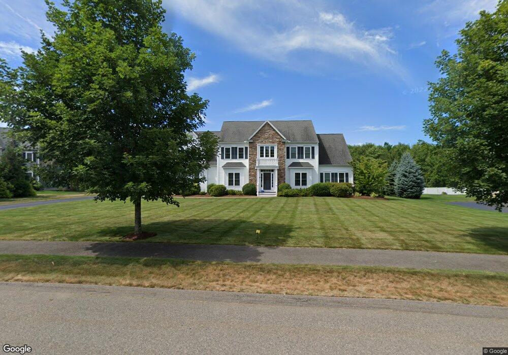
12 Iarussi Way Medway, MA 02053
Estimated Value: $1,197,568 - $1,457,000
4
Beds
4
Baths
4,420
Sq Ft
$297/Sq Ft
Est. Value
About This Home
This home is located at 12 Iarussi Way, Medway, MA 02053 and is currently estimated at $1,314,392, approximately $297 per square foot. 12 Iarussi Way is a home located in Norfolk County with nearby schools including John D. McGovern Elementary School, Burke-Memorial Elementary, and Medway Middle School.
Ownership History
Date
Name
Owned For
Owner Type
Purchase Details
Closed on
Jun 1, 2011
Sold by
Senek Llc
Bought by
Popko Roman and Popko Diana
Current Estimated Value
Home Financials for this Owner
Home Financials are based on the most recent Mortgage that was taken out on this home.
Original Mortgage
$503,000
Outstanding Balance
$368,164
Interest Rate
6%
Mortgage Type
Purchase Money Mortgage
Estimated Equity
$946,228
Create a Home Valuation Report for This Property
The Home Valuation Report is an in-depth analysis detailing your home's value as well as a comparison with similar homes in the area
Home Values in the Area
Average Home Value in this Area
Purchase History
| Date | Buyer | Sale Price | Title Company |
|---|---|---|---|
| Popko Roman | $690,000 | -- |
Source: Public Records
Mortgage History
| Date | Status | Borrower | Loan Amount |
|---|---|---|---|
| Open | Popko Roman | $503,000 |
Source: Public Records
Tax History Compared to Growth
Tax History
| Year | Tax Paid | Tax Assessment Tax Assessment Total Assessment is a certain percentage of the fair market value that is determined by local assessors to be the total taxable value of land and additions on the property. | Land | Improvement |
|---|---|---|---|---|
| 2025 | $14,635 | $1,027,000 | $362,800 | $664,200 |
| 2024 | $14,789 | $1,027,000 | $362,800 | $664,200 |
| 2023 | $13,535 | $849,100 | $303,700 | $545,400 |
| 2022 | $12,870 | $760,200 | $223,600 | $536,600 |
| 2021 | $12,828 | $734,700 | $213,000 | $521,700 |
| 2020 | $12,931 | $738,900 | $215,100 | $523,800 |
| 2019 | $12,756 | $751,700 | $210,900 | $540,800 |
| 2018 | $13,054 | $739,200 | $210,900 | $528,300 |
| 2017 | $12,910 | $720,400 | $200,400 | $520,000 |
| 2016 | $13,184 | $728,000 | $210,900 | $517,100 |
| 2015 | $13,126 | $719,600 | $210,900 | $508,700 |
| 2014 | $12,621 | $669,900 | $208,800 | $461,100 |
Source: Public Records
Map
Nearby Homes