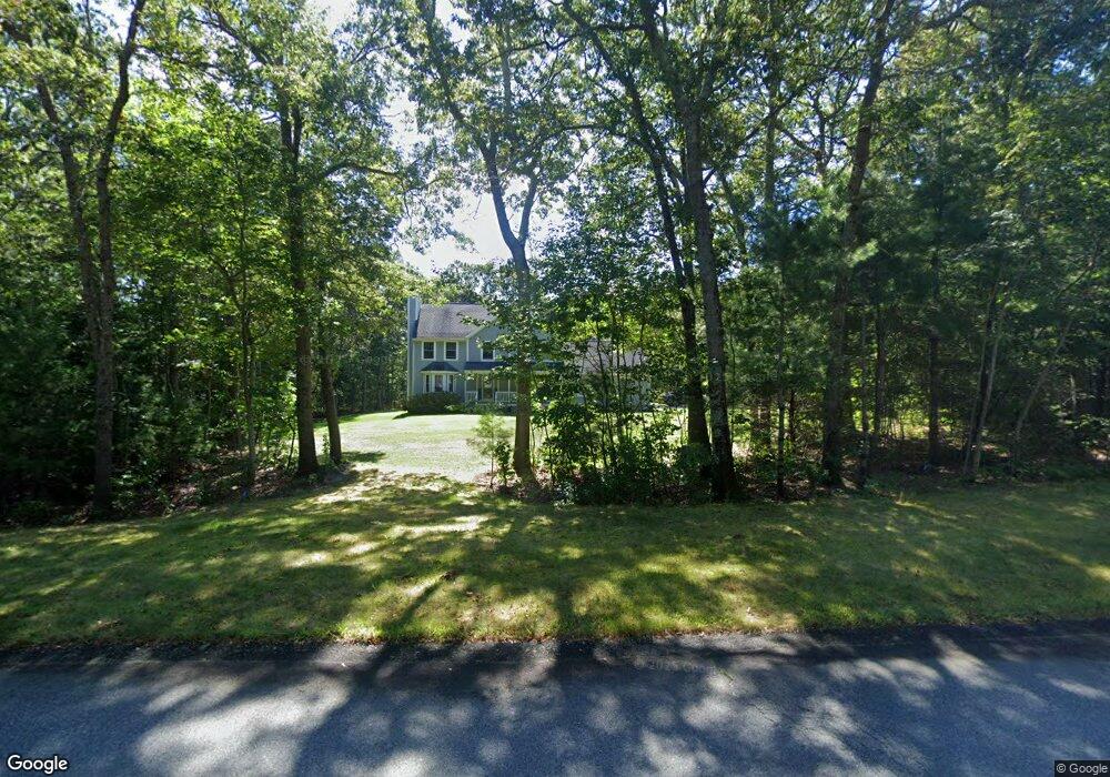
12 King Philip Way East Freetown, MA 02717
Estimated Value: $737,000 - $890,000
4
Beds
3
Baths
2,148
Sq Ft
$377/Sq Ft
Est. Value
About This Home
This home is located at 12 King Philip Way, East Freetown, MA 02717 and is currently estimated at $808,914, approximately $376 per square foot. 12 King Philip Way is a home located in Bristol County with nearby schools including Freetown Elementary School, George R Austin Intermediate School, and Freetown-Lakeville Middle School.
Ownership History
Date
Name
Owned For
Owner Type
Purchase Details
Closed on
Jul 9, 2020
Sold by
Matthews Lisa M and Matthews Patrick T
Bought by
Dupras Christine M and Dupras Joshua R
Current Estimated Value
Home Financials for this Owner
Home Financials are based on the most recent Mortgage that was taken out on this home.
Original Mortgage
$425,000
Outstanding Balance
$376,862
Interest Rate
3.1%
Mortgage Type
New Conventional
Estimated Equity
$432,052
Purchase Details
Closed on
Jul 22, 2004
Sold by
Allaire Brian M and Allaire Lizabeth L
Bought by
Matthews Lisa M and Matthews Patrick T
Home Financials for this Owner
Home Financials are based on the most recent Mortgage that was taken out on this home.
Original Mortgage
$387,000
Interest Rate
6.28%
Mortgage Type
Purchase Money Mortgage
Purchase Details
Closed on
Mar 12, 2001
Sold by
Frates David A and Frates Maria D
Bought by
Allaire Brian M and Allaire Lizabeth L
Create a Home Valuation Report for This Property
The Home Valuation Report is an in-depth analysis detailing your home's value as well as a comparison with similar homes in the area
Home Values in the Area
Average Home Value in this Area
Purchase History
| Date | Buyer | Sale Price | Title Company |
|---|---|---|---|
| Dupras Christine M | $500,000 | None Available | |
| Matthews Lisa M | $430,000 | -- | |
| Allaire Brian M | $84,900 | -- |
Source: Public Records
Mortgage History
| Date | Status | Borrower | Loan Amount |
|---|---|---|---|
| Open | Dupras Christine M | $425,000 | |
| Previous Owner | Allaire Brian M | $387,000 | |
| Previous Owner | Allaire Brian M | $205,000 | |
| Previous Owner | Allaire Brian M | $30,000 |
Source: Public Records
Tax History Compared to Growth
Tax History
| Year | Tax Paid | Tax Assessment Tax Assessment Total Assessment is a certain percentage of the fair market value that is determined by local assessors to be the total taxable value of land and additions on the property. | Land | Improvement |
|---|---|---|---|---|
| 2025 | $6,127 | $618,300 | $196,700 | $421,600 |
| 2024 | $6,087 | $583,600 | $185,500 | $398,100 |
| 2023 | $5,984 | $558,700 | $167,100 | $391,600 |
| 2022 | $5,751 | $476,900 | $141,600 | $335,300 |
| 2021 | $2,725 | $437,900 | $128,700 | $309,200 |
| 2020 | $5,561 | $427,100 | $123,800 | $303,300 |
| 2019 | $2,625 | $407,600 | $123,400 | $284,200 |
| 2018 | $5,068 | $380,800 | $123,400 | $257,400 |
| 2017 | $4,951 | $371,700 | $123,400 | $248,300 |
| 2016 | $4,763 | $363,900 | $119,900 | $244,000 |
| 2015 | $4,569 | $354,200 | $114,500 | $239,700 |
| 2014 | $4,472 | $354,600 | $117,400 | $237,200 |
Source: Public Records
Map
Nearby Homes
- 144 Chace Rd
- 0 Costa Dr
- 195 Slab Bridge Rd
- 150 Quanapoag Rd
- Lot 2/3 Quanapoag Rd
- 599 Quanapoag Rd
- 1475 Braley Rd Unit 17
- 13 Luscomb Ln
- 4597 Acushnet Ave
- 16 Swallow St
- 24 Bells Brook Rd
- 264 Collins Corner Rd
- 1069 Cherokee St
- 353 Upland St
- 319 Northwest St
- 64 Blaze Rd
- 9 Paul Ave
- 210 Heritage Dr
- 34 Poplar Rd
- 111 High St
- 8 King Philip Way
- 14 King Philip Way
- 13 King Philip Way
- 11 King Philip Way
- 6 King Philip Way
- 9 King Philip Way
- 19 Billys Ln
- 16 King Philip Way
- 15 King Philip Way
- 4 King Philip Way
- 17 Billys Ln
- 20 Billys Ln
- 18 King Philip Way
- 7 Jordan Ln
- 9 Jordan Ln
- 17 King Philip Way
- 33 King Philip Way
- 18 Billys Ln
- 19 King Philip Way
- 15 Billys Ln