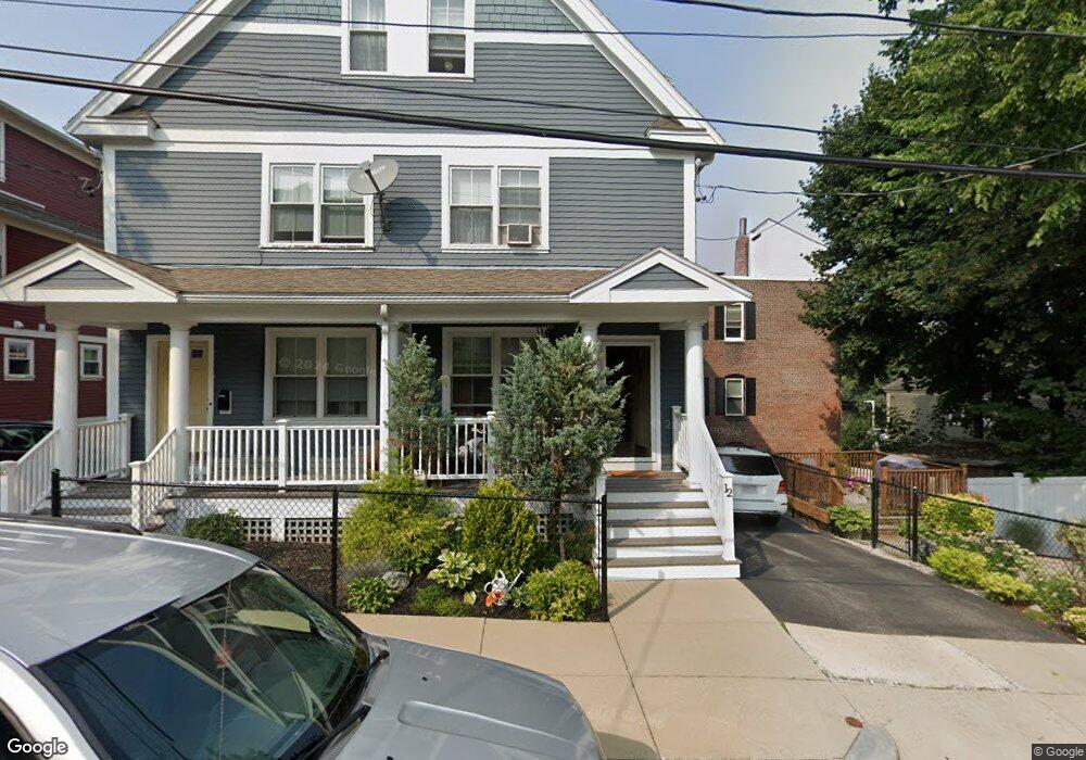
12 Lambert St Roxbury, MA 02119
Fort Hill NeighborhoodEstimated Value: $486,000 - $603,000
3
Beds
2
Baths
1,660
Sq Ft
$327/Sq Ft
Est. Value
About This Home
This home is located at 12 Lambert St, Roxbury, MA 02119 and is currently estimated at $543,245, approximately $327 per square foot. 12 Lambert St is a home with nearby schools including City on a Hill Charter Public School, Paige Academy, and Malik Academy.
Ownership History
Date
Name
Owned For
Owner Type
Purchase Details
Closed on
Jan 26, 2010
Sold by
Highland Park Phase Ll
Bought by
Owens Sharon Y
Current Estimated Value
Home Financials for this Owner
Home Financials are based on the most recent Mortgage that was taken out on this home.
Original Mortgage
$159,698
Outstanding Balance
$104,416
Interest Rate
4.79%
Mortgage Type
Purchase Money Mortgage
Estimated Equity
$438,829
Purchase Details
Closed on
Oct 23, 2009
Sold by
Highland Park Phase Hs
Bought by
Braxton Koresha A
Home Financials for this Owner
Home Financials are based on the most recent Mortgage that was taken out on this home.
Original Mortgage
$151,198
Interest Rate
5.09%
Mortgage Type
Purchase Money Mortgage
Create a Home Valuation Report for This Property
The Home Valuation Report is an in-depth analysis detailing your home's value as well as a comparison with similar homes in the area
Home Values in the Area
Average Home Value in this Area
Purchase History
| Date | Buyer | Sale Price | Title Company |
|---|---|---|---|
| Owens Sharon Y | $207,400 | -- | |
| Braxton Koresha A | $207,400 | -- |
Source: Public Records
Mortgage History
| Date | Status | Borrower | Loan Amount |
|---|---|---|---|
| Open | Owens Sharon Y | $159,698 | |
| Previous Owner | Braxton Koresha A | $151,198 |
Source: Public Records
Tax History
| Year | Tax Paid | Tax Assessment Tax Assessment Total Assessment is a certain percentage of the fair market value that is determined by local assessors to be the total taxable value of land and additions on the property. | Land | Improvement |
|---|---|---|---|---|
| 2025 | $4,755 | $410,600 | $135,498 | $275,102 |
| 2024 | $4,262 | $391,000 | $105,570 | $285,430 |
| 2023 | $4,000 | $372,400 | $100,548 | $271,852 |
| 2022 | $3,859 | $354,700 | $95,769 | $258,931 |
| 2021 | $3,604 | $337,800 | $0 | $337,800 |
| 2020 | $3,397 | $321,700 | $0 | $321,700 |
| 2019 | $3,229 | $306,400 | $130,200 | $176,200 |
| 2018 | $3,058 | $291,800 | $130,200 | $161,600 |
| 2017 | $2,943 | $277,900 | $130,200 | $147,700 |
| 2016 | $2,912 | $264,700 | $130,200 | $134,500 |
| 2015 | $3,053 | $252,100 | $90,600 | $161,500 |
| 2014 | $3,020 | $240,100 | $90,600 | $149,500 |
Source: Public Records
Map
Nearby Homes
- 10 Linwood St
- 27 Dudley St
- 65 Lambert Ave
- 48-50 Dudley St
- 156-160 Highland St Unit 156
- 16 Hawthorne St
- 9 W Cedar St Unit 1
- 51 Saint James St
- 80 Terrace St Unit 501
- 134 Terrace St
- 743 Parker St Unit 3
- 187 Highland St
- 64 Alpine St Unit 104
- 64 Alpine St Unit 304
- 5 Valentine St Unit 1
- 21 Marcella St Unit 2
- 2149 Washington St Unit 610
- 2149 Washington St Unit 604
- 91 Zeigler St
- 22 Rockville Park
- 8 Lambert St
- 15 Norfolk St
- 15 Norfolk St Unit 2
- 6 Lambert St
- 20 Lambert St Unit 22
- 20 Lambert St Unit 22
- 19 Norfolk St Unit 2
- 19 Norfolk St Unit 1
- 21 Norfolk St Unit 21
- 19-21 Norfolk St Unit 21
- 19-21 Norfolk St Unit 1
- 19-21 Norfolk St Unit 2
- 13 Lambert St Unit 15
- 13 Lambert St Unit 1
- 13 Lambert St Unit 2
- 22 Lambert St
- 22 Lambert St Unit 1
- 22 Lambert St Unit 3
- 22 Lambert St Unit 2
- 22 Lambert St
Your Personal Tour Guide
Ask me questions while you tour the home.