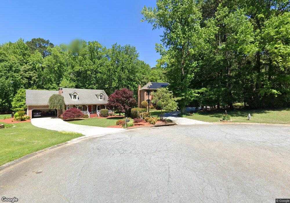
12 Lancaster Ct SW Lilburn, GA 30047
Estimated Value: $411,000 - $513,000
4
Beds
3
Baths
2,679
Sq Ft
$165/Sq Ft
Est. Value
About This Home
This home is located at 12 Lancaster Ct SW, Lilburn, GA 30047 and is currently estimated at $443,353, approximately $165 per square foot. 12 Lancaster Ct SW is a home located in Gwinnett County with nearby schools including Arcado Elementary School, Trickum Middle School, and Parkview High School.
Ownership History
Date
Name
Owned For
Owner Type
Purchase Details
Closed on
Sep 25, 2008
Sold by
Colie Robert W and Colie Elizabeth C
Bought by
Nadeem Muhammad and Khalid Fatima
Current Estimated Value
Home Financials for this Owner
Home Financials are based on the most recent Mortgage that was taken out on this home.
Original Mortgage
$160,000
Outstanding Balance
$105,834
Interest Rate
6.49%
Mortgage Type
New Conventional
Estimated Equity
$337,519
Purchase Details
Closed on
Feb 20, 2008
Sold by
Colie Robert W
Bought by
Colie Robert W and Colie Elizabeth C
Purchase Details
Closed on
Jun 30, 1995
Sold by
Stanford William C Mary L
Bought by
Colie Robert W Monique M
Create a Home Valuation Report for This Property
The Home Valuation Report is an in-depth analysis detailing your home's value as well as a comparison with similar homes in the area
Home Values in the Area
Average Home Value in this Area
Purchase History
| Date | Buyer | Sale Price | Title Company |
|---|---|---|---|
| Nadeem Muhammad | $212,500 | -- | |
| Colie Robert W | -- | -- | |
| Colie Robert W | -- | -- | |
| Colie Robert W Monique M | $162,900 | -- |
Source: Public Records
Mortgage History
| Date | Status | Borrower | Loan Amount |
|---|---|---|---|
| Open | Nadeem Muhammad | $160,000 | |
| Closed | Colie Robert W Monique M | $0 |
Source: Public Records
Tax History Compared to Growth
Tax History
| Year | Tax Paid | Tax Assessment Tax Assessment Total Assessment is a certain percentage of the fair market value that is determined by local assessors to be the total taxable value of land and additions on the property. | Land | Improvement |
|---|---|---|---|---|
| 2025 | $4,516 | $178,160 | $26,120 | $152,040 |
| 2024 | $4,591 | $175,000 | $26,120 | $148,880 |
| 2023 | $4,591 | $153,480 | $38,000 | $115,480 |
| 2022 | $0 | $139,160 | $34,800 | $104,360 |
| 2021 | $3,257 | $107,240 | $27,600 | $79,640 |
| 2020 | $3,609 | $95,440 | $24,000 | $71,440 |
| 2019 | $3,597 | $95,440 | $24,000 | $71,440 |
| 2018 | $3,609 | $95,440 | $24,000 | $71,440 |
| 2016 | $3,235 | $84,960 | $18,000 | $66,960 |
| 2015 | $3,269 | $84,960 | $18,000 | $66,960 |
| 2014 | $3,014 | $77,800 | $18,000 | $59,800 |
Source: Public Records
Map
Nearby Homes
- 194 Jennifer Ln NW
- 215 Hauteur Place SW
- 239 Andrea Cir NW
- 140 Cross Creek Dr
- 5524 Laurel Ln NW
- 90 Cross Creek Dr
- 5265 Sunset Maple Trail Unit 3
- 246 Greenwood Dr NW Unit 1
- 228 Amour Way SW
- 5781 Four Winds Dr SW Unit 1B
- 5533 N Wind Dr SW
- 222 Black Birch Pass
- 315 Greenwood Dr NW
- 5521 E Wind Dr SW
- 358 W Wind Dr SW
- 5779 Chisholm Trail SW
- 50 Bailey Dr SW
- 262 Harmony Grove Rd
- 22 Lancaster Ct SW
- 13 Lancaster Ct SW Unit 6
- 32 Lancaster Ct SW Unit 6
- 33 Lancaster Ct SW
- 107 Rockbridge Rd SW
- 43 Lancaster Ct SW
- 101 Rockbridge Rd SW Unit 1
- 42 Lancaster Ct SW
- 113 Rockbridge Rd SW Unit 1
- 81 Rockbridge Rd SW
- 24 Suffolk Place SW
- 119 Rockbridge Rd SW
- 51 Rockbridge Rd SW
- 53 Lancaster Ct SW
- 52 Lancaster Ct SW
- 34 Suffolk Place SW Unit 6
- 14 Suffolk Place SW
- 125 Rockbridge Rd SW
- 102 Rockbridge Rd SW
- 104 Rockbridge Rd SW