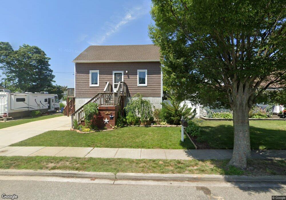
12 Lester Ave Freeport, NY 11520
Estimated Value: $530,795 - $561,000
--
Bed
--
Bath
1,594
Sq Ft
$342/Sq Ft
Est. Value
About This Home
This home is located at 12 Lester Ave, Freeport, NY 11520 and is currently estimated at $545,898, approximately $342 per square foot. 12 Lester Ave is a home located in Nassau County with nearby schools including Columbus Avenue School, Caroline G. Atkinson Intermediate School, and John W Dodd Middle School.
Ownership History
Date
Name
Owned For
Owner Type
Purchase Details
Closed on
Mar 4, 2025
Sold by
Maloney Michael
Bought by
Maloney Michael and Maloney Maria Suriel
Current Estimated Value
Purchase Details
Closed on
Aug 1, 2005
Sold by
Connellan Douglas
Bought by
Maloney Michael
Purchase Details
Closed on
May 17, 1993
Sold by
Connellan Edwin Est
Bought by
Connellan Douglas
Create a Home Valuation Report for This Property
The Home Valuation Report is an in-depth analysis detailing your home's value as well as a comparison with similar homes in the area
Home Values in the Area
Average Home Value in this Area
Purchase History
| Date | Buyer | Sale Price | Title Company |
|---|---|---|---|
| Maloney Michael | -- | East Coast Abstract Inc | |
| Maloney Michael | $365,000 | -- | |
| Maloney Michael | $365,000 | -- | |
| Connellan Douglas | -- | -- | |
| Connellan Douglas | -- | -- |
Source: Public Records
Tax History Compared to Growth
Tax History
| Year | Tax Paid | Tax Assessment Tax Assessment Total Assessment is a certain percentage of the fair market value that is determined by local assessors to be the total taxable value of land and additions on the property. | Land | Improvement |
|---|---|---|---|---|
| 2025 | $5,809 | $311 | $164 | $147 |
| 2024 | $689 | $301 | $165 | $136 |
| 2023 | $5,627 | $301 | $165 | $136 |
| 2022 | $5,627 | $284 | $165 | $119 |
| 2021 | $8,035 | $268 | $84 | $184 |
| 2020 | $5,864 | $487 | $413 | $74 |
| 2019 | $5,828 | $487 | $413 | $74 |
| 2018 | $5,615 | $487 | $0 | $0 |
| 2017 | $4,461 | $487 | $413 | $74 |
| 2016 | $5,192 | $484 | $348 | $136 |
| 2015 | $831 | $575 | $413 | $162 |
| 2014 | $831 | $575 | $413 | $162 |
| 2013 | $785 | $575 | $413 | $162 |
Source: Public Records
Map
Nearby Homes
- 106 Irving Ave
- 110 Stirling Ave
- 587 S Bayview Ave
- 8 Florence Ave Unit 16C
- 12 Florence Ave Unit 29A
- 210 Westend Ave Unit 8B
- 208 Westend Ave Unit 11A
- 300 Branch Ave
- 1108 Washington Place
- 1116 Washington Place
- 1130 Van Buren Place
- 77 Hampton Place
- 1130 Hayes Place
- 256 Westside Ave
- 159 Branch Ave
- 292 Westside Ave
- 226 Westside Ave Unit B
- 205 Saint Marks Ave
- 90 Hampton Place
- 1166 Hastings Cir
- 12 Lester Ave
- 8 Lester Ave
- 11 Buchanan St
- 75 Meister Blvd
- 20 Lester Ave
- 20 Lester Ave
- 17 Buchanan St
- 15 Lester Ave
- 17 Lester Ave
- 30 Lester Ave
- 5 Lester Ave
- 25 Buchanan St
- 27 Lester Ave
- 78 Meister Blvd
- 87 Meister Blvd
- 60 Meister Blvd
- 12 Buchanan St
- 0 Buchanan St
- 0 Buchanan St Unit 2875487
- 46 Lester Ave