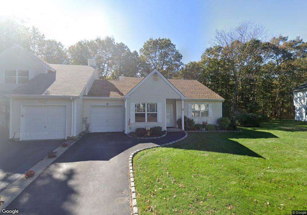
12 Lindsey Ct Holtsville, NY 11742
Estimated Value: $392,000 - $539,000
1
Bed
1
Bath
1,020
Sq Ft
$451/Sq Ft
Est. Value
About This Home
This home is located at 12 Lindsey Ct, Holtsville, NY 11742 and is currently estimated at $459,637, approximately $450 per square foot. 12 Lindsey Ct is a home located in Suffolk County with nearby schools including Tamarac Elementary School, Sachem High School East, and Long Island Baptist Academy.
Ownership History
Date
Name
Owned For
Owner Type
Purchase Details
Closed on
Sep 14, 2017
Sold by
Taylor Albert W and Taylor Reva R
Bought by
Baker Ruth Ann
Current Estimated Value
Purchase Details
Closed on
May 18, 2009
Sold by
Scalzo Jane
Bought by
Taylor Reva Albert W
Purchase Details
Closed on
Mar 24, 2000
Sold by
Scalzo Alfredo P and Scalzo Michelle A
Bought by
Scalzo Pasquale and Scalzo Jane
Purchase Details
Closed on
Nov 30, 1995
Sold by
King Michael J and King Lucille
Bought by
Scalzo Alfredo P and Scalzo Michelle A
Create a Home Valuation Report for This Property
The Home Valuation Report is an in-depth analysis detailing your home's value as well as a comparison with similar homes in the area
Home Values in the Area
Average Home Value in this Area
Purchase History
| Date | Buyer | Sale Price | Title Company |
|---|---|---|---|
| Baker Ruth Ann | $265,000 | None Available | |
| Taylor Reva Albert W | $293,500 | Wendy Funk | |
| Scalzo Pasquale | $115,000 | Fidelity National Title | |
| Scalzo Alfredo P | $95,000 | First American Title Ins Co |
Source: Public Records
Tax History Compared to Growth
Tax History
| Year | Tax Paid | Tax Assessment Tax Assessment Total Assessment is a certain percentage of the fair market value that is determined by local assessors to be the total taxable value of land and additions on the property. | Land | Improvement |
|---|---|---|---|---|
| 2024 | -- | $24,200 | $7,600 | $16,600 |
| 2023 | -- | $24,200 | $7,600 | $16,600 |
| 2022 | $5,207 | $24,200 | $7,600 | $16,600 |
| 2021 | $5,207 | $24,200 | $7,600 | $16,600 |
| 2020 | $5,128 | $24,200 | $7,600 | $16,600 |
| 2019 | $5,207 | $0 | $0 | $0 |
| 2018 | -- | $24,200 | $7,600 | $16,600 |
| 2017 | $5,355 | $24,200 | $7,600 | $16,600 |
| 2016 | $5,120 | $24,200 | $7,600 | $16,600 |
| 2015 | -- | $24,200 | $7,600 | $16,600 |
| 2014 | -- | $24,200 | $7,600 | $16,600 |
Source: Public Records
Map
Nearby Homes
- 18 Lindsey Ct
- 23 Storm Dr
- 286 Storm Dr
- 283 Storm Dr
- 257 Storm Dr
- 89 Storm Dr
- 220 Storm Dr
- 219 Storm Dr
- 119 Storm Dr
- 139 Storm Dr
- 270 Singingwood Dr
- 146 Blue Point Rd W
- 80 Burleigh Dr
- 89 Live Oak Dr
- 46 Blue Point Rd E
- 76 Blueberry Ridge Dr
- 185 14th Ave
- 3 Timber Ridge Dr
- 31 Fallen Leaf Rd
- 19 Hampshire Ct