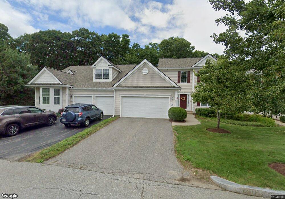
12 Linkside Ct Northbridge, MA 01534
Estimated Value: $586,694 - $667,000
2
Beds
3
Baths
1,775
Sq Ft
$349/Sq Ft
Est. Value
About This Home
This home is located at 12 Linkside Ct, Northbridge, MA 01534 and is currently estimated at $619,424, approximately $348 per square foot. 12 Linkside Ct is a home located in Worcester County with nearby schools including Northbridge Elementary School, Northbridge Middle School, and Northbridge High School.
Ownership History
Date
Name
Owned For
Owner Type
Purchase Details
Closed on
Feb 29, 2008
Sold by
Potenza Patricia L and Potenza Thomas J
Bought by
Potenza Rt and Potenza
Current Estimated Value
Purchase Details
Closed on
Nov 18, 2005
Sold by
Pulte Homes Of Ne Llc
Bought by
Potenza Patricia L and Potenza Thomas J
Home Financials for this Owner
Home Financials are based on the most recent Mortgage that was taken out on this home.
Original Mortgage
$367,029
Interest Rate
6.07%
Mortgage Type
Purchase Money Mortgage
Create a Home Valuation Report for This Property
The Home Valuation Report is an in-depth analysis detailing your home's value as well as a comparison with similar homes in the area
Home Values in the Area
Average Home Value in this Area
Purchase History
| Date | Buyer | Sale Price | Title Company |
|---|---|---|---|
| Potenza Rt | -- | -- | |
| Potenza Rt | -- | -- | |
| Potenza Patricia L | $407,810 | -- | |
| Potenza Patricia L | $407,810 | -- |
Source: Public Records
Mortgage History
| Date | Status | Borrower | Loan Amount |
|---|---|---|---|
| Previous Owner | Potenza Patricia L | $367,029 |
Source: Public Records
Tax History Compared to Growth
Tax History
| Year | Tax Paid | Tax Assessment Tax Assessment Total Assessment is a certain percentage of the fair market value that is determined by local assessors to be the total taxable value of land and additions on the property. | Land | Improvement |
|---|---|---|---|---|
| 2025 | $6,172 | $523,500 | $0 | $523,500 |
| 2024 | $6,272 | $518,800 | $0 | $518,800 |
| 2023 | $5,791 | $446,800 | $0 | $446,800 |
| 2022 | $5,505 | $399,800 | $0 | $399,800 |
| 2021 | $5,277 | $364,200 | $0 | $364,200 |
| 2020 | $4,838 | $349,600 | $0 | $349,600 |
| 2019 | $4,346 | $335,100 | $0 | $335,100 |
| 2018 | $4,149 | $320,600 | $0 | $320,600 |
| 2017 | $4,220 | $311,900 | $0 | $311,900 |
| 2016 | $4,154 | $302,100 | $0 | $302,100 |
| 2015 | $3,868 | $289,100 | $0 | $289,100 |
| 2014 | $3,887 | $293,100 | $0 | $293,100 |
Source: Public Records
Map
Nearby Homes
- 41 Shannon Way Unit 41
- 42 Shining Rock Dr
- 79-81 Upton St
- 61 Tulip Cir
- 89 Buttercup Ln Unit 255
- 217 Brookway Dr
- 58 Buttercup Ln
- 151 Fowler Rd
- 1880 Providence Rd
- 135 Main St
- 1825 Quaker St
- 36 Knowlton Cir Unit 36
- 3 Knowlton Cir Unit 3
- 2767 Providence Rd
- 19 Milford Rd
- 27 Fowler St
- 39 Mechanic St
- 86 Mikes Way Unit 86
- 84 Mikes Way Unit 84
- 0 Puddon St
- 14 Linkside Ct
- 10 Linkside Ct
- 8 Linkside Ct
- 123 Clubhouse Ln
- 125 Clubhouse Ln
- 127 Clubhouse Ln
- 129 Clubhouse Ln
- 129 Clubhouse Ln Unit 32,9
- 16 Linkside Ct Unit 16
- 24 Linkside Ct
- 22 Linkside Ct
- 20 Linkside Ct
- 18 Linkside Ct
- 16 Linkside Ct
- 18 Linkside Ct Unit 41
- 16 Linkside Ct Unit 40-11
- 18 Linkside Ct Unit 41-11
- 16 Linkside Ct
- 24 Linkside Ct Unit 24
- 24 Linkside Ct Unit 44